MyTopo
Frenchman Mountain Nevada US Topo Map
Couldn't load pickup availability
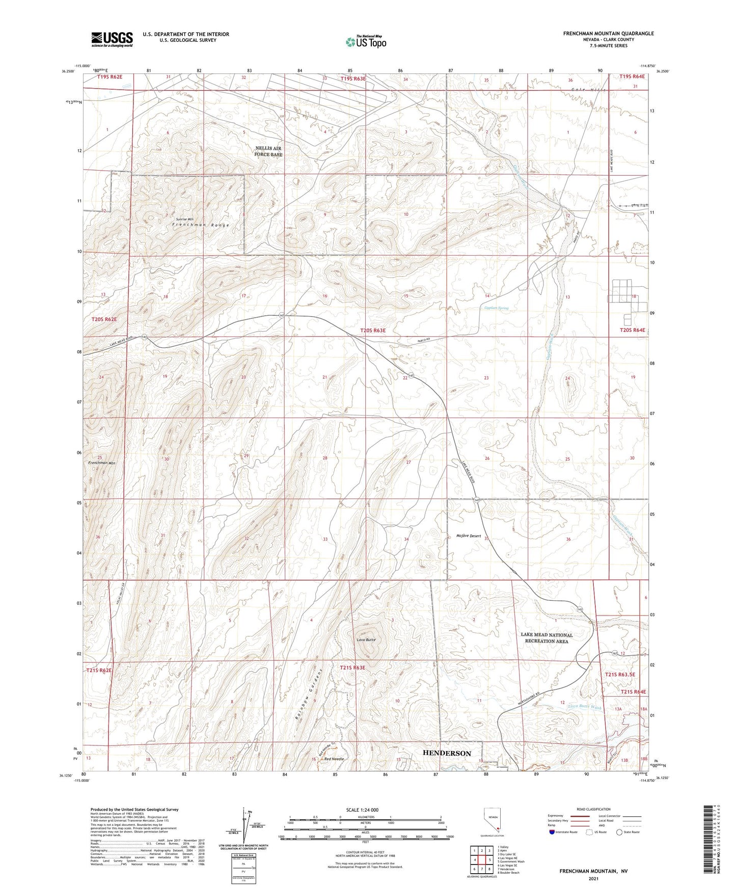
2021 topographic map quadrangle Frenchman Mountain in the state of Nevada. Scale: 1:24000. Based on the newly updated USGS 7.5' US Topo map series, this map is in the following counties: Clark. The map contains contour data, water features, and other items you are used to seeing on USGS maps, but also has updated roads and other features. This is the next generation of topographic maps. Printed on high-quality waterproof paper with UV fade-resistant inks.
Quads adjacent to this one:
West: Las Vegas NE
Northwest: Valley
North: Apex
Northeast: Dry Lake SE
East: Government Wash
Southeast: Boulder Beach
South: Henderson
Southwest: Las Vegas SE
This map covers the same area as the classic USGS quad with code o36114b8.
Contains the following named places: Alamo Mine, Frenchman Mountain, Frenchman Range, Gypsum Cave Mine, Gypsum Spring, Las Vegas Wash, Lava Butte, Lava Butte Wash, Nellis Air Force Base, Rainbow Gardens, Red Needle, Schumaker Gypsum Mine, Sunrise Mountain, Sunrise Mountain Natural Area, White Eagle Mine, ZIP Code: 89156