MyTopo
Wells Station Nevada US Topo Map
Couldn't load pickup availability
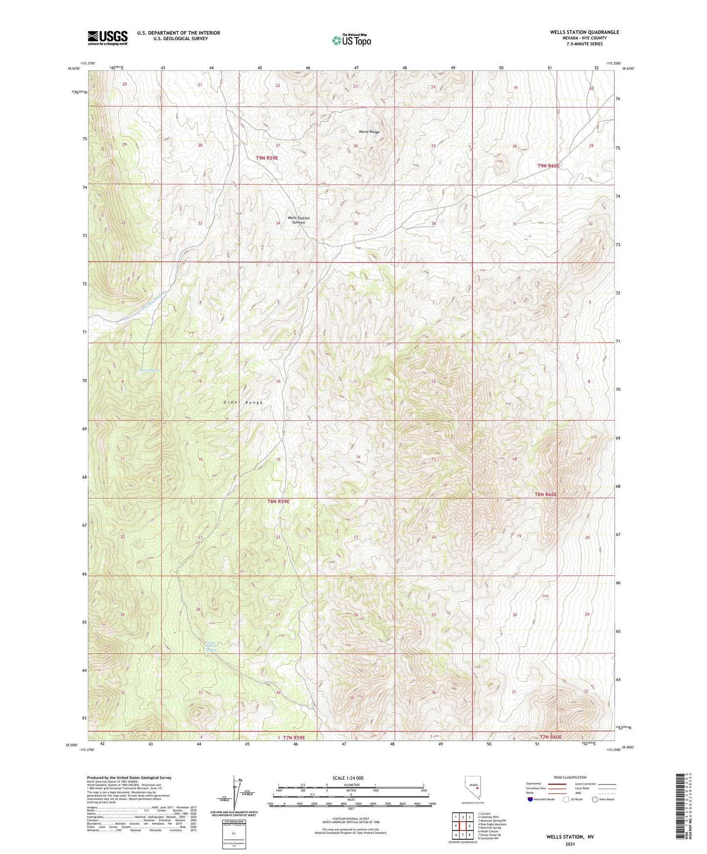
2021 topographic map quadrangle Wells Station in the state of Nevada. Scale: 1:24000. Based on the newly updated USGS 7.5' US Topo map series, this map is in the following counties: Nye. The map contains contour data, water features, and other items you are used to seeing on USGS maps, but also has updated roads and other features. This is the next generation of topographic maps. Printed on high-quality waterproof paper with UV fade-resistant inks.
Quads adjacent to this one:
West: Blue Eagle Mountain
Northwest: Currant
North: Callaway Well
Northeast: Moorman Spring NW
East: Moorman Spring
Southeast: Sunnyside NW
South: Forest Home NE
Southwest: Heath Canyon
This map covers the same area as the classic USGS quad with code o38115e3.
Contains the following named places: Albert Spring, Burnt Station Well, Upper Perish Spring, Wells Station, Wells Station Summit