MyTopo
Wildcat Wash SW Nevada US Topo Map
Couldn't load pickup availability
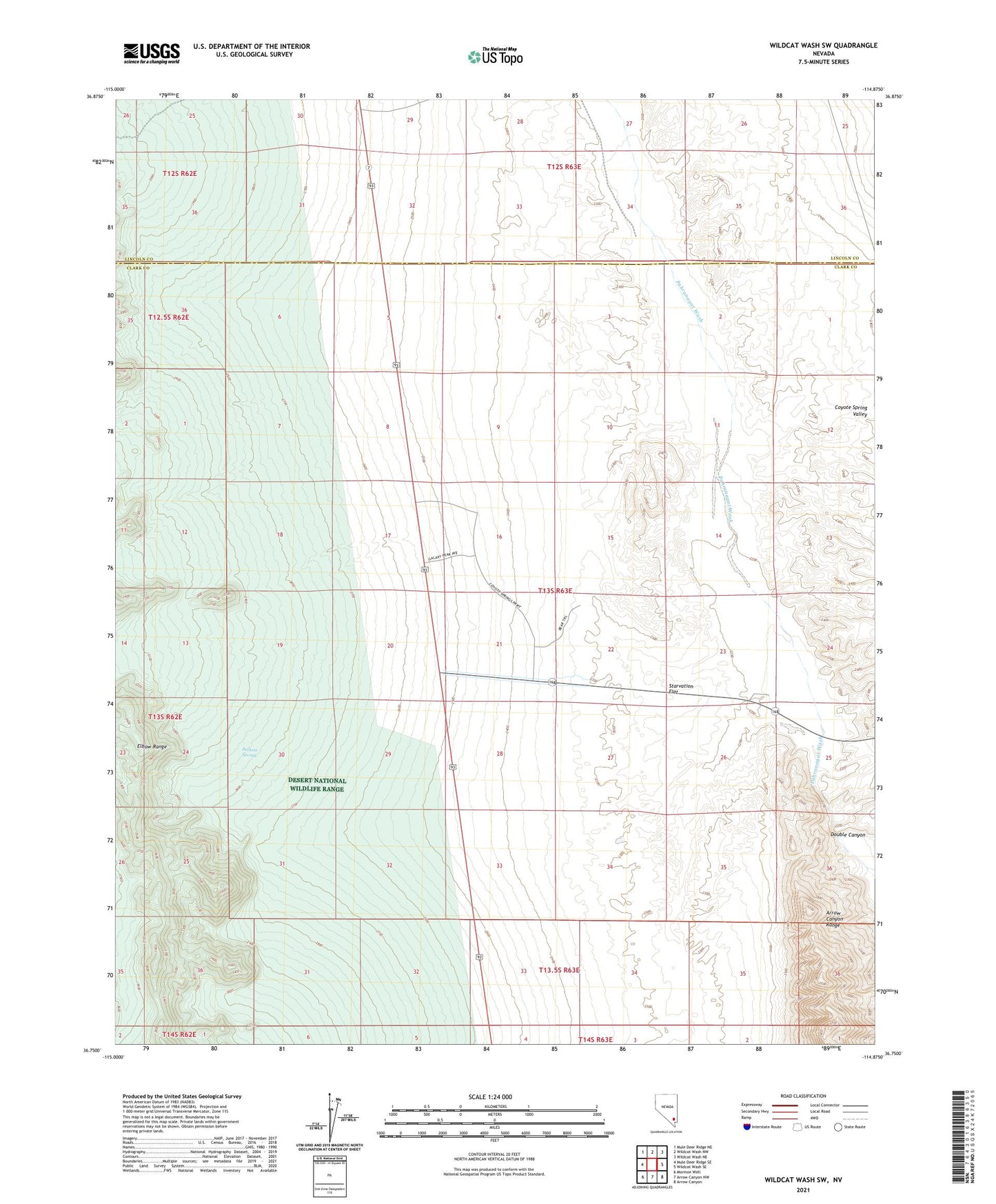
2021 topographic map quadrangle Wildcat Wash SW in the state of Nevada. Scale: 1:24000. Based on the newly updated USGS 7.5' US Topo map series, this map is in the following counties: Clark, Lincoln. The map contains contour data, water features, and other items you are used to seeing on USGS maps, but also has updated roads and other features. This is the next generation of topographic maps. Printed on high-quality waterproof paper with UV fade-resistant inks.
Quads adjacent to this one:
West: Mule Deer Ridge SE
Northwest: Mule Deer Ridge NE
North: Wildcat Wash NW
Northeast: Wildcat Wash NE
East: Wildcat Wash SE
Southeast: Arrow Canyon
South: Arrow Canyon NW
Southwest: Mormon Well
This map covers the same area as the classic USGS quad with code o36114g8.
Contains the following named places: Double Canyon, Elbow Range, Perkins Number One Reservoir, Perkins Spring, Starvation Flat