MyTopo
Wilson Reservoir Nevada US Topo Map
Couldn't load pickup availability
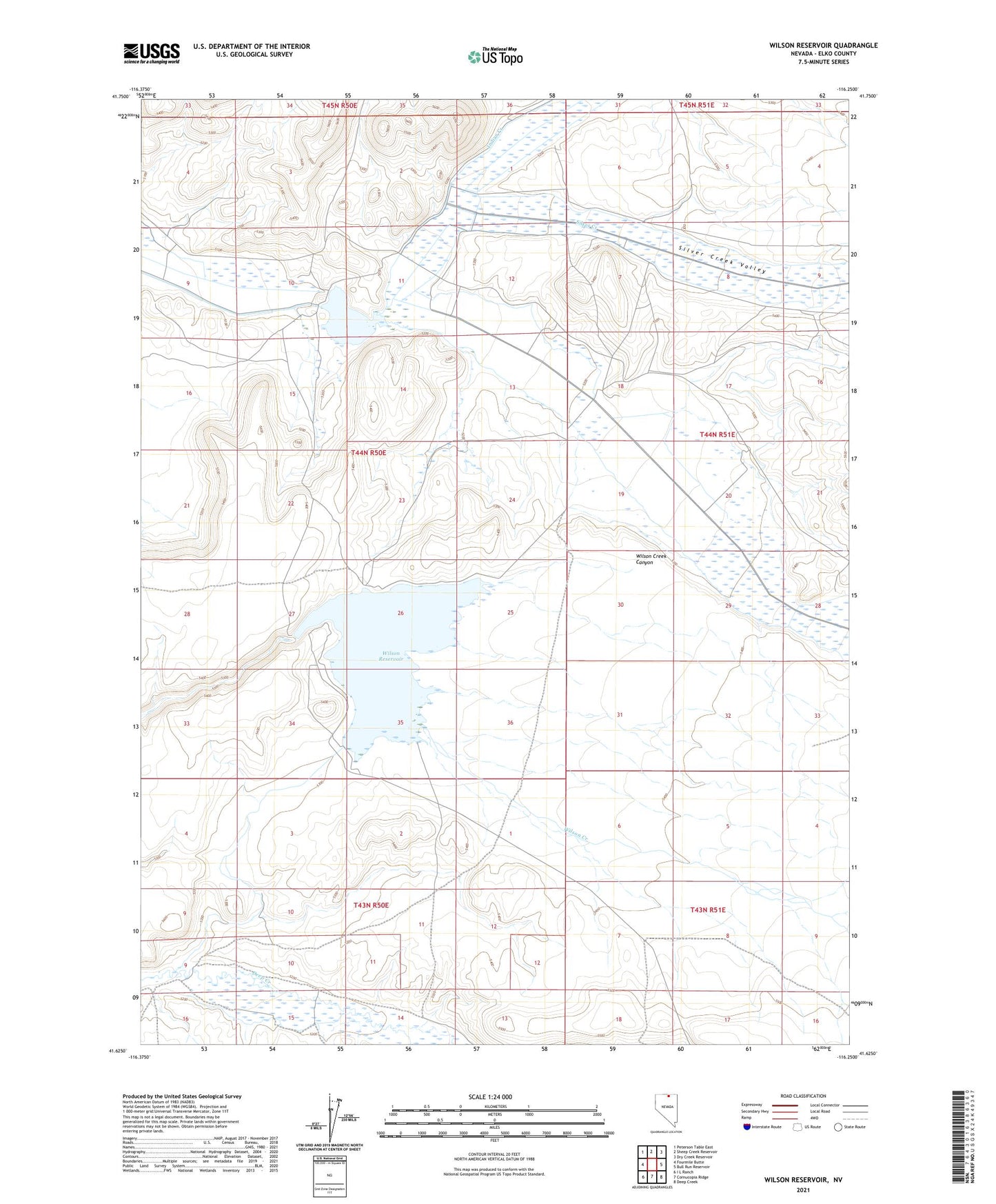
2021 topographic map quadrangle Wilson Reservoir in the state of Nevada. Scale: 1:24000. Based on the newly updated USGS 7.5' US Topo map series, this map is in the following counties: Elko. The map contains contour data, water features, and other items you are used to seeing on USGS maps, but also has updated roads and other features. This is the next generation of topographic maps. Printed on high-quality waterproof paper with UV fade-resistant inks.
Quads adjacent to this one:
West: Fourmile Butte
Northwest: Peterson Table East
North: Sheep Creek Reservoir
Northeast: Dry Creek Reservoir
East: Bull Run Reservoir
Southeast: Deep Creek
South: Cornucopia Ridge
Southwest: I L Ranch
This map covers the same area as the classic USGS quad with code o41116f3.
Contains the following named places: Edgemont School, Indian Creek, Mitchum Ranch, Rawhide Reservoir, Rawhide Reservoir Dam, Silver Creek, Silver Creek Valley, Spring Creek, Warm Spring Creek, Wilson Creek, Wilson Reservoir, Wilson Reservoir Dam