MyTopo
Carter Dome New Hampshire US Topo Map
Couldn't load pickup availability
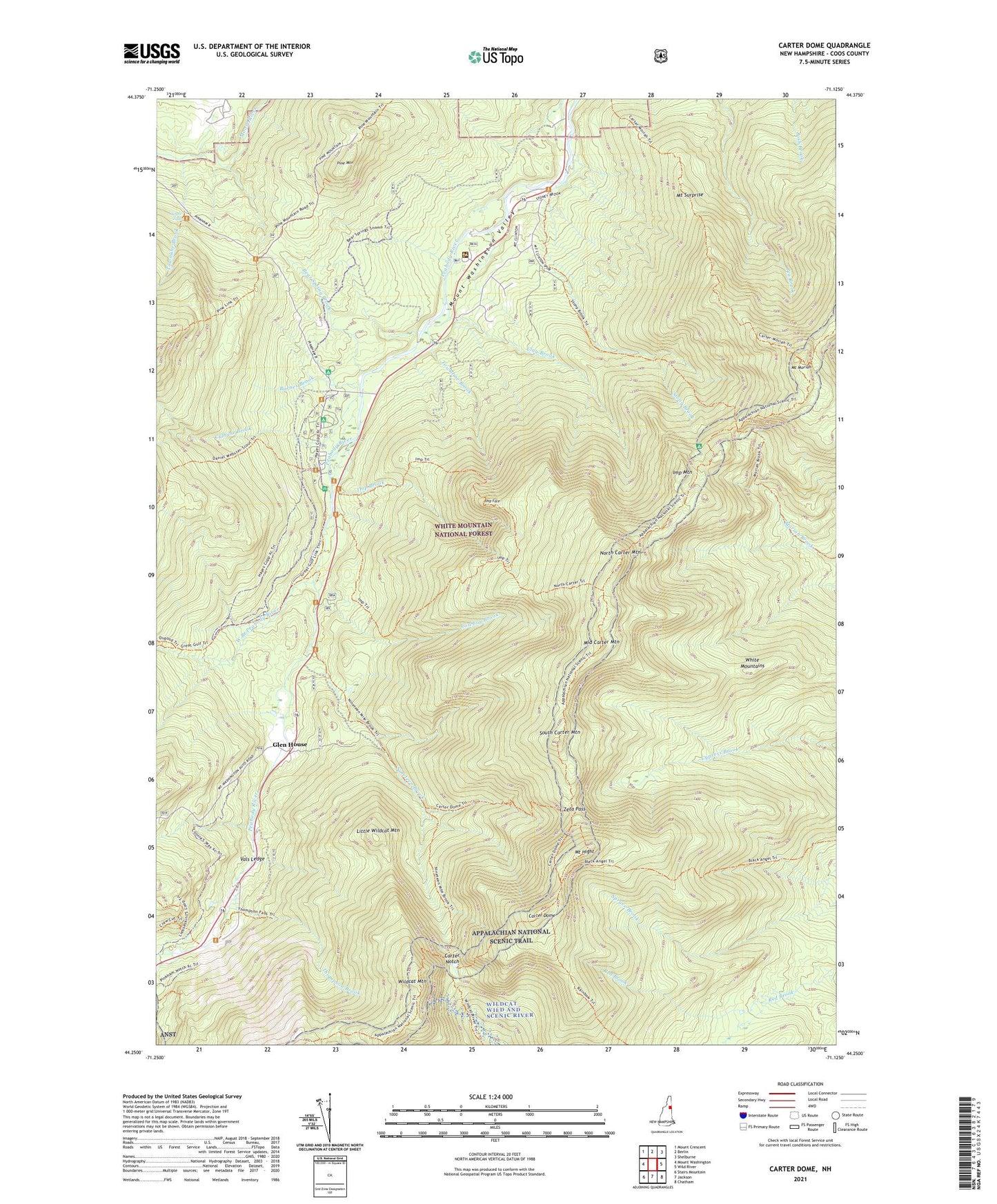
2021 topographic map quadrangle Carter Dome in the state of New Hampshire. Scale: 1:24000. Based on the newly updated USGS 7.5' US Topo map series, this map is in the following counties: Coos. The map contains contour data, water features, and other items you are used to seeing on USGS maps, but also has updated roads and other features. This is the next generation of topographic maps. Printed on high-quality waterproof paper with UV fade-resistant inks.
Quads adjacent to this one:
West: Mount Washington
Northwest: Mount Crescent
North: Berlin
Northeast: Shelburne
East: Wild River
Southeast: Chatham
South: Jackson
Southwest: Stairs Mountain
Contains the following named places: Aqueduct Path, Barnes Brook, Barnes Field Camping Area, Bear Spring Brook, Black Angel Trail, Carter Dome, Carter Dome Trail, Carter Moriah Trail, Carter Notch, Carter Notch Hut, Clay Brook, Cowboy Brook, Crew Cut Trail, Culhane Brook, Daniel Webster Trail, Dolly Copp Campground, Emerald Pool, Garnet Pool, Glen House, Great Gulf Trail, Greens Grant, Imp Brook, Imp Face, Imp Mountain, Imp Shelter, Imp Shelter Cut Off, Imp Trail, Little Wildcat Mountain, Martins Location, Middle Carter Mountain, Mount Hight, Mount Moriah, Mount Surprise, Nineteen Brook, Nineteenmile Brook Trail, North Carter Mountain, North Carter Trail, Peabody Field Picnic Area, Pine Link Trail, Pine Mountain, Pine Mountain Trail, Pinkhams Grant, Rainbow Trail, Restricted Ledge Trail, RMC Brook Path, RMC Straight Path, South Carter Mountain, Stony Brook, Stony Brook Trail, Thompson Brook, Townline Brook, Triple Falls, Vals Ledge, WEDB-TV (Berlin), West Branch Peabody River, Wildcat Mountain, Wildcat Mountain Ski Area, Wildcat Ridge Trail, Wildcat River Trail, Zeta Pass, ZIP Code: 03581