MyTopo
Chatham New Hampshire US Topo Map
Couldn't load pickup availability
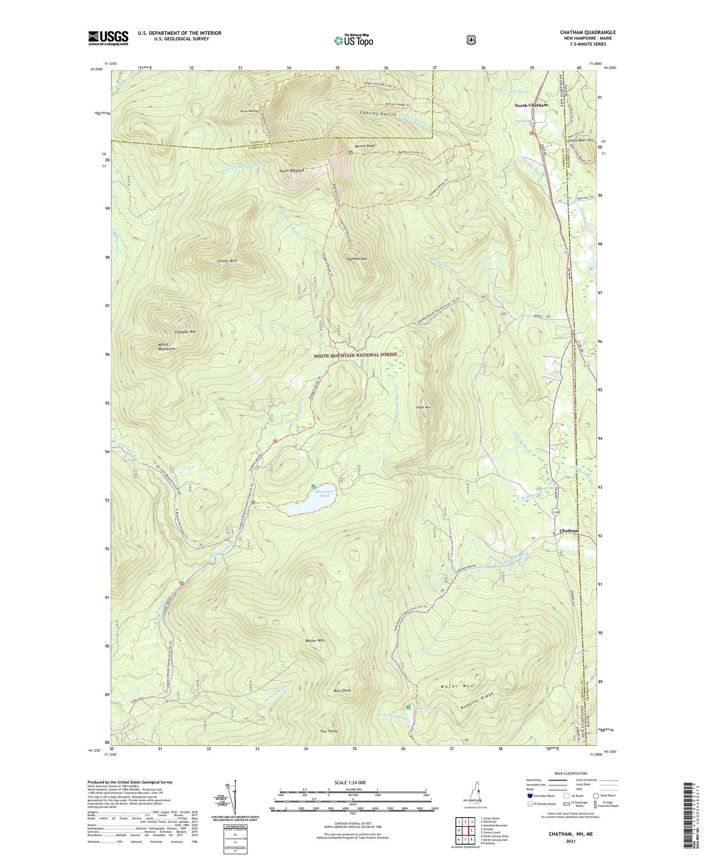
2021 topographic map quadrangle Chatham in the states of Maine, New Hampshire. Scale: 1:24000. Based on the newly updated USGS 7.5' US Topo map series, this map is in the following counties: Carroll, Coos, Oxford. The map contains contour data, water features, and other items you are used to seeing on USGS maps, but also has updated roads and other features. This is the next generation of topographic maps. Printed on high-quality waterproof paper with UV fade-resistant inks.
Quads adjacent to this one:
West: Jackson
Northwest: Carter Dome
North: Wild River
Northeast: Speckled Mountain
East: Center Lovell
Southeast: Fryeburg
South: North Conway East
Southwest: North Conway West
Contains the following named places: Baldface Shelter, Baldface Trail, Bilknell Ridge Trail, Bradley Brook Trail, Brucknell Ridge Trail, Burnt Knoll Brook, Chandler Brook, Chandler Mountain, Charles Brook, Charles Ravine, Chatham, Cold River AMC Camp, East Fork East Branch Saco River, Eastman Mountain, Eastman School, Major Mountain, McDonough Brook, Mill Brook, Mountain Eastman Trail, Mountain Pond, Mountain Pond Shelter, Mountain Pond Trail, Mountain Shaw, Mountain Shaw Trail, North Baldface, North Chatham, Province Pond, Province Pond Shelter, Robbins Ridge, Sable Mountain, Sable Mountain Trail, Shell Pond Brook, Slippery Brook, Slippery Brook Trail, Slope Mountain, South Baldface, Spruce Knoll, Stillwater Trail, The Twins, Town of Chatham, Walter Mountain, Watson Brook, ZIP Code: 03813