MyTopo
Gilmanton Ironworks New Hampshire US Topo Map
Couldn't load pickup availability
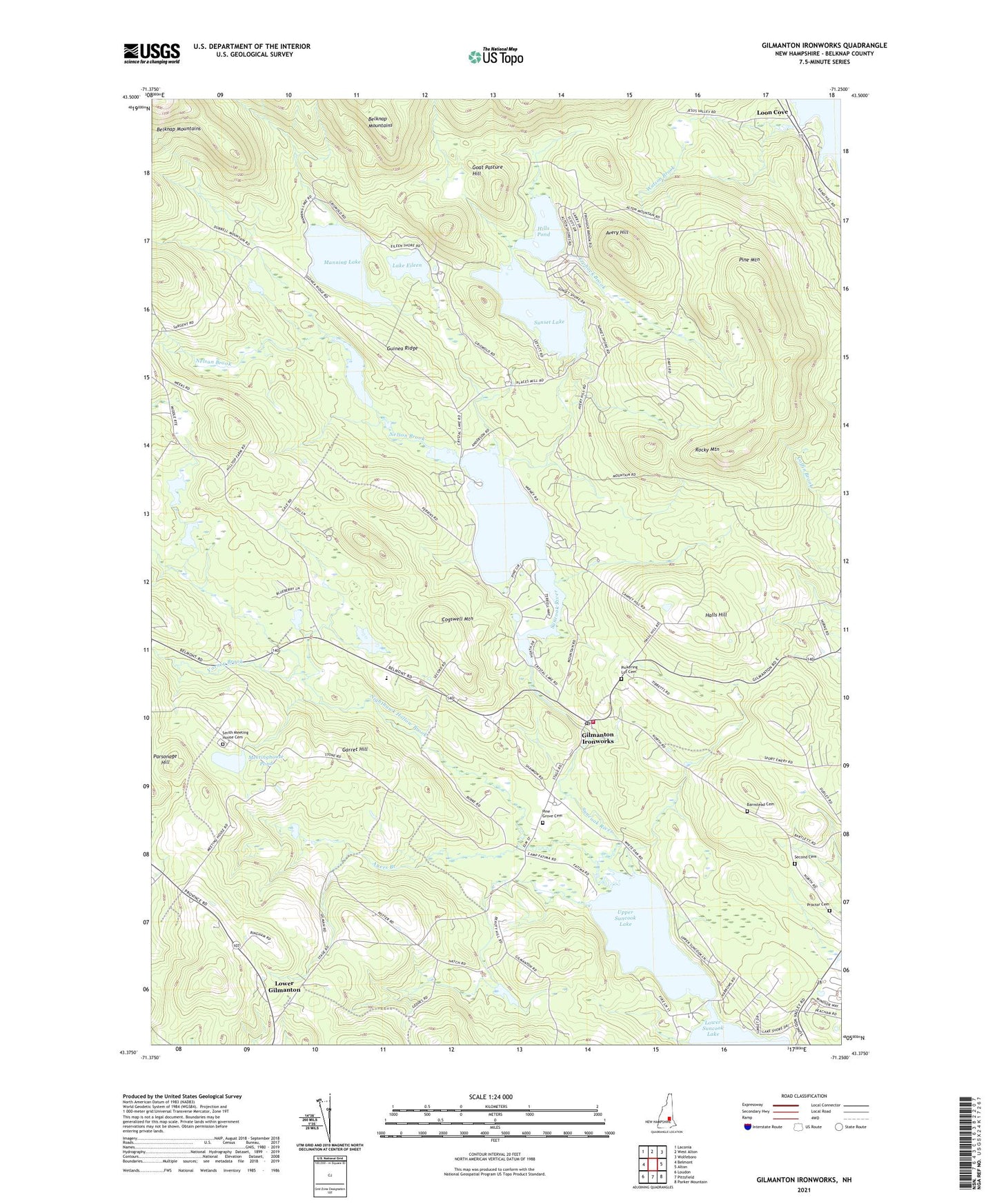
2021 topographic map quadrangle Gilmanton Ironworks in the state of New Hampshire. Scale: 1:24000. Based on the newly updated USGS 7.5' US Topo map series, this map is in the following counties: Belknap. The map contains contour data, water features, and other items you are used to seeing on USGS maps, but also has updated roads and other features. This is the next generation of topographic maps. Printed on high-quality waterproof paper with UV fade-resistant inks.
Quads adjacent to this one:
West: Belmont
Northwest: Laconia
North: West Alton
Northeast: Wolfeboro
East: Alton
Southeast: Parker Mountain
South: Pittsfield
Southwest: Loudon
Contains the following named places: Avery Hill, Ayers Branch, Barnstead Cemetery, Camp Fatima, Camp Leo, Cogswell Mountain, Crystal Lake, Crystal Lake-Gilmanton Dam, Frohock Brook, Garret Hill, Gillan Pond, Gillan Pond Dam, Gilmanton Fire Department Station 1, Gilmanton Iron Works Post Office, Gilmanton Ironworks, Gilmanton School, Goat Pasture Hill, Guinea Ridge, Halls Hill, Hills Pond, Lake Eileen, Loon Cove, Lower Gilmanton, Manning Lake, Meetinghouse Pond, Nelson Brook, Nighthawk Hollow Brook, Parsonage Hill, Pickering Lot Cemetery, Pine Grove Cemetery, Pine Mountain, Rainbow Rod and Gun Club, Rocky Mountain, Second Cemetery, Smith Meeting House, Smith Meeting House Cemetery, Suncook Ponds, Sunset Lake, Sunset Lake Dam, Town of Gilmanton, United Church of Gilmanton, Upper Suncook Lake, Varney Brook, Watson Brook, Whiteoak School, ZIP Code: 03837