MyTopo
Loudon New Hampshire US Topo Map
Couldn't load pickup availability
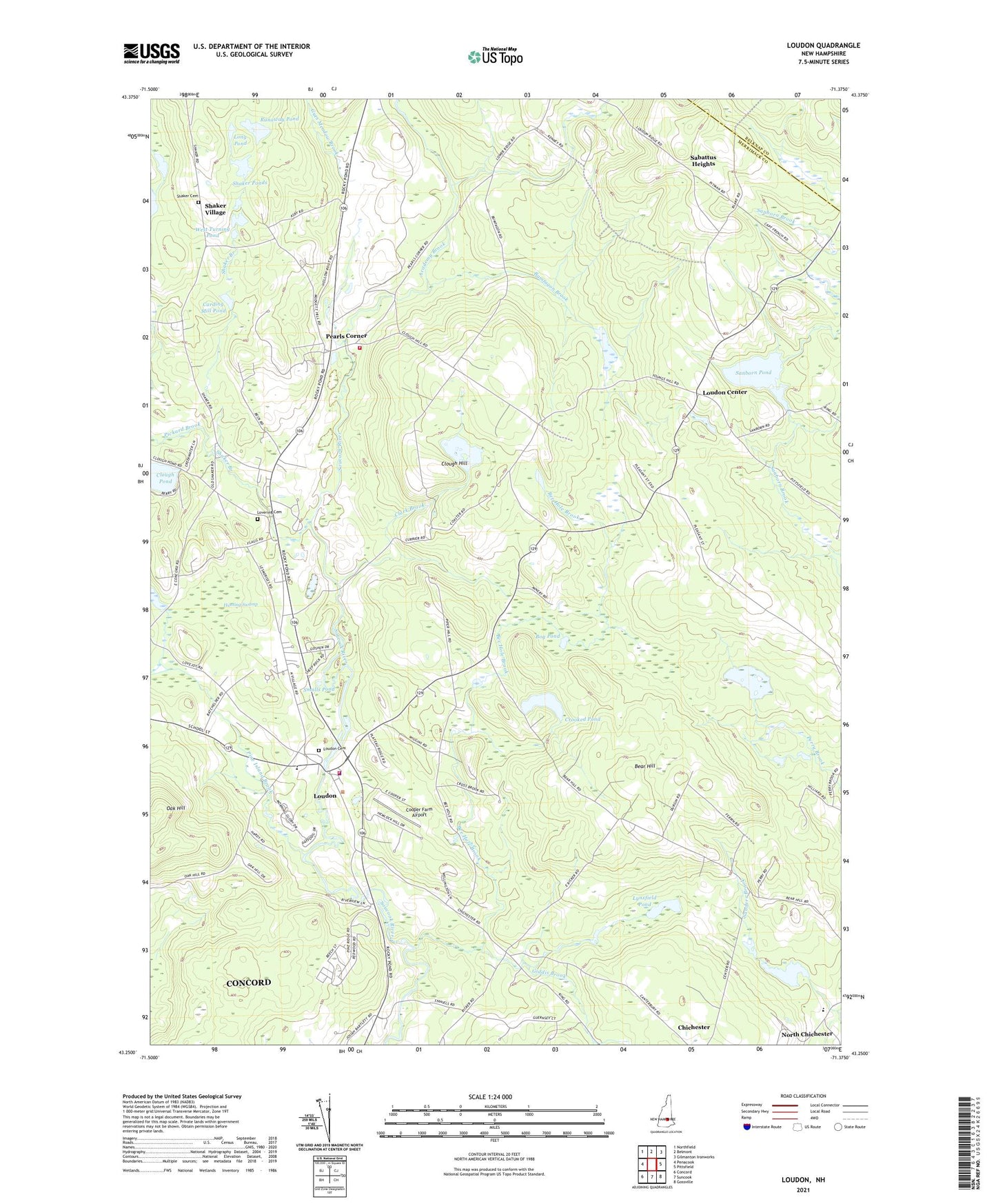
2024 topographic map quadrangle Loudon in the state of New Hampshire. Scale: 1:24000. Based on the newly updated USGS 7.5' US Topo map series, this map is in the following counties: Merrimack, Belknap. The map contains contour data, water features, and other items you are used to seeing on USGS maps, but also has updated roads and other features. This is the next generation of topographic maps. Printed on high-quality waterproof paper with UV fade-resistant inks.
Quads adjacent to this one:
West: Penacook
Northwest: Northfield
North: Belmont
Northeast: Gilmanton Ironworks
East: Pittsfield
Southeast: Gossville
South: Suncook
Southwest: Concord
This map covers the same area as the classic USGS quad with code o43071c4.
Contains the following named places: Academy Brook, Bear Hill, Bee Hole Brook, Bog Pond, Bumfagon Brook, Carding Mill Pond, Center Dam, Center Pond, Chichester Central School, Clark Brook, Clough Hill, Clough Pond, Cooper Farm Airport, Crooked Pond, Crowley Heliport, East Dam, East Turning Pond, East Turning Pond Dam, Giddis Brook, Gues Meadow Brook, Hunting Swamp, Long Pond, Long Pond Dike, Loudon, Loudon Cemetery, Loudon Census Designated Place, Loudon Center, Loudon Center Church, Loudon Center Freewill Baptist Church, Loudon Elementary School, Loudon Fire Department Station 1, Loudon Fire Department Station 2, Loudon Police Department, Lovering Cemetery, Lynxfield Pond, Meadow Ledge Farm, New Hampshire International Speedway, Pearls Corner, Pickard Brook, Pine Island Brook, Runaway Pond, Sabattus Heights, Sanborn Pond, Sanborn Pond Outlet Dam, Shaker Branch, Shaker Cemetery, Shaker Ponds, Shaker Village, Smalls Pond, Soucook River State Forest, Speedway Heliport, Town of Chichester, Town of Loudon, West Turning Pond, West Turning Pond Dam, ZIP Codes: 03258, 03307