MyTopo
Parker Mountain New Hampshire US Topo Map
Couldn't load pickup availability
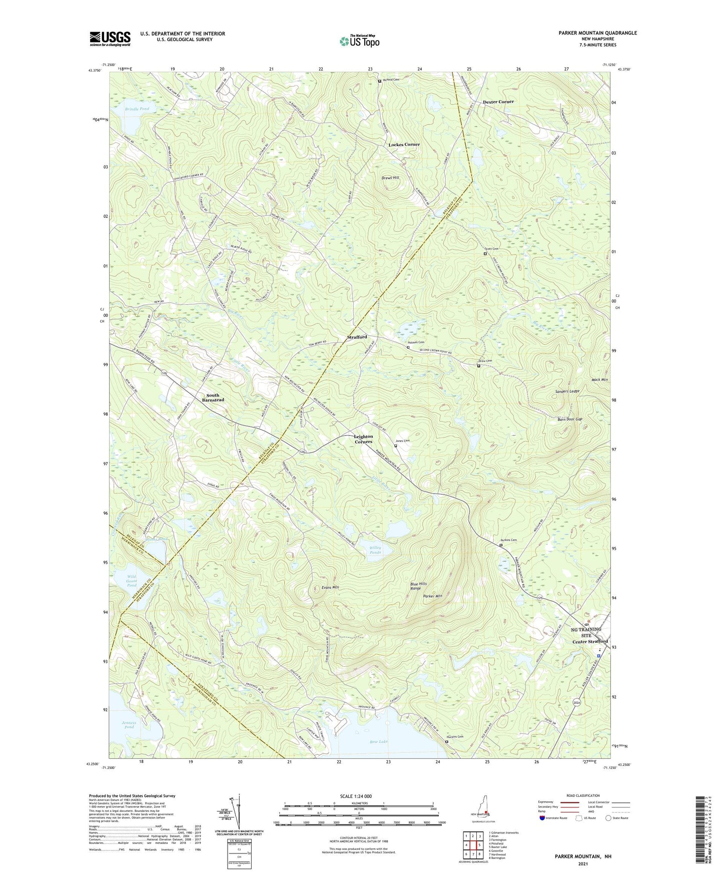
2024 topographic map quadrangle Parker Mountain in the state of New Hampshire. Scale: 1:24000. Based on the newly updated USGS 7.5' US Topo map series, this map is in the following counties: Strafford, Belknap, Rockingham, Merrimack. The map contains contour data, water features, and other items you are used to seeing on USGS maps, but also has updated roads and other features. This is the next generation of topographic maps. Printed on high-quality waterproof paper with UV fade-resistant inks.
Quads adjacent to this one:
West: Pittsfield
Northwest: Gilmanton Ironworks
North: Alton
Northeast: Farmington
East: Baxter Lake
Southeast: Barrington
South: Northwood
Southwest: Gossville
This map covers the same area as the classic USGS quad with code o43071c2.
Contains the following named places: Adams Pond, Austin Cate Academy, Barn Door Gap, Blue Hills Range, Brindle Pond, Camp Foss, Center Strafford, Dexter Corner, Drew Cemetery, Drews Hill, Evans Mountain, Hills Corner, Holmes Cemetery, Huckins Cemetery, Jenness Pond, Jones Cemetery, Leighton Corners, Little River, Lockes Corner, McNeal Cemetery, Memorial Chapel, North Barnstead, Parker Mountain, Parker Mountain Camp, Perkins Cemetery, Sanders Ledge, Scott Cemetery, Shackford Corners, Shinglemill Brook, South Barnstead, Strafford, Strafford Police Department, Strafford Post Office, Strafford School, Third Free Will Baptist Church, Town of Strafford, Trinity Camp, Welshs Corner, Wild Goose Pond, Willey Ponds, ZIP Codes: 03225, 03884