MyTopo
Holderness New Hampshire US Topo Map
Couldn't load pickup availability
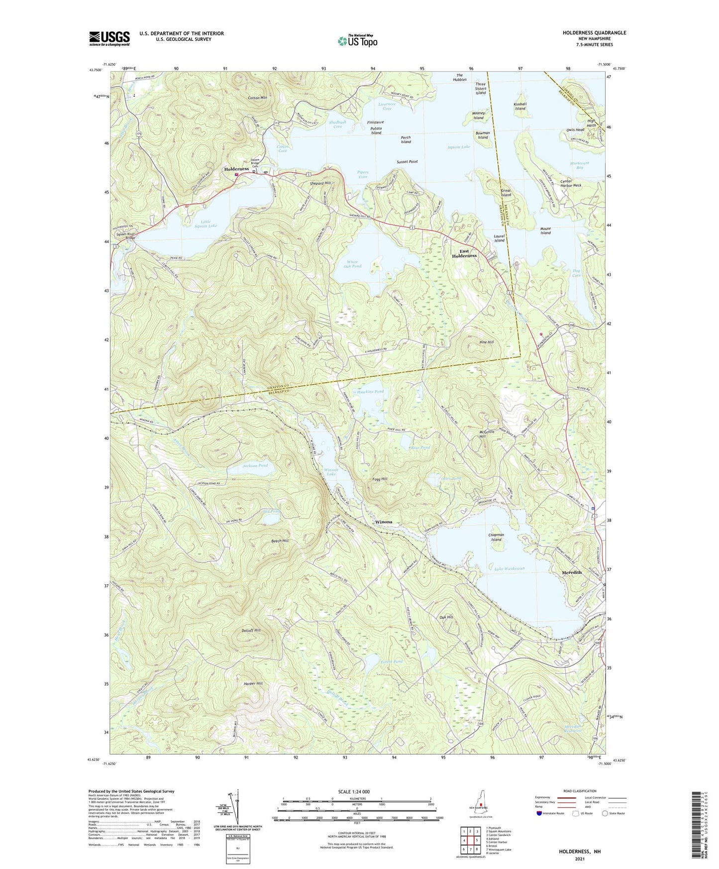
2021 topographic map quadrangle Holderness in the state of New Hampshire. Scale: 1:24000. Based on the newly updated USGS 7.5' US Topo map series, this map is in the following counties: Belknap, Grafton, Carroll. The map contains contour data, water features, and other items you are used to seeing on USGS maps, but also has updated roads and other features. This is the next generation of topographic maps. Printed on high-quality waterproof paper with UV fade-resistant inks.
Quads adjacent to this one:
West: Ashland
Northwest: Plymouth
North: Squam Mountains
Northeast: Center Sandwich
East: Center Harbor
Southeast: Laconia
South: Winnisquam Lake
Southwest: Bristol
Contains the following named places: Advent Christian Church, Bear Pond, Beech Hill, Benjamin M Smith Memorial Library, Bowman Island, Calvary Bible Church, Camp Winnetaska, Carr Brook, Center Harbor Fire and Rescue Station 2, Center Harbor Neck, Central School, Chapman Island, Cotton Cove, Cotton Mountain, Dog Cove, Dolloff Hill, East Holderness, Finisterre, First Baptist Church, Fogg Hill, Forest Pond, Great Island, Harper Hill, Hawkins Pond, Hawkins Pond Dam, High Haith, Holderness, Holderness Community Church, Holderness Fire Department, Holderness Free Library, Holderness Police Department, Holderness Post Office, Hoyt Brook, Immaculate Conception Apostolic School, Jackson Pond, Kimball Island, Lake Waukewan, Lake Waukewan Dam, Laurel Island, Little Squam Lake, Livernore Cove, McGrillis Hill, Meredith, Meredith Congregational Church, Meredith Police Department, Meredith Post Office, Meredith Reservoir, Meredith Reservoir Dam, Mill Falls Marketplace Shopping Center, Mooney Island, Mouse Island, Oak Hill, Oak Hill Golf Course, Otter Pond, Owl Brook, Owls Head, Perch Island, Pine Hill, Pipers Cove, Potato Island, Saint Peters Church, Shadbush Cove, Shepard Hill, Sky Pond, Sky Pond State Forest, Smiling Jack Heliport, Squam Bridge Cemetery, Squam Lake Science Center, Squam River Bridge, State of New Hampshire, Stewarts Ambulance Service, Sturtevant Bay, Sunset Point, Swainey Brook, The Hubbles, Three Sisters Island, Town of Center Harbor, Town of Meredith, Waukewan Golf Course, West Center Harbor, White Oak Pond, White Oak Pond Dam, Winona, Winona Lake, ZIP Code: 03226