MyTopo
Ashland New Hampshire US Topo Map
Couldn't load pickup availability
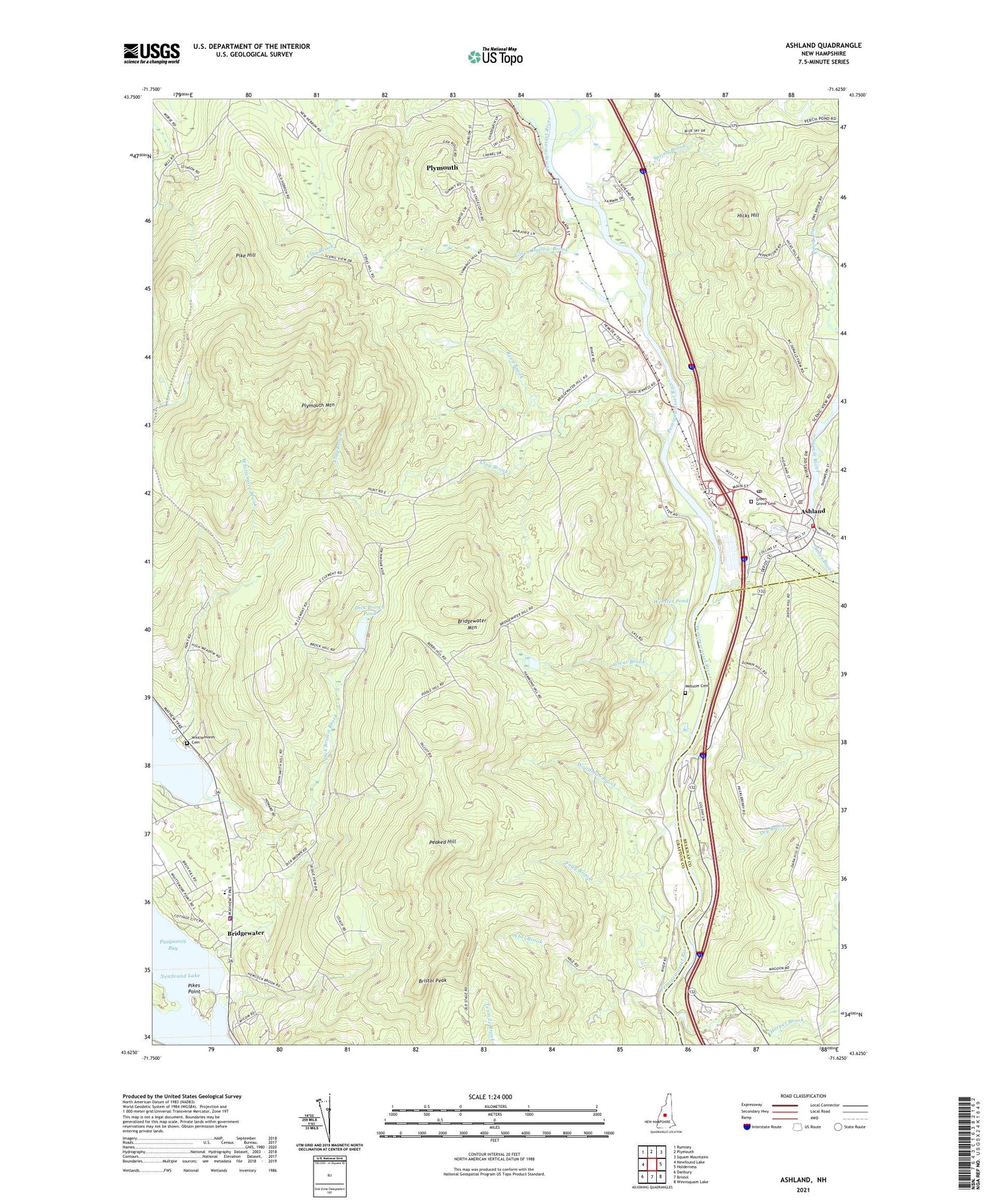
2024 topographic map quadrangle Ashland in the state of New Hampshire. Scale: 1:24000. Based on the newly updated USGS 7.5' US Topo map series, this map is in the following counties: Grafton, Belknap. The map contains contour data, water features, and other items you are used to seeing on USGS maps, but also has updated roads and other features. This is the next generation of topographic maps. Printed on high-quality waterproof paper with UV fade-resistant inks.
Quads adjacent to this one:
West: Newfound Lake
Northwest: Rumney
North: Plymouth
Northeast: Squam Mountains
East: Holderness
Southeast: Winnisquam Lake
South: Bristol
Southwest: Danbury
This map covers the same area as the classic USGS quad with code o43071f6.
Contains the following named places: Abel Brook, Ames Brook, Ames Brook Campground, Ashland, Ashland Census Designated Place, Ashland Elementary School, Ashland Fire Department, Ashland Junior High School, Ashland Mill Dam, Ashland Police Department, Ashland Post Office, Ashland Town Hall, Ashland Town Sewage Lagoon Dikes, Ashland Town Sewage Lagoons, Bridgewater, Bridgewater Hebron Village Elementary School, Bridgewater Hebron Village Preschool, Bridgewater Mountain, Bridgewater Police Department, Bristol Peak, Church Hill Wildlife Management Area, Clay Brook, Dana Church, Department Of Public Safety Bridgewater Fire Department and Emergency Medical Services, Dick Brown Brook, Dick Brown Pond, Dick Brown Pond Dam, Dry Brook, First Free Will Baptist Church, Fogg Brook, Glove Hollow Brook, Great Brook, Green Grove Cemetery, Grist Mill Pond, Harper Brook, Hicks Hill, Little Squam Lake, Mayhew Island, Peaked Hill, Pike Hill, Pikes Point, Plymouth Census Designated Place, Plymouth Mountain, Reed Brook, River Road School, Riverside Airport, Saint Agnes Church, Saint Marks Episcopal Church, Scribner Fellows State Forest, Spring Brook, Squam Lake Dam, Squam River, Town of Ashland, Town of Bridgewater, Town of Plymouth, Webster Cemetery, Webster Pond, Whittemore Brook, Whittemores Cemetery, Wildwood Ski Touring Center, Woodman Brook, ZIP Codes: 03217, 03264