MyTopo
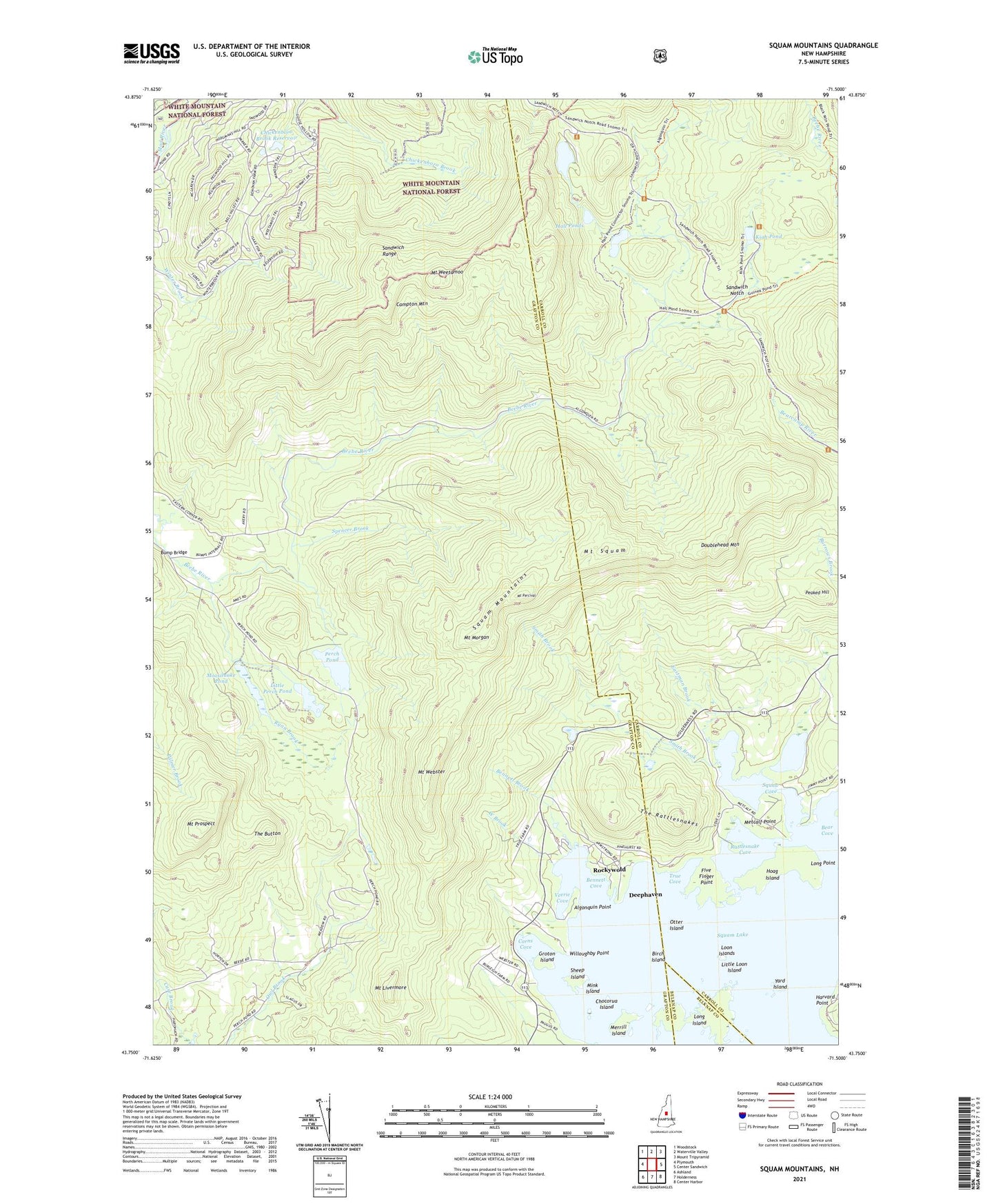
Squam Mountains New Hampshire US Topo Map
Couldn't load pickup availability
Also explore the Squam Mountains Forest Service Topo of this same quad for updated USFS data
2024 topographic map quadrangle Squam Mountains in the state of New Hampshire. Scale: 1:24000. Based on the newly updated USGS 7.5' US Topo map series, this map is in the following counties: Grafton, Carroll, Belknap. The map contains contour data, water features, and other items you are used to seeing on USGS maps, but also has updated roads and other features. This is the next generation of topographic maps. Printed on high-quality waterproof paper with UV fade-resistant inks.
Quads adjacent to this one:
West: Plymouth
Northwest: Woodstock
North: Waterville Valley
Northeast: Mount Tripyramid
East: Center Sandwich
Southeast: Center Harbor
South: Holderness
Southwest: Ashland
This map covers the same area as the classic USGS quad with code o43071g5.
Contains the following named places: Algonquin Point, Bear Cove, Bennett Brook, Bennett Cove, Birch Island, Bridle Path, Bump Bridge, Butterworth Trail, Campton Mountain, Carns Cove, Cascade Trail, Chickenboro Brook Reservoir, Chickenboro Brook Reservoir Dam, Chocorua Island, Col Trail, Deephaven, Doublehead Mountain, Doublehead Trail, Eastman Brook, Five Finger Point, Groton Island, Hall Ponds, Harvard Point, Hoag Island, Intervale Pond, Kiah Pond, Little Loon Island, Little Perch Pond, Locke Waterville Corporation Dam, Locke Waterville Corporation Number 2 Dam, Long Island, Long Point, Loon Islands, Merrill Island, Metcalf Point, Mink Island, Moosilauke Pond, Mount Livermore, Mount Morgan, Mount Morgan Trail, Mount Percival, Mount Prospect, Mount Squam, Mount Webster, Mount Weetamoo, Otter Island, Pasture Trail, Peaked Hill, Perch Pond, Percival Trail, Prospect Trail, Ramsey Trail, Rattlesnake Cove, Rattlesnake Trail, Ridge Trail, Ridgepole Trail, Rockywold, Ryan Brook, Sandwich Notch, Sheep Island, Smith Brook, Spencer Brook, Squam Lake, Squam Mountains, Squaw Cove, The Button, The Rattlesnakes, The Wall Trail, Town of Holderness, True Cove, True School, Undercut Trail, Veerie Cove, West Brook, Willoughby Point, Yard Island, ZIP Code: 03245