MyTopo
Jefferson New Hampshire US Topo Map
Couldn't load pickup availability
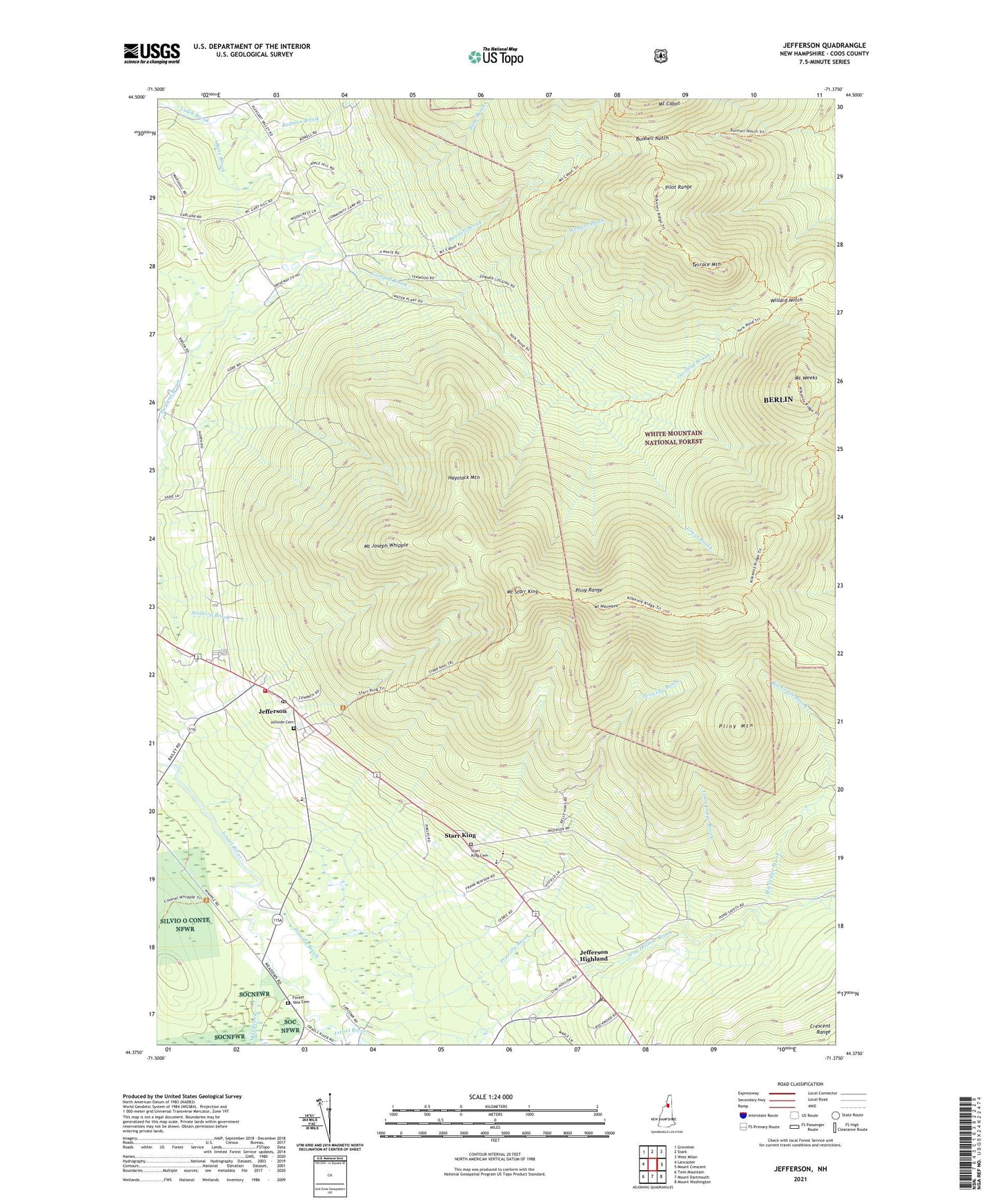
2021 topographic map quadrangle Jefferson in the state of New Hampshire. Scale: 1:24000. Based on the newly updated USGS 7.5' US Topo map series, this map is in the following counties: Coos. The map contains contour data, water features, and other items you are used to seeing on USGS maps, but also has updated roads and other features. This is the next generation of topographic maps. Printed on high-quality waterproof paper with UV fade-resistant inks.
Quads adjacent to this one:
West: Lancaster
Northwest: Groveton
North: Stark
Northeast: West Milan
East: Mount Crescent
Southeast: Mount Washington
South: Mount Dartmouth
Southwest: Twin Mountain
Contains the following named places: Big Ledge Brook, Bone Brook, Bunnell Brook, Bunnell Notch, Forest Vale Cemetery, Gore School, Great Brook, Haystack Mountain, Hillside Cemetery, Holy Trinity Church, Jefferson, Jefferson Elementary School, Jefferson Emergency Medical Services, Jefferson Fire Department, Jefferson Highland, Jefferson Historical Museum, Jefferson Post Office, Jefferson Presbyterian Church, Little Ledge Brook, Mill Brook, Mount Cabot School, Mount Cabot Trail, Mount Joseph Whipple, Mount Starr King, Mount Waumbek, Mount Weeks, North American Family Institute Davenport School, Pliny Mountain, Pliny Range, Priscilla Brook, Red Brook, Redman Brook, Saint Johns Church, Starr King, Starr King Cemetery, Terrace Mountain, Town of Jefferson, Township of Kilkenny, Waumbek Golf Course, Webster Brook, Willard Notch, York Pond Trail, ZIP Code: 03583