MyTopo
Groveton New Hampshire US Topo Map
Couldn't load pickup availability
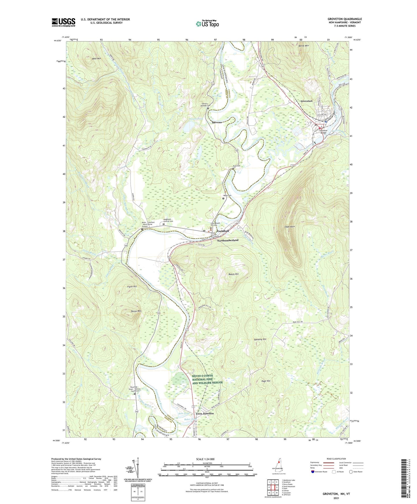
2024 topographic map quadrangle Groveton in the states of New Hampshire, Vermont. Scale: 1:24000. Based on the newly updated USGS 7.5' US Topo map series, this map is in the following counties: Coos, Essex. The map contains contour data, water features, and other items you are used to seeing on USGS maps, but also has updated roads and other features. This is the next generation of topographic maps. Printed on high-quality waterproof paper with UV fade-resistant inks.
Quads adjacent to this one:
West: Stone Mountain
North: Stratford
Northeast: Percy Peaks
East: Stark
Southeast: Jefferson
South: Lancaster
Southwest: Gilman
Contains the following named places: Baker Pond, Bald Mountain, Beech Hill, Cape Horn, Central School, Connecticut Groveton Dam, Connecticut River Reservoir, Coos Junction, Court House Hill Cemetery, Cutler Mill Brook, Dean Brook, Duren Mountain, Dutton Brook, Eames Wayside Area, Emery Brook, Essex County Courthouse, Flynn Hill, Groveton, Groveton Ambulance Service, Groveton Bridge, Groveton Census Designated Place, Groveton Elementary School, Groveton Fire and Rescue, Groveton High School, Groveton Middle School, Groveton Post Office, Guildhall, Guildhall Elementary School, Guildhall Post Office, Guildhall Square, Guildhall Station, Guildhall Village Historic District, Jones Brook, Keith - Crawford - North Burial Ground, Kent Pond, Lancaster Heliport, Lower Groveton Dam, Moore Brook, North Country Charter Academy Lancaster Center, Northumberland, Northumberland Police Department, Northumberland Public Library, Northumberland Shopping Center, Page Hill, Parks Brook, Potter Brook, Rich Cemetery, Ridgewell - Central Cemetery, Riverside - Smart - Fellows - South Cemetery, Roaring Brook, Saint Francis Xavier Church, Sheridan Brook, Spalding Hill, Stevens, Stevens - McDade Cemetery, Stevens Pond, Town of Northumberland, Upper Ammonoosuc Dam, Upper Ammonoosuc River, Upper Groveton Dam, Washburn Brook, Webb Cemetery, Whipple Brook