MyTopo
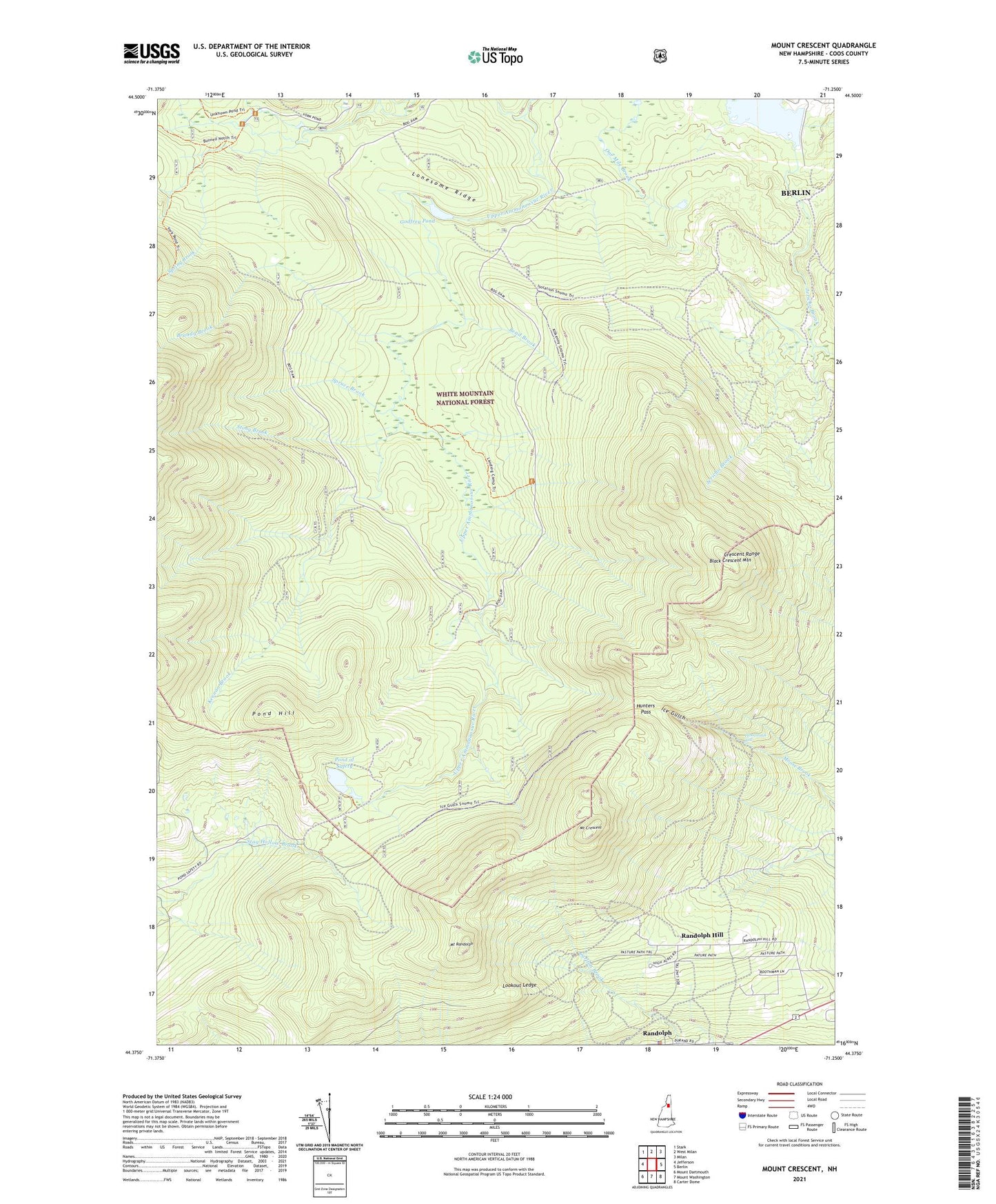
Mount Crescent New Hampshire US Topo Map
Couldn't load pickup availability
2021 topographic map quadrangle Mount Crescent in the state of New Hampshire. Scale: 1:24000. Based on the newly updated USGS 7.5' US Topo map series, this map is in the following counties: Coos. The map contains contour data, water features, and other items you are used to seeing on USGS maps, but also has updated roads and other features. This is the next generation of topographic maps. Printed on high-quality waterproof paper with UV fade-resistant inks.
Quads adjacent to this one:
West: Jefferson
Northwest: Stark
North: West Milan
Northeast: Milan
East: Berlin
Southeast: Carter Dome
South: Mount Washington
Southwest: Mount Dartmouth
Contains the following named places: Bend Brook, Black Crescent Mountain, Bog Dam, Bog Dam Trail, Brandy Brook, Camp 18, Camp 19, Carlton Notch, City of Berlin, Cook Path, Crescent Range, Godfrey Dam, Godfrey Pond, Hunters Pass, Ice Gulch, Ice Gulch Path, Jericho Lake, Jericho Lake Park, Jericho Trail, Keenan Brook, Lonesome Ridge, Lookout Ledge, Mount Crescent, Mount Randolph, Number Nine Brook, Peboamauk Fall, Pond Hill, Pond of Safety, Pond of Safety Trail, Randolph, Randolph Emergency Medical Services, Randolph Hill, Randolph Police Department, Ravine House, Refuge Brook, Scates Corner, Site Number 1 Dead River Dam, Spring Brook, Spruce Brook, Stony Brook, Town of Randolph, Upper Ammonoosuc Trail, West Branch Upper Ammonoosuc River