MyTopo
Mount Dartmouth New Hampshire US Topo Map
Couldn't load pickup availability
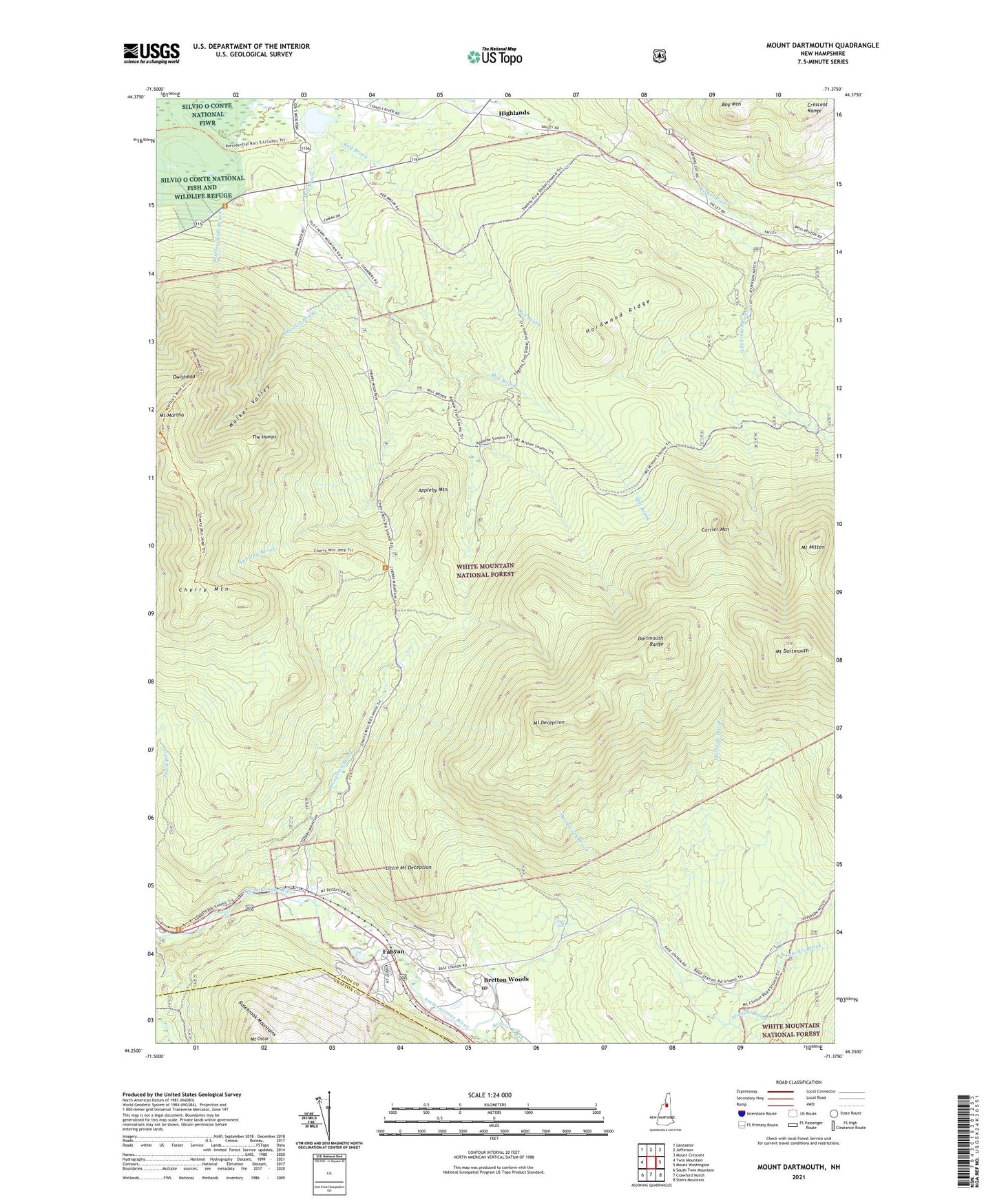
2021 topographic map quadrangle Mount Dartmouth in the state of New Hampshire. Scale: 1:24000. Based on the newly updated USGS 7.5' US Topo map series, this map is in the following counties: Coos, Grafton. The map contains contour data, water features, and other items you are used to seeing on USGS maps, but also has updated roads and other features. This is the next generation of topographic maps. Printed on high-quality waterproof paper with UV fade-resistant inks.
Quads adjacent to this one:
West: Twin Mountain
Northwest: Lancaster
North: Jefferson
Northeast: Mount Crescent
East: Mount Washington
Southeast: Stairs Mountain
South: Crawford Notch
Southwest: South Twin Mountain
Contains the following named places: Abenaki Brook, Appleby Brook, Appleby Mountain, Assaguam Brook, Boy Mountain, Bretton Woods, Bretton Woods Post Office, Bretton Woods Ski Area, Carroll Trail, Cherry Mountain, Church of the Transfiguration, Crawfords Purchase, Currier Mountain, Dartmouth Brook, Dartmouth Range, Dartmouth Trail, Deception Brook, Deception Trail, Fabyan, Halfway Brook, Hardwood Ridge, Highlands, Israel River Ranger Station, Jefferson Brook, Jefferson Station, Little Bear Brook, Little Mount Deception, Lower Falls, Meadows, Mill Brook Trail, Mount Dartmouth, Mount Deception, Mount Martha, Mount Mitten, Mount Oscar, Mount Pleasant Brook, Owlshead, Sebosis Brook, Sokokis Brook, South Branch Israel River, Stag Hollow Brook, Stanley Slide Brook, Streator Brook, The Humps, Upper Falls, Walker Valley, Zealand Forest Camp, ZIP Codes: 03575, 03595