MyTopo
South Twin Mountain New Hampshire US Topo Map
Couldn't load pickup availability
Also explore the South Twin Mountain Forest Service Topo of this same quad for updated USFS data
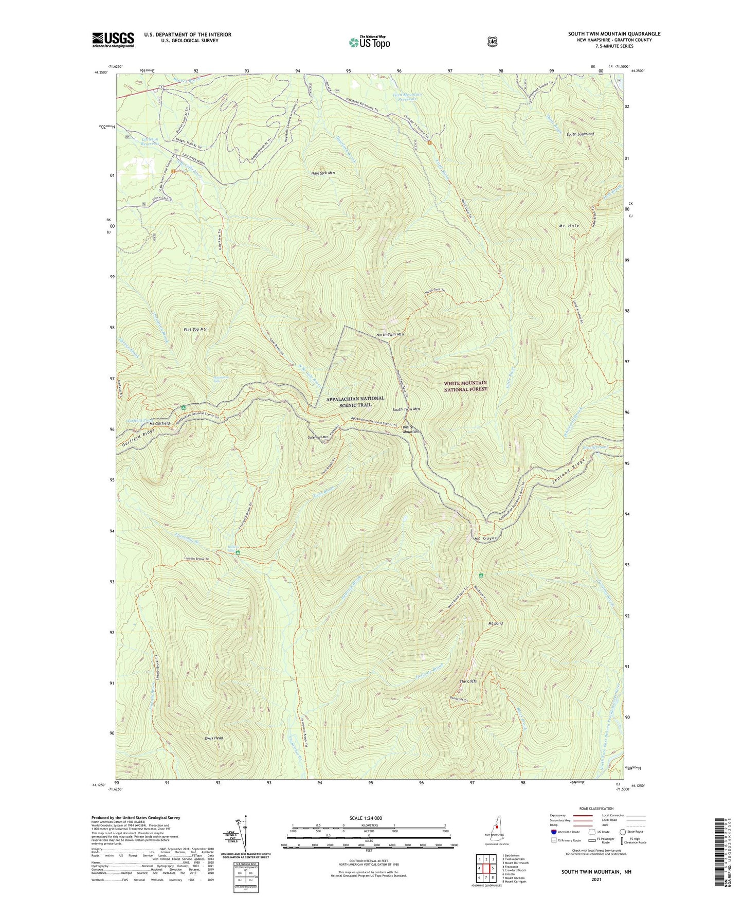
2024 topographic map quadrangle South Twin Mountain in the state of New Hampshire. Scale: 1:24000. Based on the newly updated USGS 7.5' US Topo map series, this map is in the following counties: Grafton. The map contains contour data, water features, and other items you are used to seeing on USGS maps, but also has updated roads and other features. This is the next generation of topographic maps. Printed on high-quality waterproof paper with UV fade-resistant inks.
Quads adjacent to this one:
West: Franconia
Northwest: Bethlehem
North: Twin Mountain
Northeast: Mount Dartmouth
East: Crawford Notch
Southeast: Mount Carrigain
South: Mount Osceola
Southwest: Lincoln
This map covers the same area as the classic USGS quad with code o44071b5.
Contains the following named places: Beaver Brook Recreation Area, Bondcliff Trail, Deerfield, Flat Top Mountain, Franconia Brook Trail, Gale River Trail, Galehead Hut, Galehead Mountain, Garfield Pond, Garfield Ridge Trail, Hale Brook Trail, Hawthorne Falls, Haystack Mountain, Hellgate Brook, Lend-A-Hand Trail, Lincoln Brook Trail, Littleton Reservoir, Mount Bond, Mount Garfield, Mount Guyot, Mount Guyot Shelter, Mount Hale, North Twin Mountain, North Twin Trail, Owls Head, Pemigewasset Wilderness, Redrock Brook, South Sugarloaf, South Twin Mountain, The Cliffs, Thirteen Falls, Thirteen Falls Campsite, Twin Brook, Twin Mountain Reservoir, Twinway Trail, Zeacliff Pond, Zealand Ridge