MyTopo
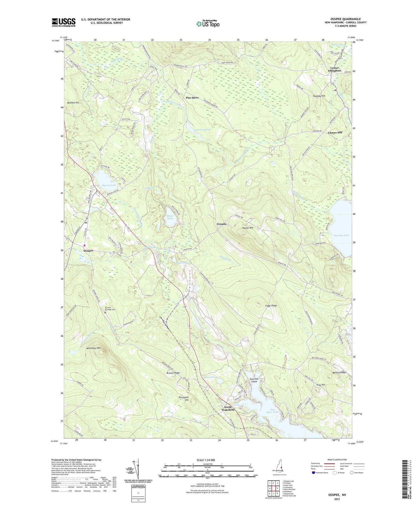
Ossipee New Hampshire US Topo Map
Couldn't load pickup availability
2021 topographic map quadrangle Ossipee in the state of New Hampshire. Scale: 1:24000. Based on the newly updated USGS 7.5' US Topo map series, this map is in the following counties: Carroll. The map contains contour data, water features, and other items you are used to seeing on USGS maps, but also has updated roads and other features. This is the next generation of topographic maps. Printed on high-quality waterproof paper with UV fade-resistant inks.
Quads adjacent to this one:
West: Tuftonboro
Northwest: Ossipee Lake
North: Freedom
Northeast: Kezar Falls
East: West Newfield
Southeast: Great East Lake
South: Sanbornville
Southwest: Wolfeboro
Contains the following named places: Arthur H Fox Memorial Dam, Ballard Ridge, Beachwood Shores Campground, Black Pond, Browns Ridge, Center Effingham, Chases Mill, Duncan Lake, Effingham Fire Department, Foggs Ridge, Frenchman Brook, Granite, Grape Corner, Hobbs Brook, Huckins Pond Dam, Hutchins Pond, Leighton Corners, Lost Ponds, Masonic Temple, Milliken Hill, New England Masonic Charitable Institution, North Wakefield, Ossipee, Ossipee Corner Fire Department, Ossipee Post Office, Overlook Island, Peavey Brook, Pike Brook, Pine River, Pine River State Forest, Pocket Mountain, Poland Brook, Porcupine Hill, Pray Hill, Red Brook, Round Pond, Rumney Hill, Snake Pond, Summer Brook Rearing Station, Town of Effingham, White Pond, Whiteface Mountain, Wilkinson Brook, Youngs Brook, ZIP Codes: 03864, 03882