MyTopo
Tuftonboro New Hampshire US Topo Map
Couldn't load pickup availability
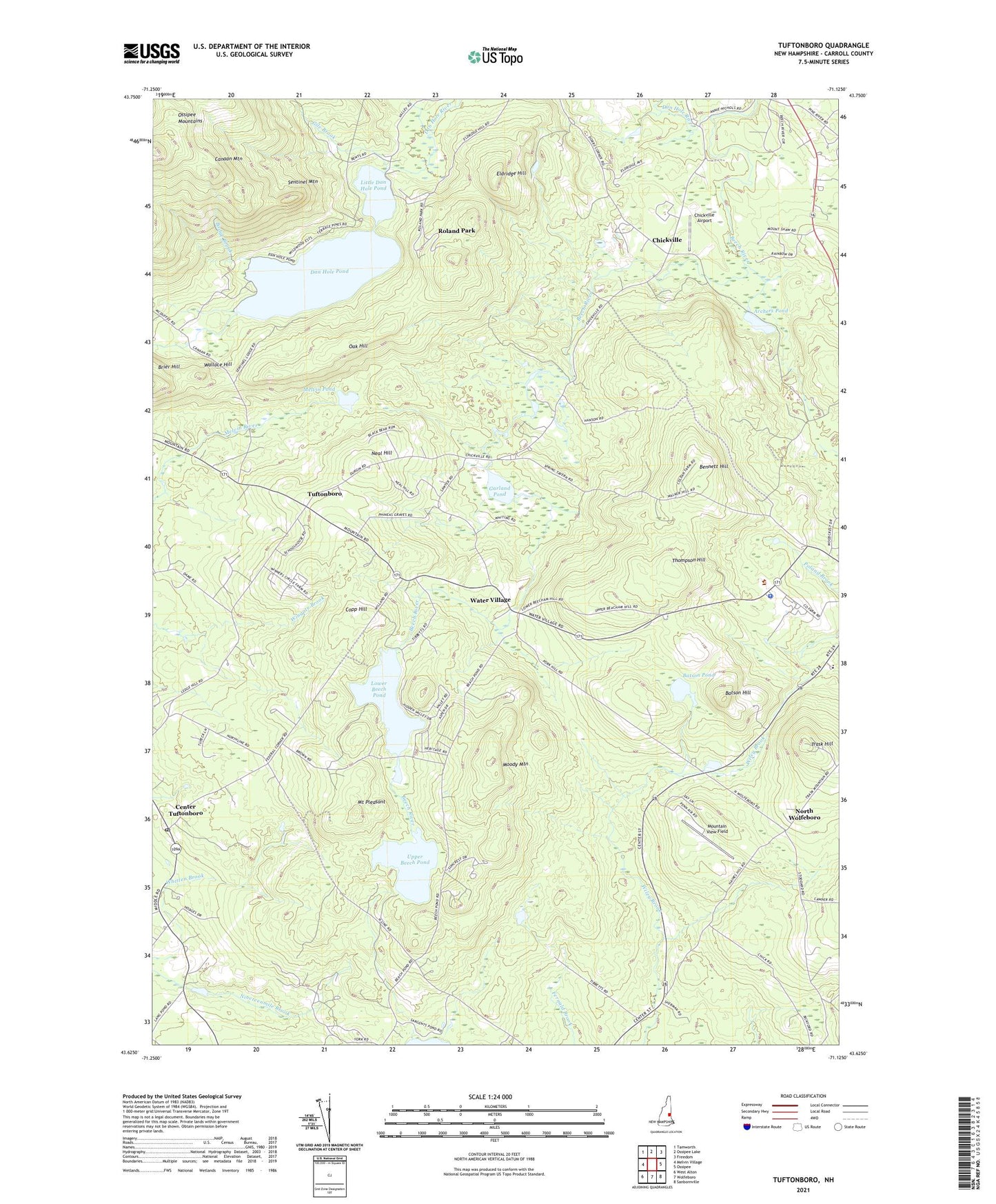
2021 topographic map quadrangle Tuftonboro in the state of New Hampshire. Scale: 1:24000. Based on the newly updated USGS 7.5' US Topo map series, this map is in the following counties: Carroll. The map contains contour data, water features, and other items you are used to seeing on USGS maps, but also has updated roads and other features. This is the next generation of topographic maps. Printed on high-quality waterproof paper with UV fade-resistant inks.
Quads adjacent to this one:
West: Melvin Village
Northwest: Tamworth
North: Ossipee Lake
Northeast: Freedom
East: Ossipee
Southeast: Sanbornville
South: Wolfeboro
Southwest: West Alton
Contains the following named places: Archers Pond, Batson Hill, Batson Pond, Bennett Hill, Bodge Brook, Canaan Mountain, Carroll County Farm, Carroll County Sheriff's Office, Center Tuftonboro, Center Tuftonboro Post Office, Chickville, Chickville Airport, Copp Hill, Cornerstone Christian Academy, Dan Hole Pond, Dan Hole Pond Dam, Dan Hole River, Deer Cap Campground, Dimon Corner, Eldridge Hill, Federal Corner, Garland Pond, Gile Brook, Little Dan Hole Pond, Lower Beech Pond, Lower Beech Pond Dam, Melvin Pond, Moody Mountain, Mount Pleasant, Mountain View Field, Neal Hill, North Wolfeboro, Oak Hill, Pollys Crossing, Roland Park, Sentinel Mountain, Stockbridge Corner, Thompson Hill, Town of Ossipee, Trask Hill, Tuftonboro, Tuftonboro United Methodist Church, Upper Beech Pond, Wallace Hill, Water Village, Whitten Brook, Wolfeboro Campground