MyTopo
Tamworth New Hampshire US Topo Map
Couldn't load pickup availability
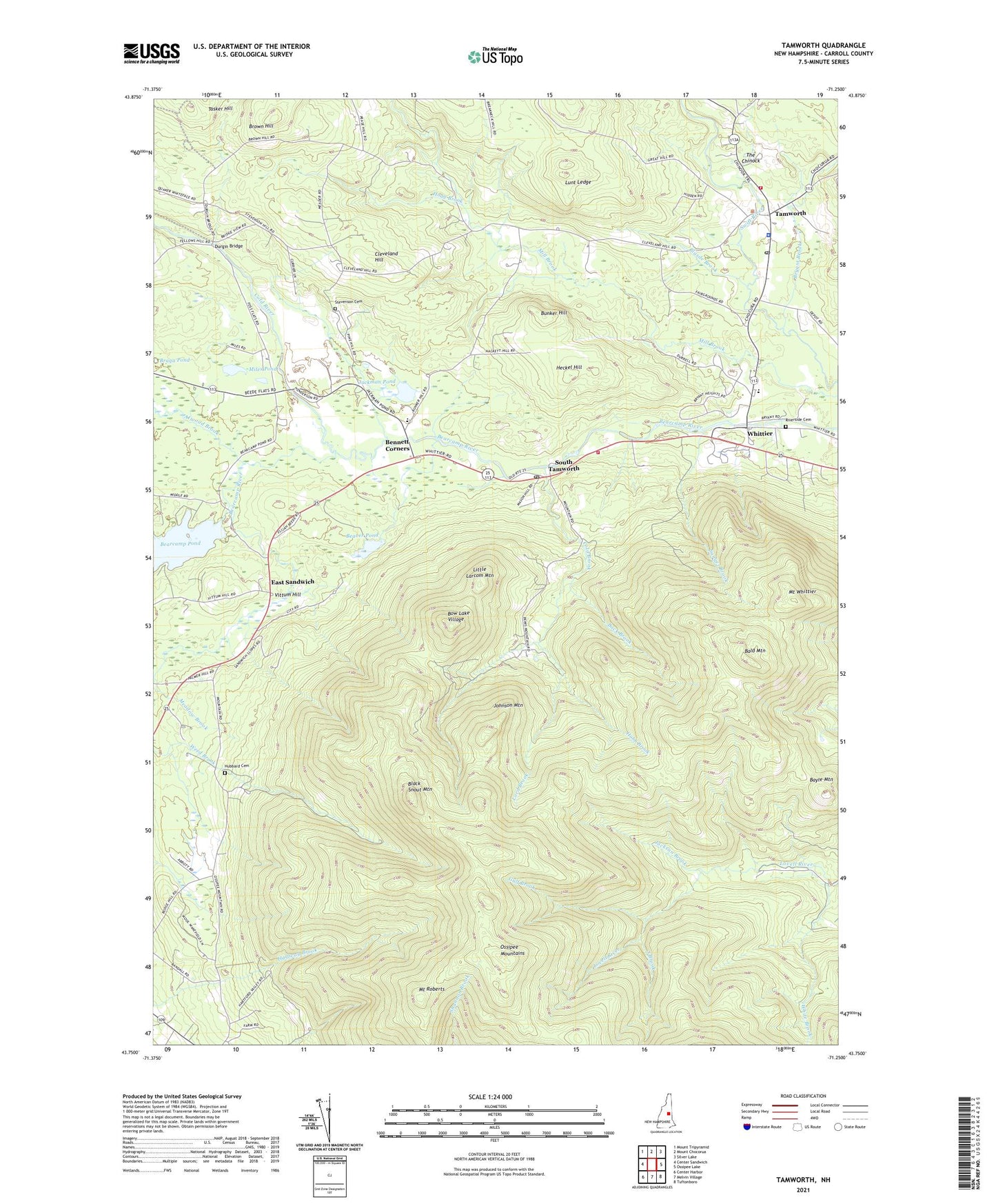
2024 topographic map quadrangle Tamworth in the state of New Hampshire. Scale: 1:24000. Based on the newly updated USGS 7.5' US Topo map series, this map is in the following counties: Carroll. The map contains contour data, water features, and other items you are used to seeing on USGS maps, but also has updated roads and other features. This is the next generation of topographic maps. Printed on high-quality waterproof paper with UV fade-resistant inks.
Quads adjacent to this one:
West: Center Sandwich
Northwest: Mount Tripyramid
North: Mount Chocorua
Northeast: Silver Lake
East: Ossipee Lake
Southeast: Tuftonboro
South: Melvin Village
Southwest: Center Harbor
This map covers the same area as the classic USGS quad with code o43071g3.
Contains the following named places: Atwood Brook, Back Brook, Bald Mountain, Bayle Mountain, Bearcamp Pond, Beaver Pond, Bennett Corners, Black Snout Mountain, Blasde Brook, Bow Lake Village, Braga Pond, Brown Hill, Bryant Brook, Bunker Hill, Cleveland Hill, Cold Brook, Cold River, Durgin Bridge, East Sandwich, East Sandwich Chapel, Friends Church, Gulf Brook, Heckel Hill, Hoag Brook, Hobb Brook, Hubbard Cemetery, Jackman Pond, Jackson Brook, Johnson Mountain, Kenneth A Brett School, Little Larcom Mountain, Lord Brook, Lunt Ledge, Meadow Brook, Miles Pond, Mill Brook, Mount Roberts, Mount Whittier, Ossipee Mountain Ski Area, Ossipee Mountains, Red Hill Pond, Red Hill Pond Dam, Riverside Cemetery, Sanger Brook, South Brook, South Tamworth, South Tamworth Post Office, Stevenson Cemetery, Tamworth, Tamworth Fire Department, Tamworth Fire Department Central Station, Tamworth Police Department, Tamworth Post Office, Tamworth Rescue Squad, Tasker Hill, Taylor Pond, The Chinock, The Community School, Town of Tamworth, Vittum Hill, White Brook, Whittier, WNHX-FM (Moultonborough), ZIP Codes: 03883, 03886