MyTopo
Melvin Village New Hampshire US Topo Map
Couldn't load pickup availability
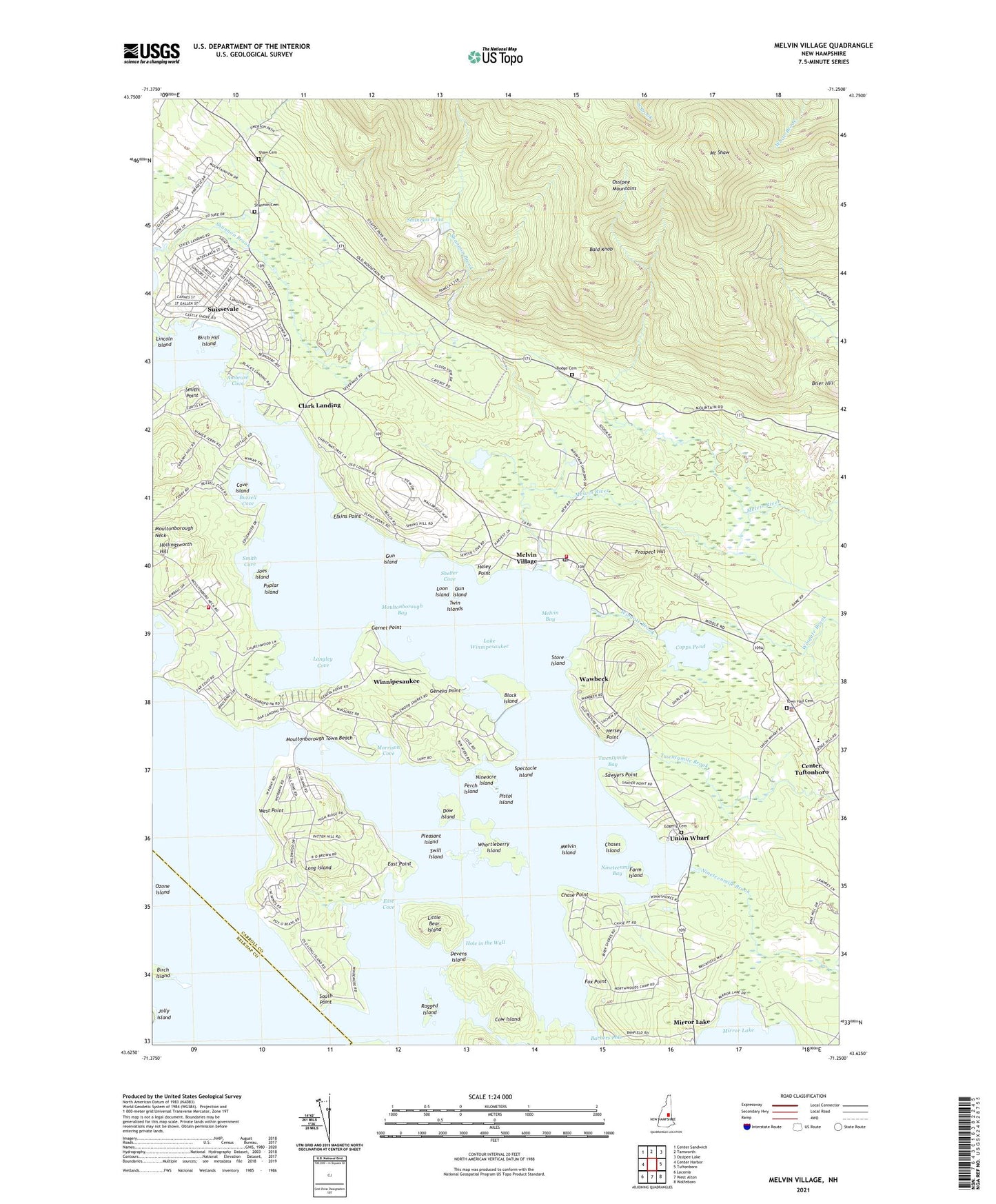
2024 topographic map quadrangle Melvin Village in the state of New Hampshire. Scale: 1:24000. Based on the newly updated USGS 7.5' US Topo map series, this map is in the following counties: Carroll, Belknap. The map contains contour data, water features, and other items you are used to seeing on USGS maps, but also has updated roads and other features. This is the next generation of topographic maps. Printed on high-quality waterproof paper with UV fade-resistant inks.
Quads adjacent to this one:
West: Center Harbor
Northwest: Center Sandwich
North: Tamworth
Northeast: Ossipee Lake
East: Tuftonboro
Southeast: Wolfeboro
South: West Alton
Southwest: Laconia
This map covers the same area as the classic USGS quad with code o43071f3.
Contains the following named places: Ambrose Cove, Arthurs Seaplane Base, Bald Knob, Bald Peak Colony Club, Barbers Pole, Birch Hill Island, Birch Island, Black Island, Bodge Cemetery, Braun Bay, Brier Hill, Buzzell Cove, Chase Point, Chases Island, Clark Landing, Copps Pond, Copps Pond Dam, Copps Pond Wildlife Management Area, Cove Island, Cow Island, Devens Island, Dow Island, East Cove, East Point, Edgerly Cemetery, Elkins Point, Farm Island, Flying H Skyport, Fox Point, Garnet Point, Geneva Point, Gun Island, Haley Point, Hermit Island, Hersey Point, Hole in the Wall, Joes Island, Jonathans Landing, Langley Cove, Lincoln Island, Little Bear Island, Long Island, Long Island Bridge Travel Trailer Park, Loon Island, Loons Nest Seaplane Base, Melvin Bay, Melvin Island, Melvin River, Melvin Village, Melvin Village Airport, Melvin Village Census Designated Place, Melvin Village Post Office, Morrison Cove, Moultonborough Bay, Moultonborough Fire Rescue Department Neck Station 2, Moultonborough Neck, Moultonborough Town Beach, Mount Shaw, Nineacre Island, Nineteenmile Bay, Nineteenmile Brook, North Woods Camp, Ozone Island, Perch Island, Pistol Island, Pleasant Island, Poplar Island, Prospect Hill, Ragged Island, Sawyers Point, Shannon Cemetery, Shannon Pond, Shannon Pond Dam, Shaw Cemetery, Shelter Cove, Smith Cove, Smith Point, South Point, Spectacle Island, State Landing, Steamboat Island, Store Island, Suissevale Census Designated Place, Swill Island, Town Hall Cemetery, Town of Tuftonboro, Tuftonboro Central School, Tuftonboro Fire and Rescue Melvin Village Station, Tuftonboro Police Department, Twentymile Bay, Twentymile Brook, Twin Islands, Union Wharf, Wawbeek, West Point, Whortleberry Island, Wingate Brook, Winnipesaukee, ZIP Codes: 03254, 03816, 03850, 03853