
MyTopo
Canton New Jersey US Topo Map
Couldn't load pickup availability
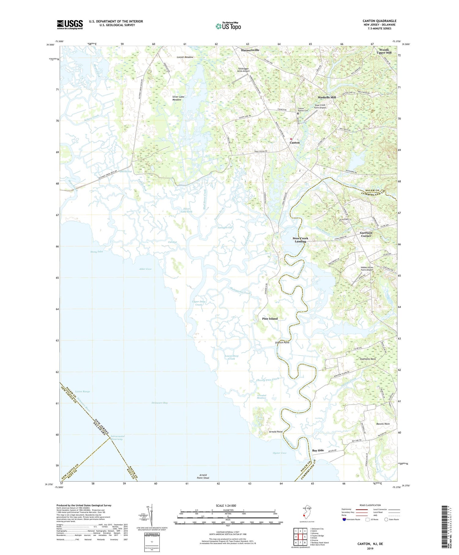
2019 topographic map quadrangle Canton in the state of New Jersey. Scale: 1:24000. Based on the newly updated USGS 7.5' US Topo map series, this map is in the following counties: Salem, Cumberland, New Castle, Kent. The map contains contour data, water features, and other items you are used to seeing on USGS maps, but also has updated roads and other features. This is the next generation of topographic maps. Printed on high-quality waterproof paper with UV fade-resistant inks.
Quads adjacent to this one:
West: Taylors Bridge
Northwest: Delaware City
North: Salem
Northeast: Alloway
East: Shiloh
Southeast: Ben Davis Point
South: Bombay Hook Island
Southwest: Smyrna
Contains the following named places: Alder Cove, Arnold Point, Bacons Neck, Bacons Neck School, Bay Side, Bucks Ditch, Canton, Canton Baptist Cemetery, Canton Drain, Canton School, Cat Gut, Cherry Tree Creek, Denn Branch, Devils Gut, Fishing Creek, Garrison Corner, Goose Pond, Grandad Meadows, Gum Tree Corner, Harmersville, Hidden Acres Farm Airport, Little Creek, Locust Meadow, Long Pond, Lower Alloways Creek Elementary School, Lower Alloways Creek Fire and Rescue Company Station 2, Lower Deep Creek, Mad Horse Creek, Mad Horse Creek Fish and Wildlife Management Area, Malapartis Creek, Maskells Mill, Maskells Millpond, Maskells Millpond Dam, Maskells Millpond Fish and Wildlife Management Area, Muddy Creek, Newport Meadows, Newport Meadows Seaplane Base, Oyster Cove, Pattys Fork, Phillips Creek, Pine Island, Raccoon Ditch, Shore Ditch, Silver Lake Fork, Silver Lake Meadow, Solters Creek, Stathems Neck, Stoe Creek Farm Airport, Stony Inlet, Stow Creek, Stow Creek Landing, Stretch Point, Taildragger Acres Airport, Terrapin Gut, Township of Lower Alloways Creek, Turner Fork, Upper Deep Creek, Willis Corner, ZIP Code: 08038


