MyTopo
Ben Davis Point New Jersey US Topo Map
Couldn't load pickup availability
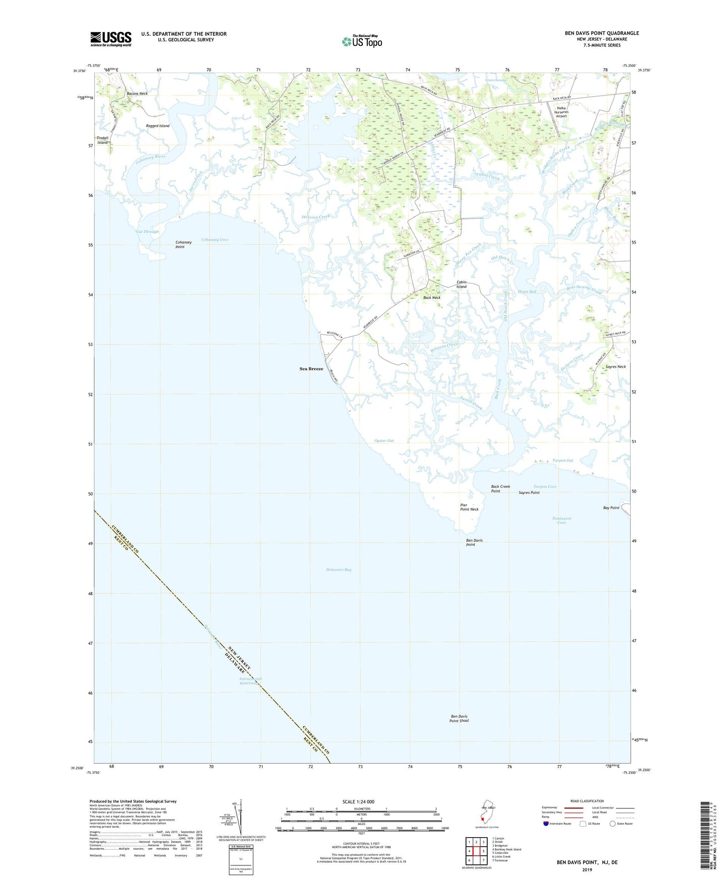
2023 topographic map quadrangle Ben Davis Point in the state of New Jersey. Scale: 1:24000. Based on the newly updated USGS 7.5' US Topo map series, this map is in the following counties: Cumberland, Kent. The map contains contour data, water features, and other items you are used to seeing on USGS maps, but also has updated roads and other features. This is the next generation of topographic maps. Printed on high-quality waterproof paper with UV fade-resistant inks.
Quads adjacent to this one:
West: Bombay Hook Island
Northwest: Canton
North: Shiloh
Northeast: Bridgeton
East: Cedarville
Southeast: Fortescue
Southwest: Little Creek
This map covers the same area as the classic USGS quad with code o39075c3.
Contains the following named places: Abbot Creek, Ayres Creek, Back Creek, Back Creek Point, Back Neck, Bay Point, Bear Swamp Creek, Ben Davis Island, Ben Davis Point, Ben Davis Point Shoal, Blews Run, Bridges Sticks Creek, Cabin Creek, Cabin Island, Cedar Creek, Cohansey Cove, Cohansey Inner Light, Cohansey Outer Light, Cohansey Point, Cohansey River, Cut Through, Dayton Creek, Division Creek, Dix Fish and Wildlife Management Area, Drum Bed, Drumbo Creek, Eastern Cross, Halka Nurseries Airport, Husted Landing, Loyds Corner, Middle Marsh Creek, Nantuxent Cove, Ogden Creek, Old Hatch Creek, Oyster Gut, Pier Point Creek, Pier Point Neck, Ragged Island, Rock Creek, Sayres Neck, Sayres Point, Sea Breeze, Sheep Pen Creek, Tarpon Cove, Tarpon Gut, Tindall Island, Tweed Creek, Western Cross