MyTopo
New Brunswick New Jersey US Topo Map
Couldn't load pickup availability
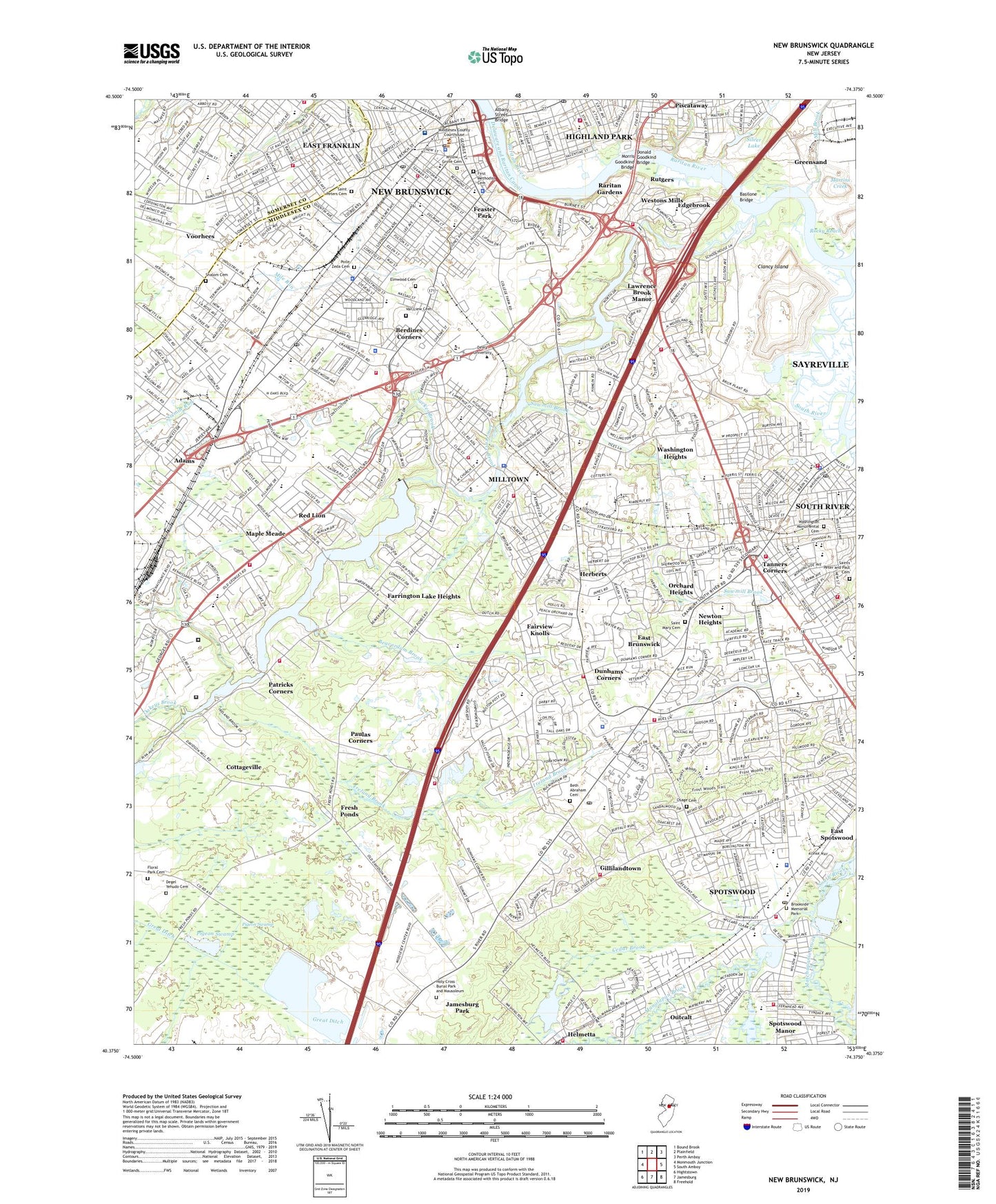
2023 topographic map quadrangle New Brunswick in the state of New Jersey. Scale: 1:24000. Based on the newly updated USGS 7.5' US Topo map series, this map is in the following counties: Middlesex, Somerset. The map contains contour data, water features, and other items you are used to seeing on USGS maps, but also has updated roads and other features. This is the next generation of topographic maps. Printed on high-quality waterproof paper with UV fade-resistant inks.
Quads adjacent to this one:
West: Monmouth Junction
Northwest: Bound Brook
North: Plainfield
Northeast: Perth Amboy
East: South Amboy
Southeast: Freehold
South: Jamesburg
Southwest: Hightstown
This map covers the same area as the classic USGS quad with code o40074d4.
Contains the following named places: A Chester Redshaw Elementary School, Adams, Adams School, Albany Street Bridge, Anshe Emeth Religious School, Arthur M Judd Elementary School, Babbage Park, Baker Park, Bartle Elementary School, Basilone Bridge, Bayard Street School, Beaverdam Brook, Berdines Corners, Beth Abraham Cemetery, Bicentennial Park, Borough of Helmetta, Borough of Milltown, Borough of South River, Borough of Spotswood, Brookside Memorial Park, Brookview, Brunswick Square Shopping Center, Campbell School, Cedar Brook, Central Elementary School, Childrens Choice School, Chittick Elementary School, Churchill Junior High School, City of New Brunswick, Clancy Island, Cornerstone Christian School, Corpus Christi Elementary School, Cottageville, Country Lane Park, Daley's Pond Recreation Area, Dallenbach Sand Pit, Darul Arqam School, Davidson Mill Pond County Park, Davidsons Millpond Dam, Degel Yehudo Cemetery, DeVoe Lake, DeVoe Lake Dam, Donald Goodkind Bridge, Donaldson County Park, Douglas College, Douglas Rutgers Child Study Center School, Dunhams Corners, E Raymond Appleby Elementary School, East Brunswick, East Brunswick Census Designated Place, East Brunswick Community Park, East Brunswick High School, East Brunswick Vocational School, East Franklin Census Designated Place, Edgebrook, Elmer B Boyd Park, Elmwood Cemetery, Escola Infante D Henrique School, Fairview Knolls, Farrington Dam, Farrington Lake, Farrington Lake Heights, Feaster Park, First Methodist Cemetery, Floral Park Cemetery, Fresh Ponds, Frost Elementary School, G Austin Schoenly Elementary School, Georges Road, Gillilandtown, Goddard School, Good Day Preschool, Great Ditch, Greensand, Halls Corners, Hamilton School, Hammarskjold Middle School, Health Sciences Technology High School, Helmetta, Helmetta Dam, Helmetta Pond, Herberts, Highland Park, Hillcrest Elementary School, Holy Cross Burial Park and Mausoleum, Immaculate Conception School, Ireland Brook, Ireland Brook County Park, Irwin Elementary School, Jamesburg County Park Conservation Area, Jamesburg Park, Jersey Turnpike Heliport, Jersey Turnpike New Brunswick Helistop, John Adams Elementary School, John Himich Farms, Joyce Kilmer Elementary School, Kindercare Learning Center, Kossuth Park, Lawrence Brook, Lawrence Brook Elementary School, Lawrence Brook Manor, Lincoln Elementary School Annex, Lincoln Park, Lincoln School, Linwood Middle School, Livingston Avenue High School, Livingston Elementary School, Livingston Park Elementary School, Lord Stirling Elementary School, MacAfee Road Elementary School, Manalapan Brook, Maple Meade, Maple Meade School, Martins Creek, Martins Landing, Matchaponix Brook, McGinnis School, McKinley Community Elementary School, Memorial Elementary School, Memorial Middle School, Memorial Stadium, Middlesex County, Middlesex County Fairgrounds, Mill Brook, Milltown, Morris Goodkind Bridge, Moshe Aaron Yeshiva High School, New Brunswick, New Brunswick Adult Learning Center School, New Brunswick Gas Distribution Heliport, New Brunswick High School, New Brunswick Industrial Park, Newton Heights, North Brunswick Township Census Designated Place, North Brunswick Township High School, North Brunswick Township Park, Oakeys Brook, Orchard Heights, Osage Cemetery, Our Lady Lourdes Elementary School, Outcalt, Pacer's Field, Parkview Elementary School, Parsons Elementary School, Patricks Corners, Paul Robeson Community Elementary School, Paul Robeson Community Elementary School Annex, Paulas Corners, Pigeon Swamp, Pigeon Swamp State Park and Forest, Pine Grove Manor Elementary School, Pine Ridge Park, Piscataway, Pixie Preschool, Poile Zeda Cemetery, Raritan Gardens, Red Lion, Redshaw School, Rhode Hall, Robert Wood Johnson Hospital Heliport, Robert Wood Johnson Medical School - New Brunswick, Robert Wood Johnson University Hospital, Rocky Reach, Roosevelt Elementary School, Rutgers, Rutgers College of Agriculture, Rutgers Helistop Sections A and B Heliport, Rutgers University, Sacred Heart Elementary School, Saint Bartholomew School, Saint Ladislaus School, Saint Mary Cemetery, Saint Mary of Mount Virgin School, Saint Marys of Ostrabrama School, Saint Peter the Apostle Elementary School, Saint Peters Cemetery, Saint Peters High School, Saint Peters Lyceum, Saints Peter and Paul Cemetery, Sawmill Brook, School of Saint John the Baptist, Shalom Cemetery, Silver Lake, Smith School, Solomon Schecter Day School, Somerset, South Plainfield OMS Helistop, South River, South River Elementary School, South River High School, South River Middle School, South River Primary School, South River School, Spotswood, Spotswood High School, Spotswood Manor, Sucker Brook, Tamarack County Golf Course, Tanners Corners, Tara Greens Golf Course, Tices Lane Park, Township of East Brunswick, Township of North Brunswick, Triangle Heliport, Van Liew Cemetery, Voorhees, Voorhees Census Designated Place, Wade School, Warnsdorfer Elementary School, Washington Cemetery, Washington Heights, Washington Monumental Cemetery, Washington School, WCTC-AM (New Brunswick), Webcraft Heliport, Weber School, Westons Mill Pond, Westons Mill Pond Dam, Westons Mill School, Westons Mills, Whitney Pond, Willett School, Willow Grove Cemetery, WMGQ-FM (New Brunswick), Woodland Elementary School, Woodrow Wilson Elementary School, WRSU-FM (New Brunswick), Zigfield, ZIP Codes: 08816, 08828, 08850, 08882, 08884, 08901, 08902


