MyTopo
Washington New Jersey US Topo Map
Couldn't load pickup availability
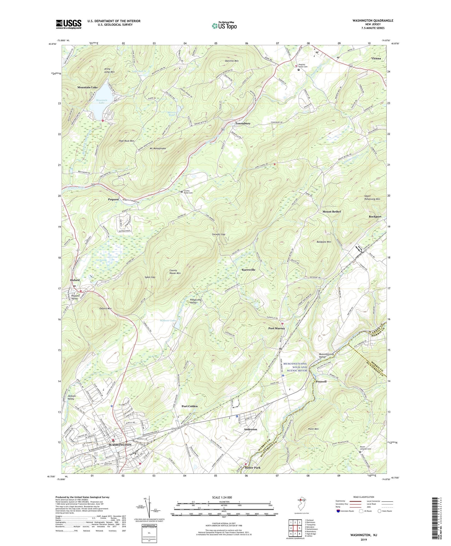
2019 topographic map quadrangle Washington in the state of New Jersey. Scale: 1:24000. Based on the newly updated USGS 7.5' US Topo map series, this map is in the following counties: Warren, Hunterdon, Morris. The map contains contour data, water features, and other items you are used to seeing on USGS maps, but also has updated roads and other features. This is the next generation of topographic maps. Printed on high-quality waterproof paper with UV fade-resistant inks.
Quads adjacent to this one:
West: Belvidere
Northwest: Portland
North: Blairstown
Northeast: Tranquility
East: Hackettstown
Southeast: Califon
South: High Bridge
Southwest: Bloomsbury
Contains the following named places: Anderson, Anderson Census Designated Place, Baldpate Mountain, Borough of Washington, Butler Park, Butler Park Fire Rescue Company, Cat Swamp, Central School, Cliffdale Park, County Home Cemetery, County House Mountain, Danville Mountain, Free Union Church, Great Meadows, Great Meadows Post Office, Great Meadows-Vienna Census Designated Place, High Rock Mountain, Independence First Aid Squad, Independence Township Volunteer Fire Department, Jackson Valley, James Chapel, Jenny Jump Brook, John E Rogers Airport, Karrsville, Lake Just-It, Mansfield Township Elementary School, Mansfield Township Fire Company Number 1, Mansfield Township Police Department, Moores Pond, Mount Bethel, Mount Bethel Volunteer Fire Company Hall, Mount Lebanon Cemetery, Mount Mohepinoke, Mountain Lake, Mountain Lake Brook, Mountain Lake Census Designated Place, Mountain Lake Dam, Mountain Lake Fire Company, New Jersey State Police Station, Oti Heliport, Oxford, Oxford Census Designated Place, Oxford Emergency Squad, Oxford Mountain, Oxford Post Office, Oxford Volunteer Fire Department, Penwell, Pequest, Pequest Fish and Wildlife Management Area, Pequest Union Cemetery, Pequest Valley, Pio Costa Sand and Gravel Heliport, Pohatcong Valley, Point Mountain, Port Colden, Port Colden Census Designated Place, Port Colden Elementary School, Port Murray, Port Murray Census Designated Place, Port Murray Post Office, Rockport, Rural America Emergency Services, Saint Josephs Church, Saint Nicholas Church, Saint Peters Church, Stewart Gap, Sykes Gap, Taylor Street Elementary School, Townsbury, Township Central School, Township of Liberty, Township of Mansfield, Township of Oxford, Vienna, Vienna Census Designated Place, Vienna Church, Vienna Post Office, Warren County, Warren Hills Middle School, Warren Hills Regional High School, Washington, Washington Borough Police Department, Washington Emergency Squad, Washington Fire Department, Washington Memorial Elementary School, Washington Post Office, Washington Township Police Department, Washington Township Volunteer Fire Department Station 2, Willever Lake, Willever Lake Dam, WNTI-FM (Hackettstown), WSRR-AM (Washington), ZIP Codes: 07863, 07865, 07880