MyTopo
Califon New Jersey US Topo Map
Couldn't load pickup availability
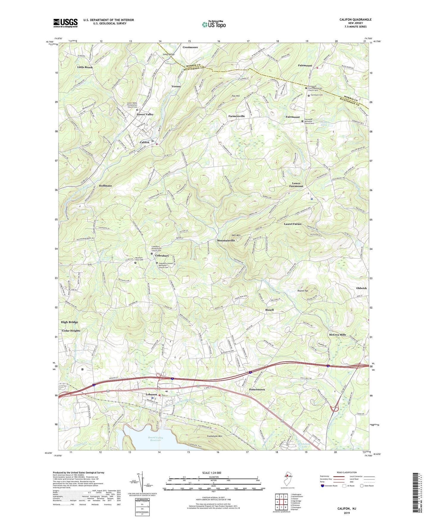
2023 topographic map quadrangle Califon in the state of New Jersey. Scale: 1:24000. Based on the newly updated USGS 7.5' US Topo map series, this map is in the following counties: Hunterdon, Morris. The map contains contour data, water features, and other items you are used to seeing on USGS maps, but also has updated roads and other features. This is the next generation of topographic maps. Printed on high-quality waterproof paper with UV fade-resistant inks.
Quads adjacent to this one:
West: High Bridge
Northwest: Washington
North: Hackettstown
Northeast: Chester
East: Gladstone
Southeast: Raritan
South: Flemington
Southwest: Pittstown
This map covers the same area as the classic USGS quad with code o40074f7.
Contains the following named places: Bissell, Bissell School, Borough of Califon, Borough of Lebanon, Burrill Mine, Califon, Califon Borough Elementary School, Califon Borough Police Department, Califon Fire Company, Califon First Aid Squad, Califon Post Office, Califon United Methodist Church, Church of the Holy Spirit Anglican Episcopal Church, Cokesbury, Cokesbury Presbyterian Church, Cokesbury Presbyterian Church Cemetery, Cokesbury School, Cokesbury United Methodist Church, Cokesbury United Methodist Church Cemetery, Crestmoore, ESC Academy at Tewksbury School, Exxon Research and Engineering Company Heliport, Fairmount, Fairmount Cemetery, Fairmount Fire Company 1, Fairmount First Presbyterian Church Yard, Fairmount Methodist Church Yard, Fairmount Presbyterian Church, Fairmount United Methodist Church, Farmersville, First Step of Lebanon Preschool, Fox Hill, Fox Hill Spring, Garden State Balloonport, Hell Mountain, Hoffmans, Hunterdon County Emergency Services Training Center, Hunterdon Learning Center School, Ken Lockwood Gorge Wildlife Management Area, Kiddie Academy School of Lebanaon, Laurel Farms, Lebanon, Lebanon Borough Elementary School, Lebanon Borough Police Department, Lebanon Fire Department Station 18, Lebanon Post Office, Lebanon Reformed Church, Lebanon United Methodist Church, Little Brook, Long Valley, Lower Fairmount, Lower Valley, Lower Valley Presbyterian Church Cemetery, McCrea Mills, Melick's Town Farm, Merck Child Learn Center School, Merck Readington Township Heliport, Mountain View Cemetery, Mountainview Youth Correctional Facility, Mountainville, Old Turnpike Middle School, Oldwick Fire Company Station 24, Potterstown, Pottersville Reservoir, Round Top, Round Valley Middle School, Round Valley North Dam, Sawmill Elementary School, South Branch Rockaway Creek, Tewksbury Elementary School, Tewksbury First Aid and Rescue Squad, Tewksbury Township Police Department, Township of Clinton, Township of Tewksbury, Valley View Elementary School, Vernoy, ZIP Codes: 07830, 08833