MyTopo
Aden Hills New Mexico US Topo Map
Couldn't load pickup availability
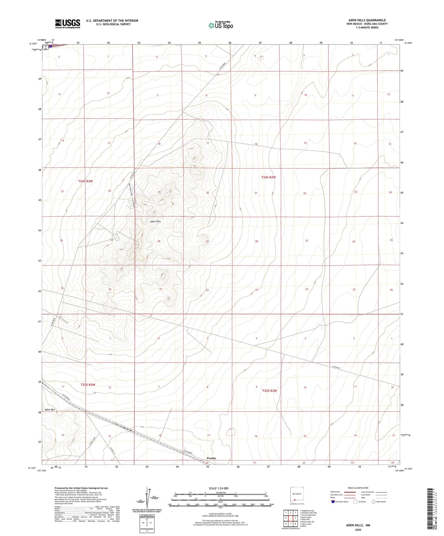
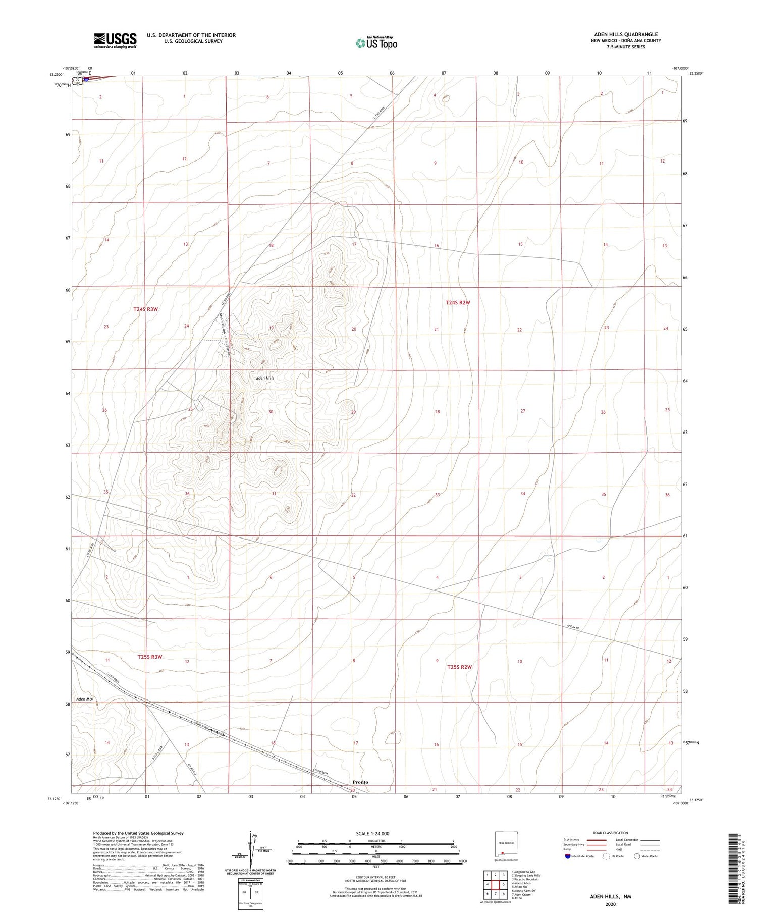
2020 topographic map quadrangle Aden Hills in the state of New Mexico. Scale: 1:24000. Based on the newly updated USGS 7.5' US Topo map series, this map is in the following counties: Doña Ana. The map contains contour data, water features, and other items you are used to seeing on USGS maps, but also has updated roads and other features. This is the next generation of topographic maps. Printed on high-quality waterproof paper with UV fade-resistant inks.
Quads adjacent to this one:
West: Mount Aden
Northwest: Magdalena Gap
North: Sleeping Lady Hills
Northeast: Picacho Mountain
East: Afton NW
Southeast: Afton
South: Aden Crater
Southwest: Mount Aden SW
Contains the following named places: 00020 Water Well, Aden, Aden Hills, Aden Station Well, Aden Well