MyTopo
Sleeping Lady Hills New Mexico US Topo Map
Couldn't load pickup availability
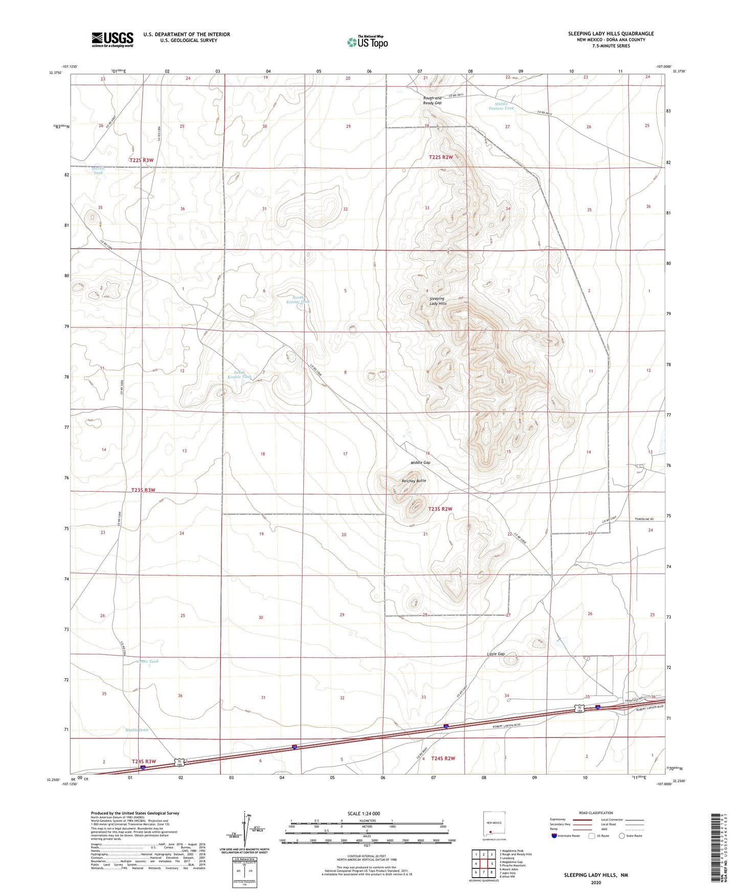
2023 topographic map quadrangle Sleeping Lady Hills in the state of New Mexico. Scale: 1:24000. Based on the newly updated USGS 7.5' US Topo map series, this map is in the following counties: Doña Ana. The map contains contour data, water features, and other items you are used to seeing on USGS maps, but also has updated roads and other features. This is the next generation of topographic maps. Printed on high-quality waterproof paper with UV fade-resistant inks.
Quads adjacent to this one:
West: Magdalena Gap
Northwest: Magdalena Peak
North: Rough and Ready Hills
Northeast: Leasburg
East: Picacho Mountain
Southeast: Afton NW
South: Aden Hills
Southwest: Mount Aden
This map covers the same area as the classic USGS quad with code o32107c1.
Contains the following named places: 00002 Water Well, 00010 Water Well, 88033, Big Gap Well, Corralitos Ranch, Corralitos Side Camp, Fairacres Division, Geothermal Well, Green Tank, Horse Trap Well, Kimble Draw, Little Gap, Little Gap Well, Martin Tank, Middle Gap, Middle Gap Tanks, Middle Pasture Tank, North Kimble Tank, Reichey Butte, Rough and Ready Gap, Sleeping Lady Hills, South Kimble Tank