
MyTopo
Apache Canyon New Mexico US Topo Map
Couldn't load pickup availability
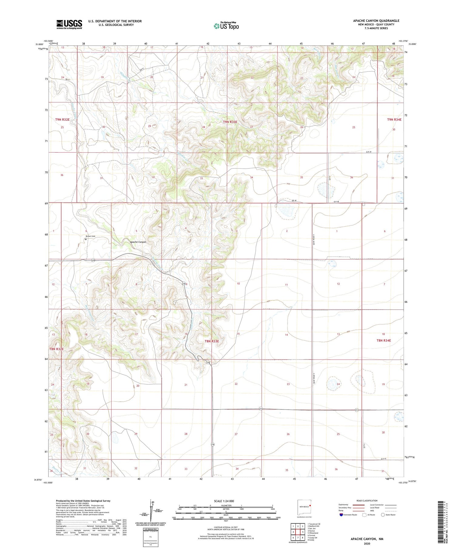
2020 topographic map quadrangle Apache Canyon in the state of New Mexico. Scale: 1:24000. Based on the newly updated USGS 7.5' US Topo map series, this map is in the following counties: Quay. The map contains contour data, water features, and other items you are used to seeing on USGS maps, but also has updated roads and other features. This is the next generation of topographic maps. Printed on high-quality waterproof paper with UV fade-resistant inks.
Quads adjacent to this one:
West: Norton
Northwest: Tucumcari SE
North: Bedford Hill
Northeast: San Jon
East: Wheatland
Southeast: Grady
South: Grady SW
Southwest: Forrest
Contains the following named places: 10250 Water Well, 10267 Water Well, 10268 Water Well, 10269 Water Well, 10270 Water Well, 10271 Water Well, 10272 Water Well, 10273 Water Well, 10274 Water Well, 10275 Water Well, 10276 Water Well, 10277 Water Well, 10763 Water Well, 10764 Water Well, 10765 Water Well, 10766 Water Well, 10767 Water Well, 10769 Water Well, 10773 Water Well, Apache Canyon, Brochard, Brown Cemetery, Duke, Puerto Canyon


