MyTopo
Bedford Hill New Mexico US Topo Map
Couldn't load pickup availability
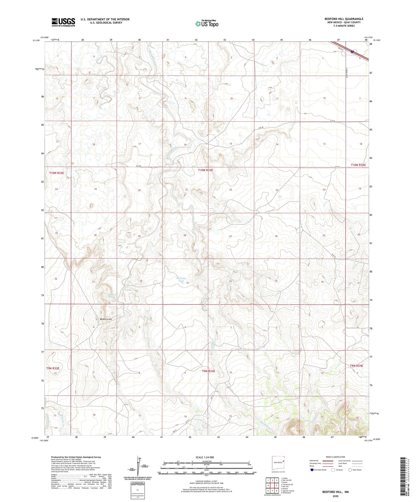
2023 topographic map quadrangle Bedford Hill in the state of New Mexico. Scale: 1:24000. Based on the newly updated USGS 7.5' US Topo map series, this map is in the following counties: Quay. The map contains contour data, water features, and other items you are used to seeing on USGS maps, but also has updated roads and other features. This is the next generation of topographic maps. Printed on high-quality waterproof paper with UV fade-resistant inks.
Quads adjacent to this one:
West: Tucumcari SE
Northwest: Lesbia
North: San Jon NW
Northeast: Porter
East: San Jon
Southeast: Wheatland
South: Apache Canyon
Southwest: Norton
This map covers the same area as the classic USGS quad with code o35103a4.
Contains the following named places: 05166 Water Well, 05173 Water Well, 05174 Water Well, 05175 Water Well, 05176 Water Well, 05177 Water Well, 05178 Water Well, 05180 Water Well, 05194 Water Well, Bedford Hill, Bedford Spring, Champion Windmill, Joe Keyes Tank, Mesa Windmill, Wallace, Wallace Ranch, Wooten Ranch