MyTopo
Bancos Mesa New Mexico US Topo Map
Couldn't load pickup availability
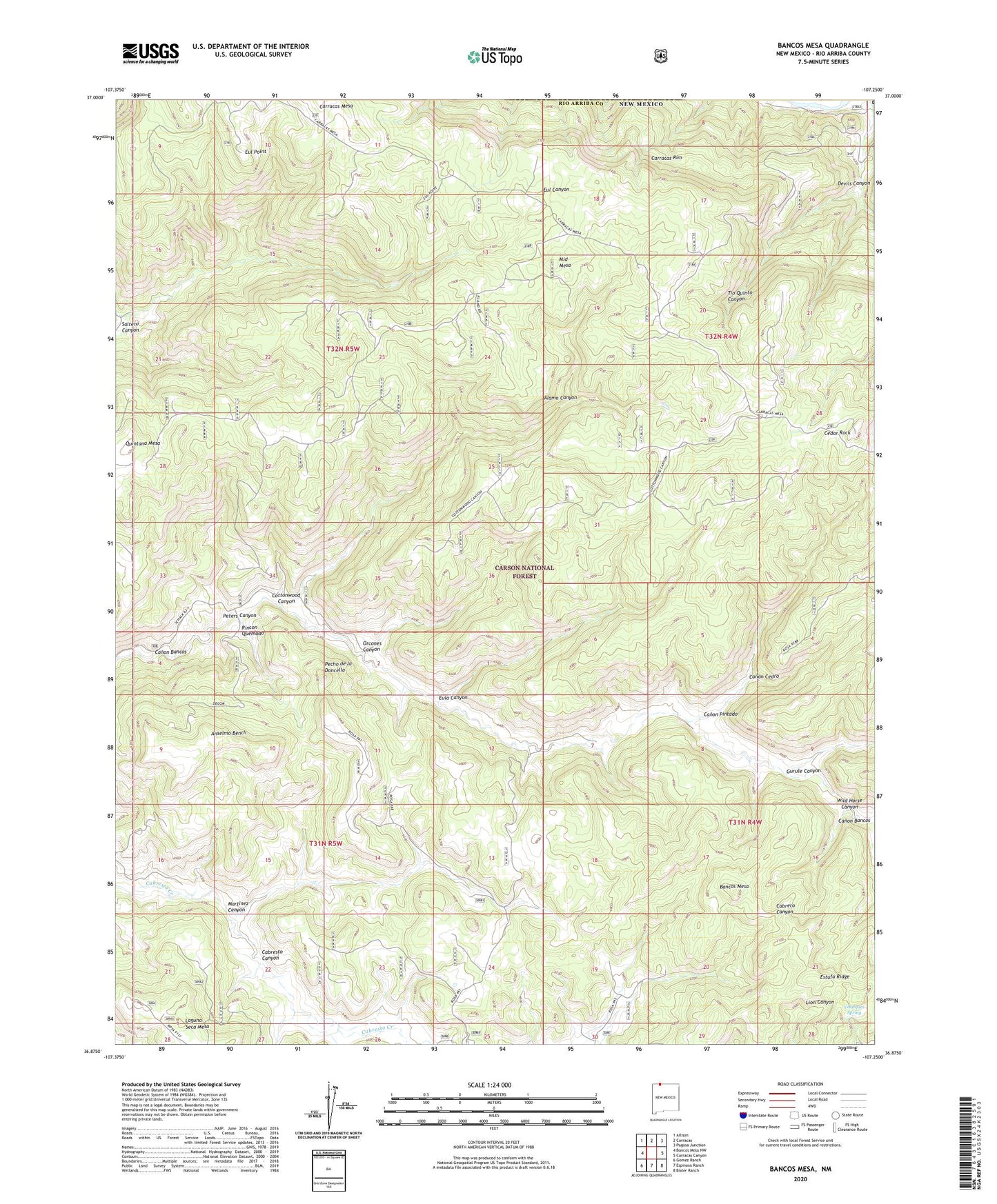
2020 topographic map quadrangle Bancos Mesa in the state of New Mexico. Scale: 1:24000. Based on the newly updated USGS 7.5' US Topo map series, this map is in the following counties: Rio Arriba. The map contains contour data, water features, and other items you are used to seeing on USGS maps, but also has updated roads and other features. This is the next generation of topographic maps. Printed on high-quality waterproof paper with UV fade-resistant inks.
Quads adjacent to this one:
West: Bancos Mesa NW
Northwest: Allison
North: Carracas
Northeast: Pagosa Junction
East: Carracas Canyon
Southeast: Bixler Ranch
South: Espinosa Ranch
Southwest: Gomez Ranch
Contains the following named places: Alamo Canyon, Alamo Tank, Anselmo Bench, Bancos Mesa, Box Tank, Canon Cedro, Canon Pintado, Carracas Cemetery, Carracas Mesa, Carracas Rim, Cedar Rock, Chavez Tank, Cottonwood Canyon, Devils Canyon, Eul Point, Eula Canyon, Gurule Canyon, Horse Tank, Log Tank, Martinez Canyon, Middle Mesa, Orcones Canyon, Pecho de la Doncella, Peters Canyon, Quintana Mesa, Rincon Quemado, Saltero Canyon, Sanchez Tank, Velasquez Spring, Wild Horse Canyon