MyTopo
Espinosa Ranch New Mexico US Topo Map
Couldn't load pickup availability
Also explore the Espinosa Ranch Forest Service Topo of this same quad for updated USFS data
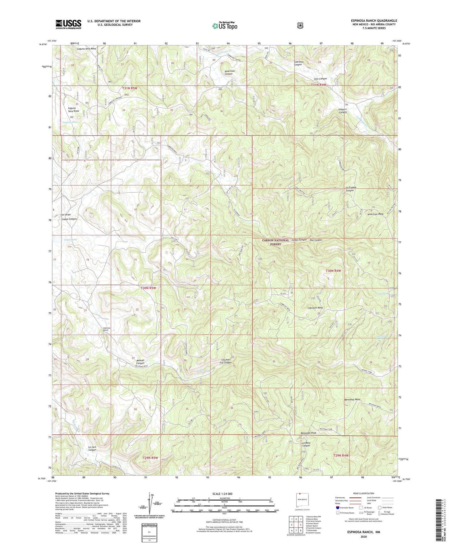
2023 topographic map quadrangle Espinosa Ranch in the state of New Mexico. Scale: 1:24000. Based on the newly updated USGS 7.5' US Topo map series, this map is in the following counties: Rio Arriba. The map contains contour data, water features, and other items you are used to seeing on USGS maps, but also has updated roads and other features. This is the next generation of topographic maps. Printed on high-quality waterproof paper with UV fade-resistant inks.
Quads adjacent to this one:
West: Gomez Ranch
Northwest: Bancos Mesa NW
North: Bancos Mesa
Northeast: Carracas Canyon
East: Bixler Ranch
Southeast: Leandro Canyon
South: Gobernador
Southwest: Fourmile Canyon
This map covers the same area as the classic USGS quad with code o36107g3.
Contains the following named places: American Canyon, American Mesa, American Tank, Cabrero Canyon, Cabresto Mesa, Cat Draw, Cedar Canyon, Cedar Spring, Chicken Fry Canyon, Espinosa Ranch, Espinoza, Jicarilla Ranger District, La Baca Tank, La Fragua Tank, Laguna Seca, Laguna Seca Mesa, Lion Canyon, Lion Tank, Lopez Canyon, Lopez Lake, Manuel Spring, Mestenas Mesa, Mestenas Peak, Mestenas Tank, Oso Canyon, Palmer, Shale Tank, Two Trough Spring, Ulibarri Canyon