
MyTopo
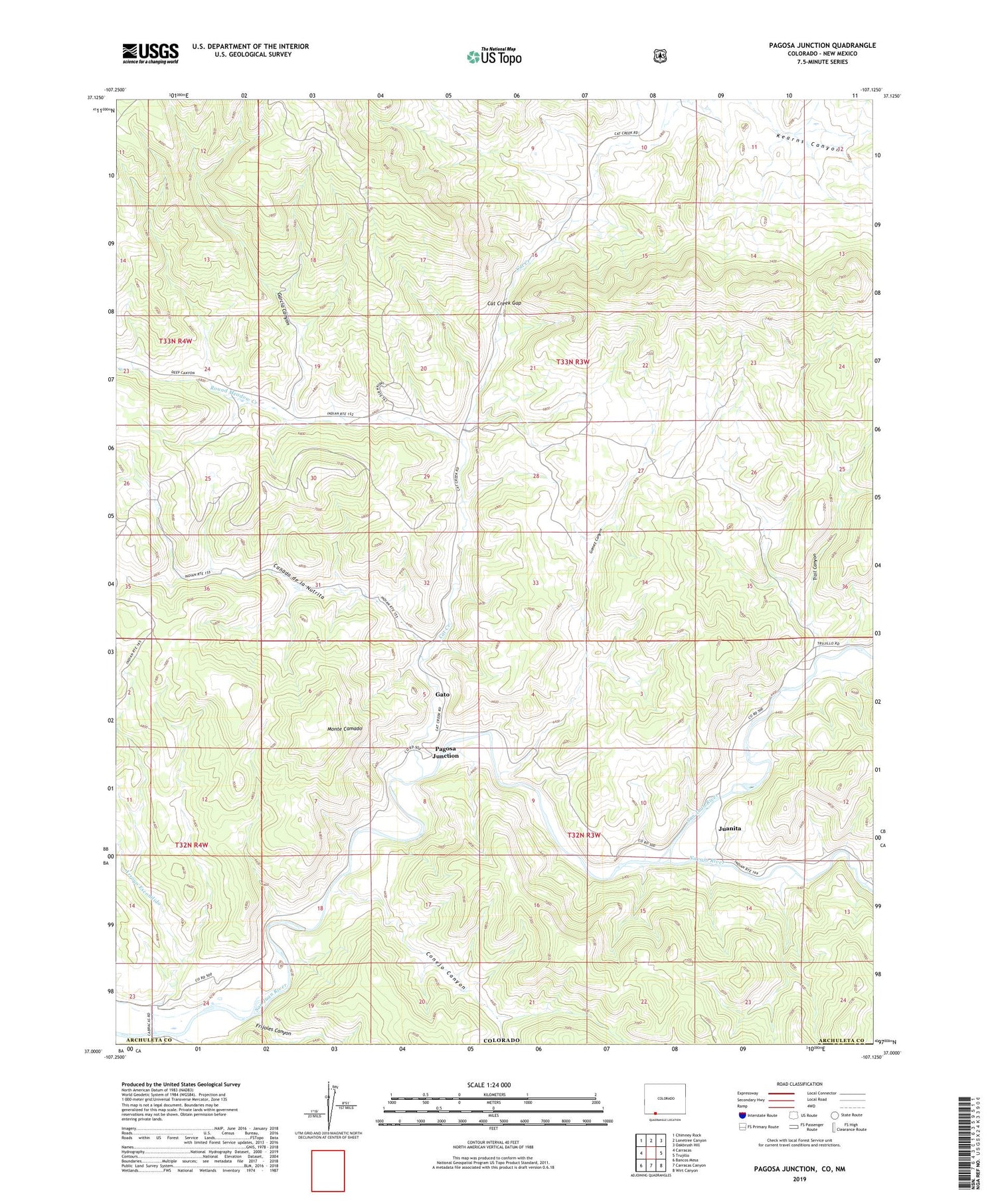
Pagosa Junction Colorado US Topo Map
Couldn't load pickup availability
Also explore the Pagosa Junction Forest Service Topo of this same quad for updated USFS data
2022 topographic map quadrangle Pagosa Junction in the state of Colorado. Scale: 1:24000. Based on the newly updated USGS 7.5' US Topo map series, this map is in the following counties: Archuleta, Rio Arriba. The map contains contour data, water features, and other items you are used to seeing on USGS maps, but also has updated roads and other features. This is the next generation of topographic maps. Printed on high-quality waterproof paper with UV fade-resistant inks.
Quads adjacent to this one:
West: Carracas
Northwest: Chimney Rock
North: Lonetree Canyon
Northeast: Oakbrush Hill
East: Trujillo
Southeast: Wirt Canyon
South: Carracas Canyon
Southwest: Bancos Mesa
Contains the following named places: Arroyo Escondido, Canada de la Nutrita, Cat Creek, Cat Creek Gap, Conejo Canyon, Frijoles Canyon, Garcia Canyon, Gato, Gomez Canyon, Italian Mine, Juanita, Monte Camado, Navajo River, Old Carr Ditch, Pagosa Junction, Round Meadow Creek, Trail Canyon


