MyTopo
Bell Lake New Mexico US Topo Map
Couldn't load pickup availability
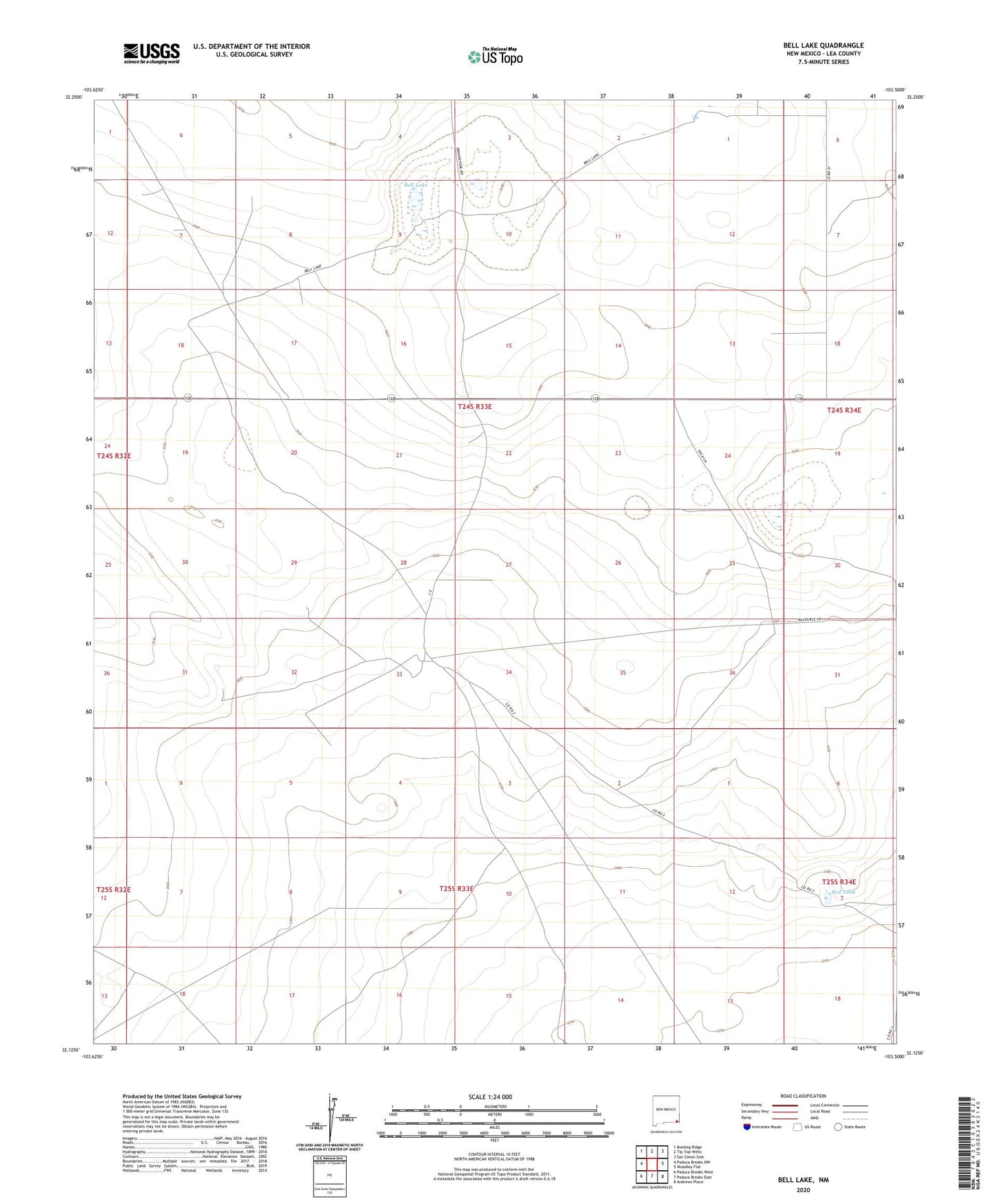
2020 topographic map quadrangle Bell Lake in the state of New Mexico. Scale: 1:24000. Based on the newly updated USGS 7.5' US Topo map series, this map is in the following counties: Lea. The map contains contour data, water features, and other items you are used to seeing on USGS maps, but also has updated roads and other features. This is the next generation of topographic maps. Printed on high-quality waterproof paper with UV fade-resistant inks.
Quads adjacent to this one:
West: Paduca Breaks NW
Northwest: Bootleg Ridge
North: Tip Top Wells
Northeast: San Simon Sink
East: Woodley Flat
Southeast: Andrews Place
South: Paduca Breaks East
Southwest: Paduca Breaks West
Contains the following named places: 05059 Water Well, 12714 Water Well, 12715 Water Well, 12716 Water Well, 12717 Water Well, 13631 Water Well, Bell Lake, Bell Lake Windmill, Big Well, Double X Ranch, Jog Tank, Pipeline Windmill, Red Tank, Slick Windmills