MyTopo
Cammak Camp New Mexico US Topo Map
Couldn't load pickup availability
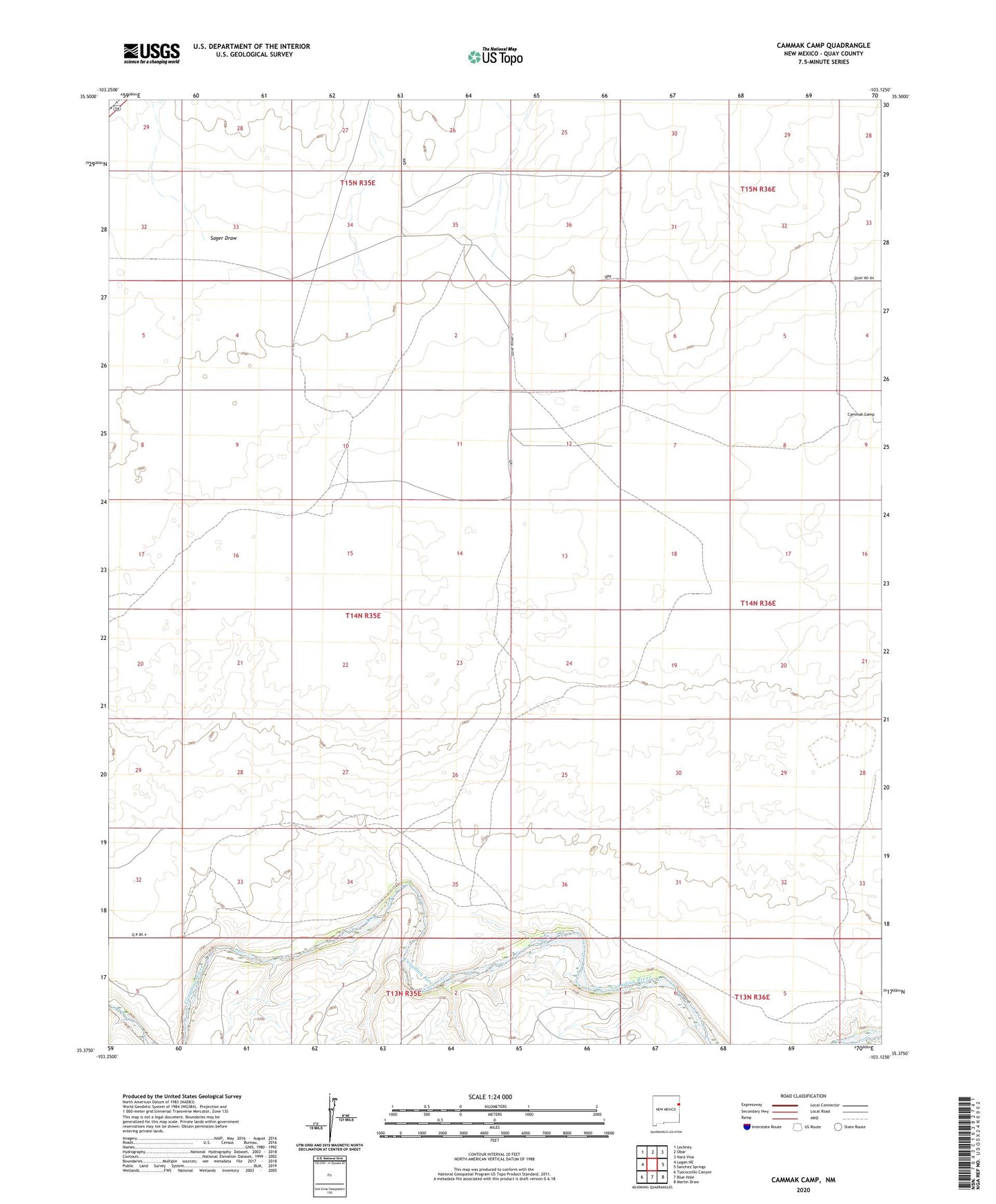
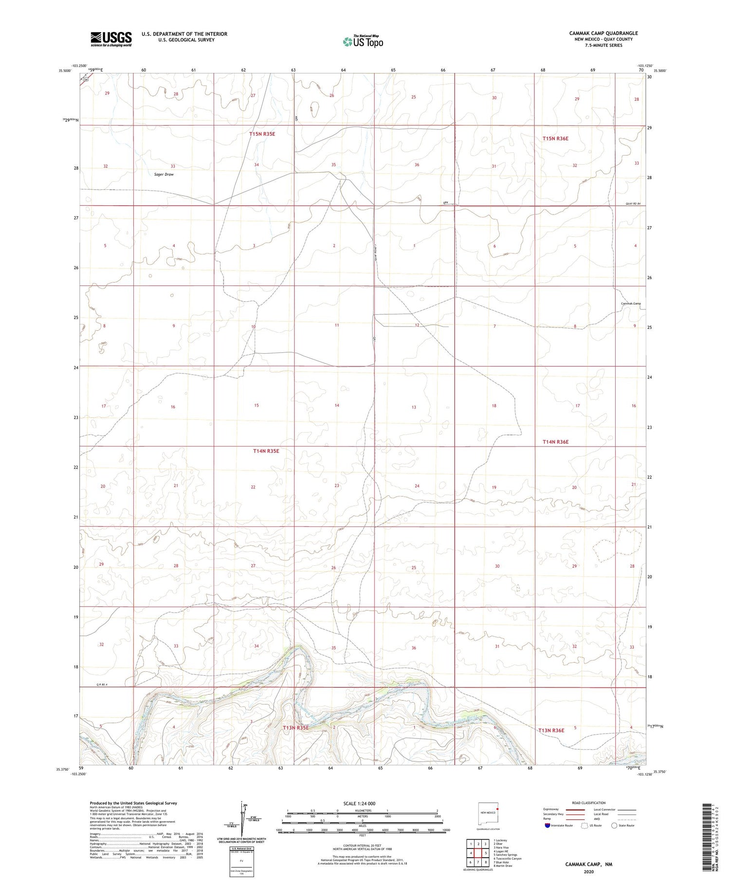
2020 topographic map quadrangle Cammak Camp in the state of New Mexico. Scale: 1:24000. Based on the newly updated USGS 7.5' US Topo map series, this map is in the following counties: Quay. The map contains contour data, water features, and other items you are used to seeing on USGS maps, but also has updated roads and other features. This is the next generation of topographic maps. Printed on high-quality waterproof paper with UV fade-resistant inks.
Quads adjacent to this one:
West: Logan NE
Northwest: Lockney
North: Obar
Northeast: Nara Visa
Southeast: Martin Draw
South: Blue Hole
Southwest: Tuscocoillo Canyon
Contains the following named places: 05243 Water Well, 05245 Water Well, 05246 Water Well, 05247 Water Well, 05252 Water Well, 05253 Water Well, 05254 Water Well, 05255 Water Well, 05256 Water Well, 05257 Water Well, 05499 Water Well, Cammak Camp, Carter Well, Collins Camp, Dempster Well, Dergy Well, Ditterline Well, East Durham Well, Fifty Well, Flag Ranch Well, Hayne Well, New Jackson Well, North Well, Red Well, Sager Draw, Schoonermaker Well, Scott Well, Two Story Well, West Durham Well, Wiggan Well