MyTopo
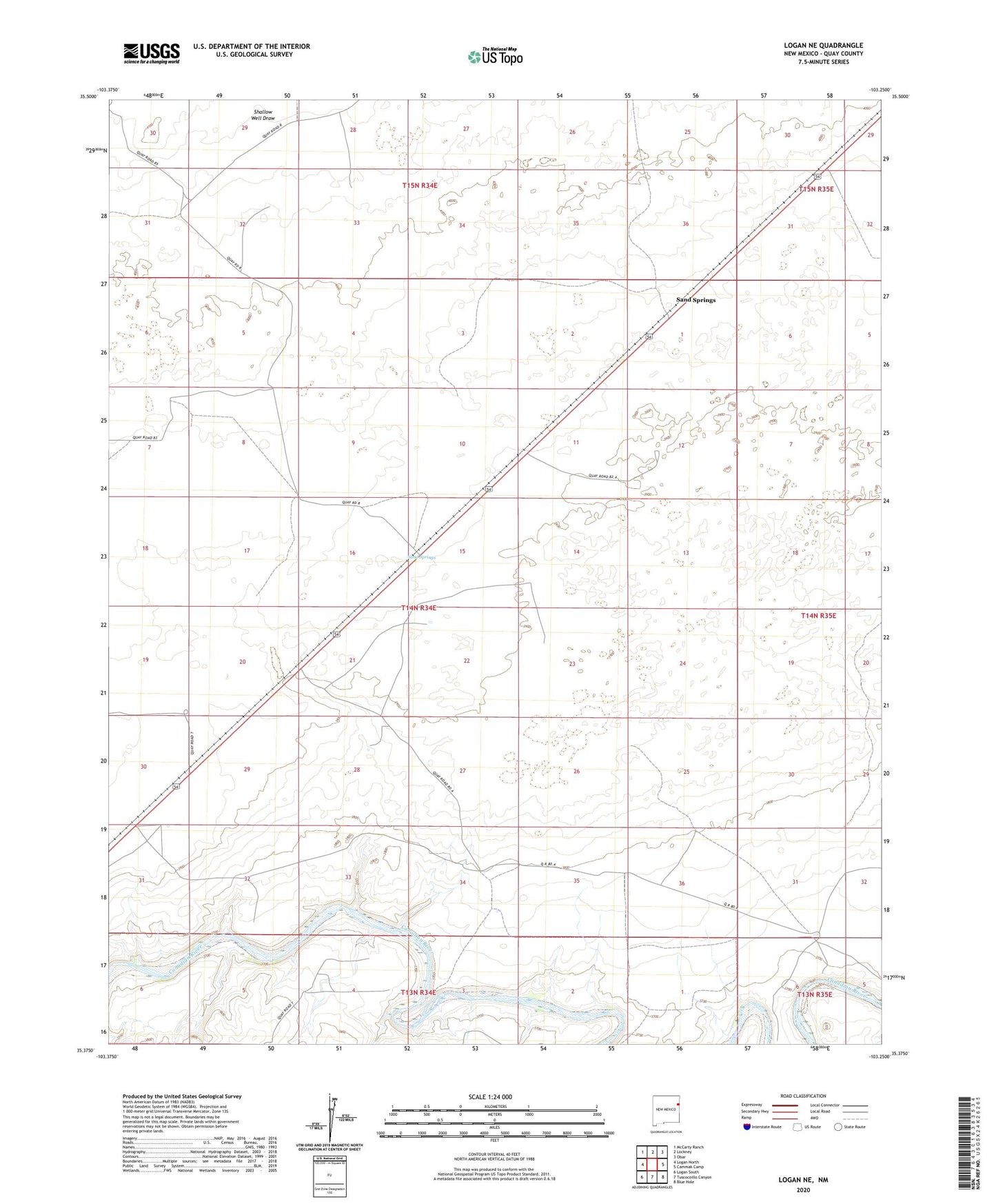
Logan NE New Mexico US Topo Map
Couldn't load pickup availability
2023 topographic map quadrangle Logan NE in the state of New Mexico. Scale: 1:24000. Based on the newly updated USGS 7.5' US Topo map series, this map is in the following counties: Quay. The map contains contour data, water features, and other items you are used to seeing on USGS maps, but also has updated roads and other features. This is the next generation of topographic maps. Printed on high-quality waterproof paper with UV fade-resistant inks.
Quads adjacent to this one:
West: Logan North
Northwest: McCarty Ranch
North: Lockney
Northeast: Obar
East: Cammak Camp
Southeast: Blue Hole
South: Tuscocoillo Canyon
Southwest: Logan South
This map covers the same area as the classic USGS quad with code o35103d3.
Contains the following named places: 05235 Water Well, 05236 Water Well, 05237 Water Well, 05238 Water Well, 05239 Water Well, 05242 Water Well, 05244 Water Well, 05262 Water Well, 05263 Water Well, 05475 Water Well, 05488 Water Well, 05489 Water Well, 05490 Water Well, 05491 Water Well, 05492 Water Well, 05493 Water Well, 05494 Water Well, 05495 Water Well, 05497 Water Well, Barnes Well, Bunk Clay Place, Canode, Canode Post Office, Chalk Well, Claer Well, Clay Windmill, Congdon Well, East Well, Garrison Well, Hadden Ranch, Hughes Well, Jones Well, Knapp Well, Litton Well, Meeks, Meeks Ranch, Morris Well, North Bunk Clay Well, North Woods Windmill, Pyle, Rodewald, Rodewald Ranch, Rodewald Well, Sand Springs, Sand Springs Ranch, Schneider Ranch, Shallow Well Draw, Shoenail Ranch, South Bunk Clay Well, South Litton Well, South Well, South Windmill, Stringer Well