MyTopo
Lockney New Mexico US Topo Map
Couldn't load pickup availability
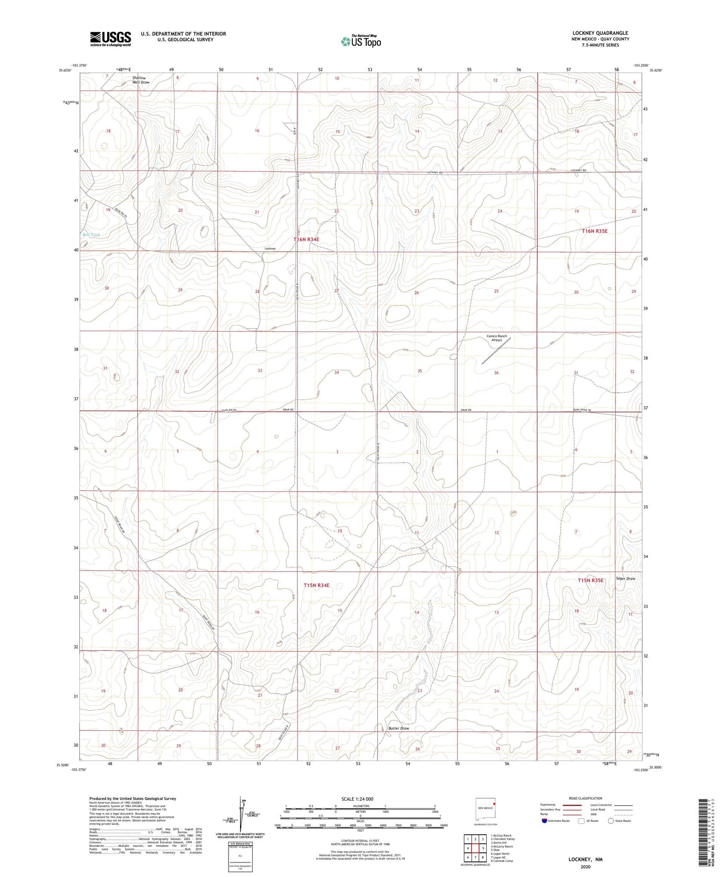
2023 topographic map quadrangle Lockney in the state of New Mexico. Scale: 1:24000. Based on the newly updated USGS 7.5' US Topo map series, this map is in the following counties: Quay. The map contains contour data, water features, and other items you are used to seeing on USGS maps, but also has updated roads and other features. This is the next generation of topographic maps. Printed on high-quality waterproof paper with UV fade-resistant inks.
Quads adjacent to this one:
West: McCarty Ranch
Northwest: McCloy Ranch
North: Cherokee Valley
Northeast: Kerlin Hill
East: Obar
Southeast: Cammak Camp
South: Logan NE
Southwest: Logan North
This map covers the same area as the classic USGS quad with code o35103e3.
Contains the following named places: 05260 Water Well, 05261 Water Well, 05268 Water Well, 05289 Water Well, 05291 Water Well, 05292 Water Well, 05293 Water Well, 05294 Water Well, 05295 Water Well, 05445 Water Well, 05446 Water Well, 05447 Water Well, 05448 Water Well, 05449 Water Well, 05450 Water Well, 05451 Water Well, 05452 Water Well, 05474 Water Well, 05477 Water Well, Bell Tank, Brice Well, Bryant Well, Butler Draw, Butler Well, Camco Ranch Airport, Carrol Well, Etheridge Well, Frampton Well, Haney Well, Kelly Well, Keyes Well, Kidder, Kieth, Lockney, Lockney Post Office, New Saggert Well, Old Ranch Well, Payne Well, Smith Well, Twin Wells, Willis Well