MyTopo
Capulin New Mexico US Topo Map
Couldn't load pickup availability
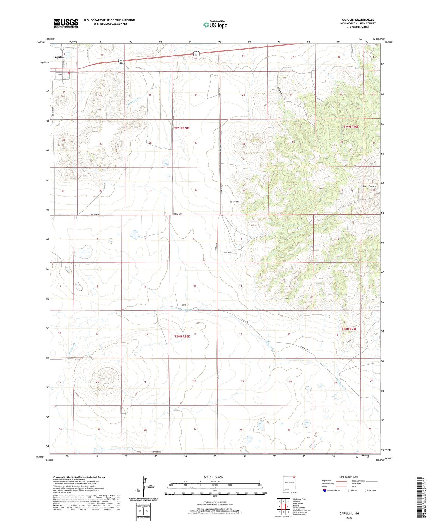
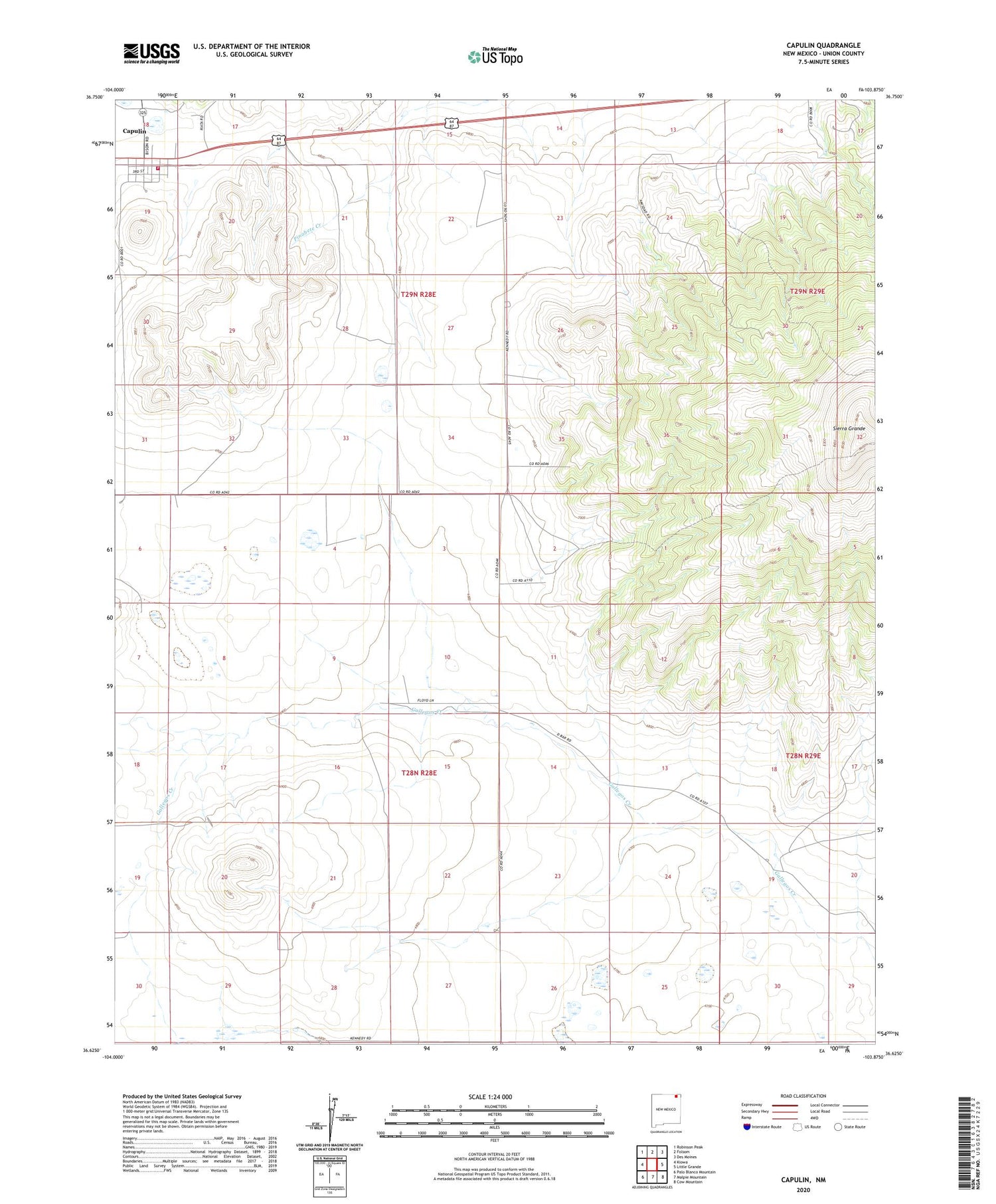
2020 topographic map quadrangle Capulin in the state of New Mexico. Scale: 1:24000. Based on the newly updated USGS 7.5' US Topo map series, this map is in the following counties: Union. The map contains contour data, water features, and other items you are used to seeing on USGS maps, but also has updated roads and other features. This is the next generation of topographic maps. Printed on high-quality waterproof paper with UV fade-resistant inks.
Quads adjacent to this one:
West: Kiowa
Northwest: Robinson Peak
North: Folsom
Northeast: Des Moines
East: Little Grande
Southeast: Cow Mountain
South: Malpie Mountain
Southwest: Palo Blanco Mountain
Contains the following named places: Bural, Capulin, Capulin Census Designated Place, Capulin Emergency Medical Services, Capulin Fire Department, Capulin Weather Station, Cox Windmill, Garcia Windmill, Goodnight-Loving Trail Historical Marker, La Cueva Windmill, Leierer, Sierra Grande, Sierra Grande Historical Marker, Windmill Number 1