MyTopo
Palo Blanco Mountain New Mexico US Topo Map
Couldn't load pickup availability
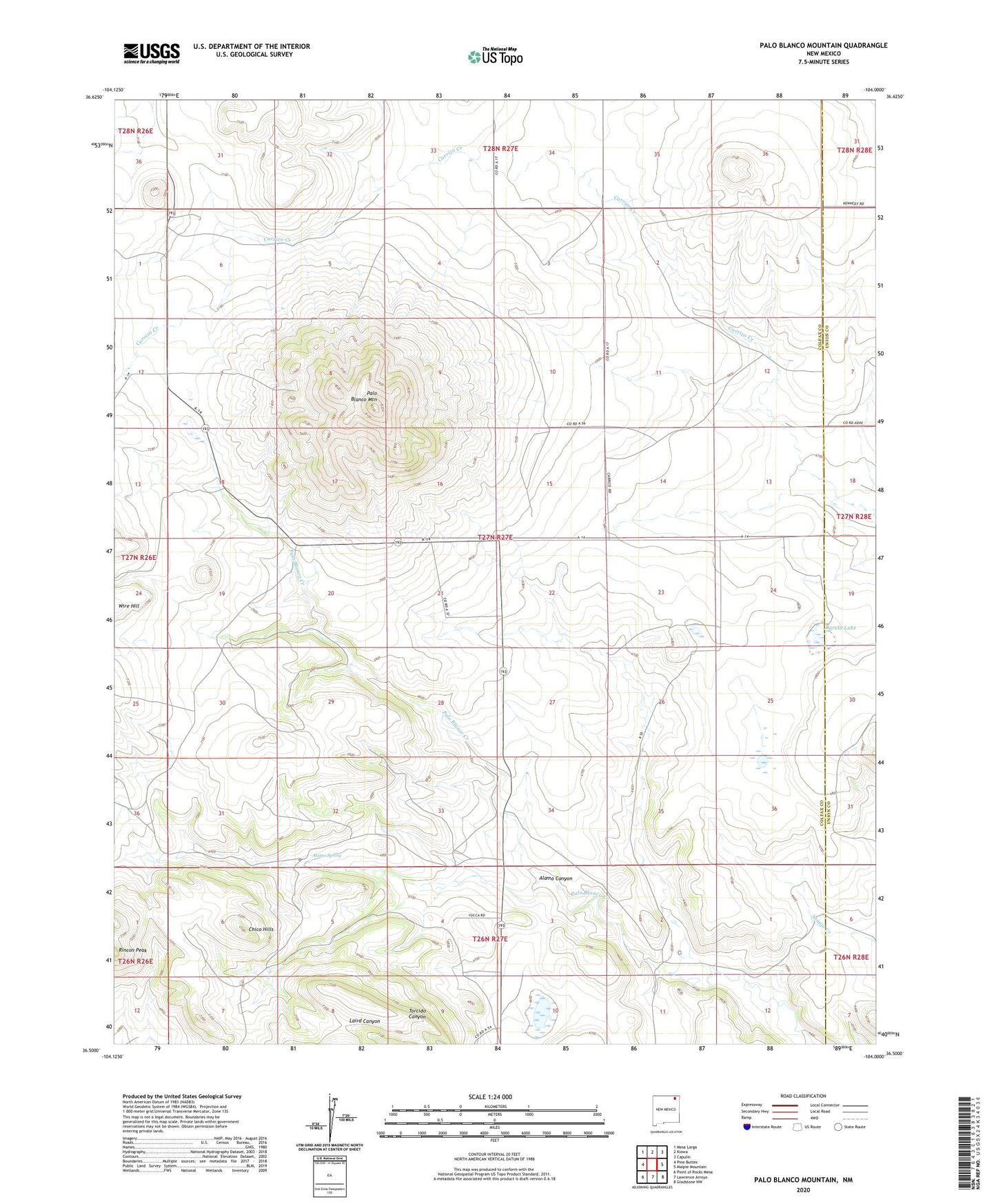
2023 topographic map quadrangle Palo Blanco Mountain in the state of New Mexico. Scale: 1:24000. Based on the newly updated USGS 7.5' US Topo map series, this map is in the following counties: Colfax, Union. The map contains contour data, water features, and other items you are used to seeing on USGS maps, but also has updated roads and other features. This is the next generation of topographic maps. Printed on high-quality waterproof paper with UV fade-resistant inks.
Quads adjacent to this one:
West: Pine Buttes
Northwest: Mesa Larga
North: Kiowa
Northeast: Capulin
East: Malpie Mountain
Southeast: Gladstone NW
South: Lawrence Arroyo
Southwest: Point of Rocks Mesa
This map covers the same area as the classic USGS quad with code o36104e1.
Contains the following named places: Alamo Canyon, Alamo Creek, Alamo Spring, Barela Lake, Castillo, Christmas, Cook Hill, DeDay, Favor, Palo Blanco, Palo Blanco Church, Palo Blanco Mountain, Rincon Peak, Torres, Wire Hill