MyTopo
Carpenter Mesa NW New Mexico US Topo Map
Couldn't load pickup availability
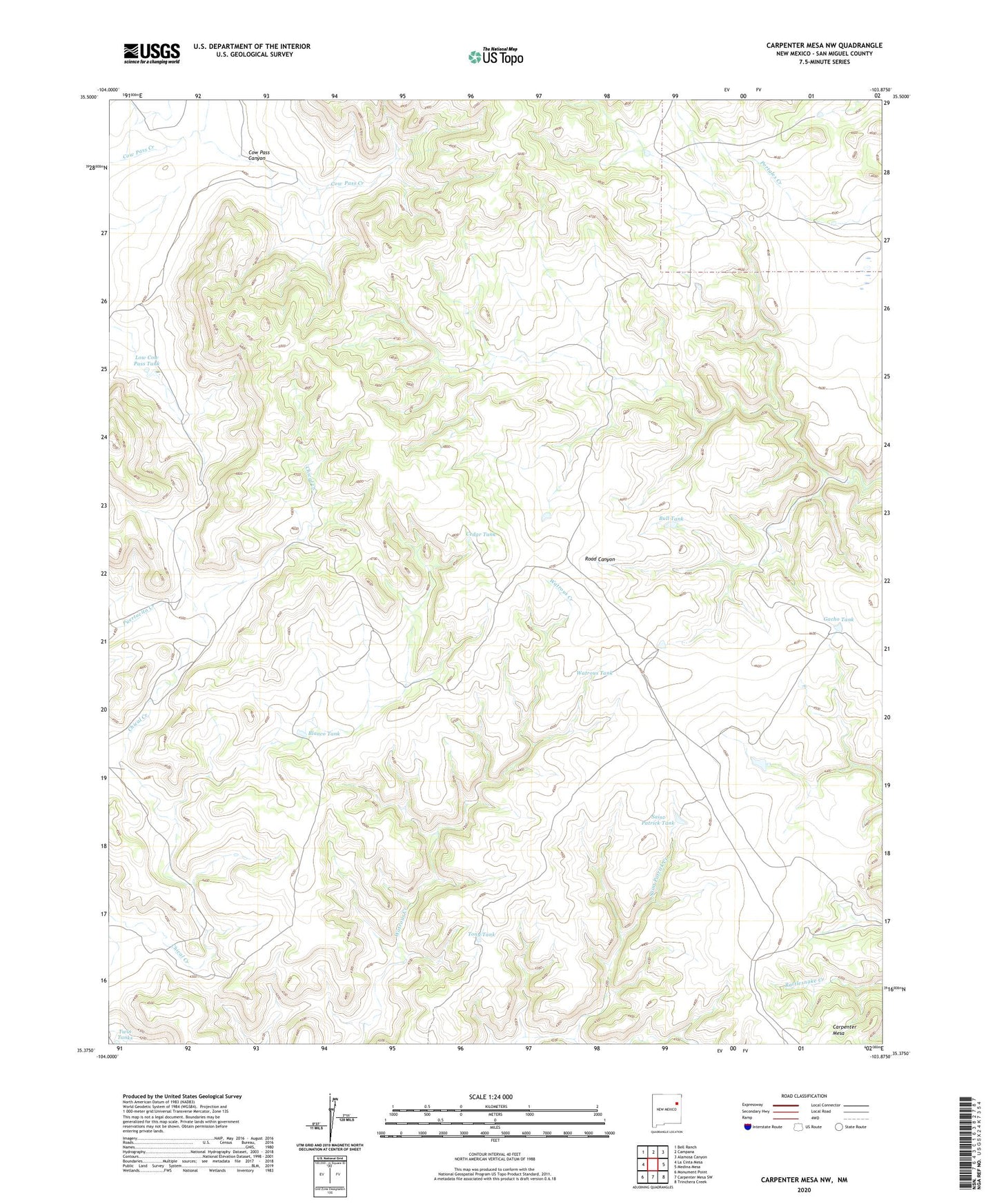
2023 topographic map quadrangle Carpenter Mesa NW in the state of New Mexico. Scale: 1:24000. Based on the newly updated USGS 7.5' US Topo map series, this map is in the following counties: San Miguel. The map contains contour data, water features, and other items you are used to seeing on USGS maps, but also has updated roads and other features. This is the next generation of topographic maps. Printed on high-quality waterproof paper with UV fade-resistant inks.
Quads adjacent to this one:
West: La Cinta Mesa
Northwest: Bell Ranch
North: Campana
Northeast: Alamosa Canyon
East: Medina Mesa
Southeast: Trinchera Creek
South: Carpenter Mesa SW
Southwest: Monument Point
This map covers the same area as the classic USGS quad with code o35103d8.
Contains the following named places: Blanco Tank, Blanco Trap Windmill, Blanco Windmill, Bull Tank, Cedar Tank, Cow Pass Canyon, Cow Pass Windmill, Doodlebug Windmill, Gacho Tank, Little Joe Windmill, Low Cow Pass Tank, Saint Patrick Tank, Tall Windmill, Tony Tank, Twin Tanks, Watrous Tank