MyTopo
Clines Corners New Mexico US Topo Map
Couldn't load pickup availability
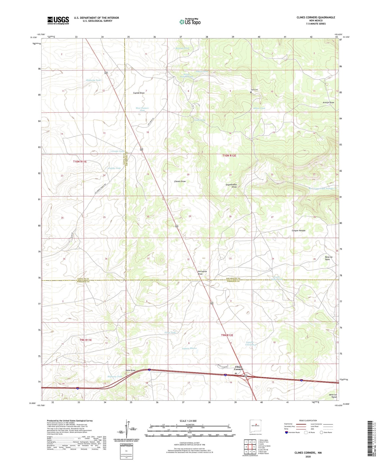
2020 topographic map quadrangle Clines Corners in the state of New Mexico. Scale: 1:24000. Based on the newly updated USGS 7.5' US Topo map series, this map is in the following counties: San Miguel, Torrance, Santa Fe. The map contains contour data, water features, and other items you are used to seeing on USGS maps, but also has updated roads and other features. This is the next generation of topographic maps. Printed on high-quality waterproof paper with UV fade-resistant inks.
Quads adjacent to this one:
West: El Cuervo Butte
Northwest: White Lakes
North: Mesa El Toro
Northeast: Leyba
East: El Cabo
Southeast: Waller Ranch
South: Rock Lake
Southwest: Lobo Hill NE
Contains the following named places: 10067 Water Well, Albino Tank, Chavez, Clines Corners, Clines Corners Post Office, Clines Corners Weather Station, Corner Tank, Cupido Tank, Edge of the Plains Historical Marker, Fence Tank, Frank Tapia Tank, Gibson Tank, Hagerman Ranch, Highway Tank, Laguna Blanca, Laguna Colorado, Los Cavos, Los Norias, Los Norios Ranch, Lost Well, Mesa las Tapia, North Pasture Tank, Ricardo Tank, Rincon Agua Verde, San Antonio Church, South Tank, South Well, Tapia, Tapia Cemetery, Tapia Ranch, West Camp Tank Number 3, West Pasture Tank