MyTopo
Cornudas Mountain New Mexico US Topo Map
Couldn't load pickup availability
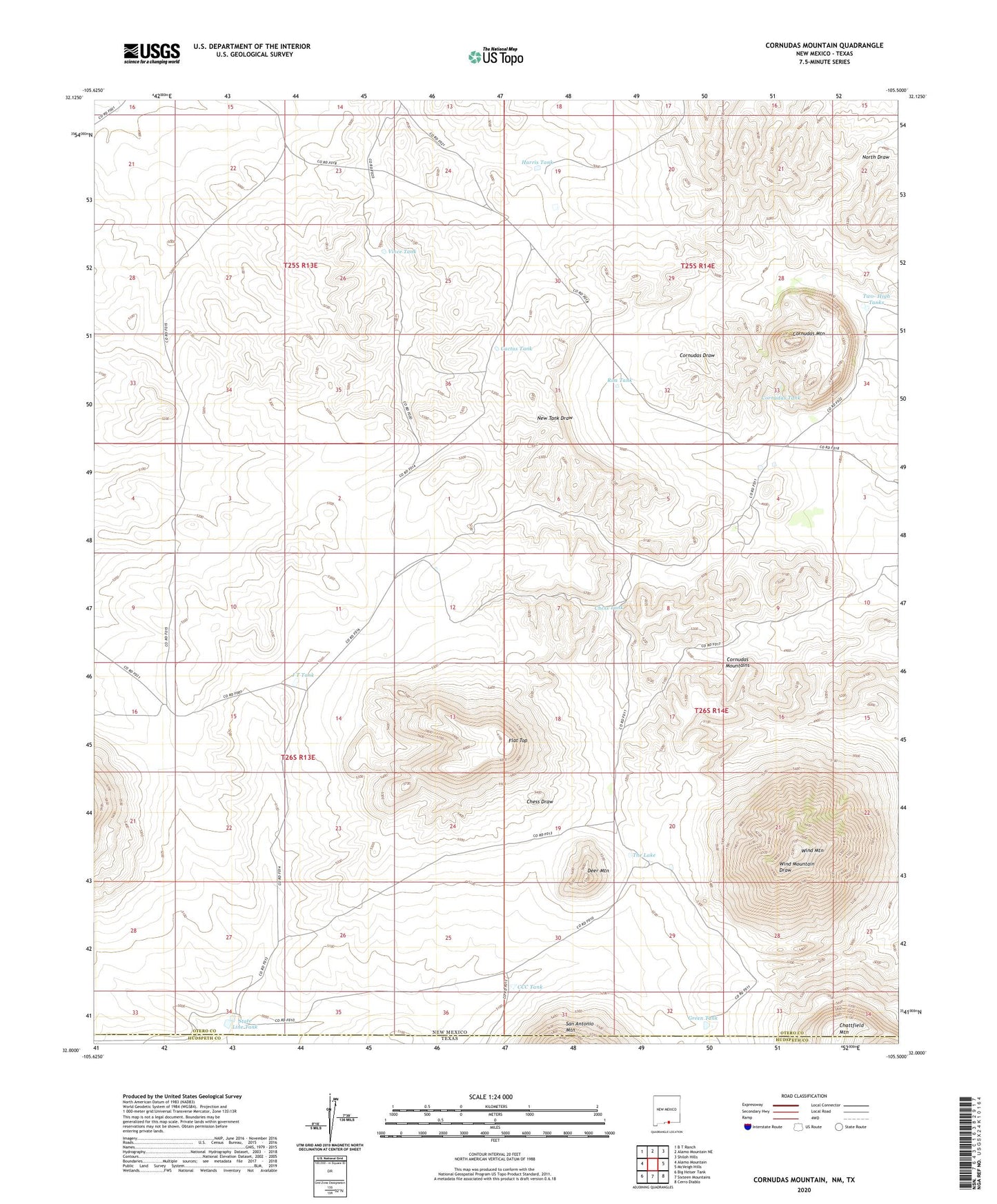
2020 topographic map quadrangle Cornudas Mountain in the state of New Mexico. Scale: 1:24000. Based on the newly updated USGS 7.5' US Topo map series, this map is in the following counties: Otero, Hudspeth. The map contains contour data, water features, and other items you are used to seeing on USGS maps, but also has updated roads and other features. This is the next generation of topographic maps. Printed on high-quality waterproof paper with UV fade-resistant inks.
Quads adjacent to this one:
West: Alamo Mountain
Northwest: B T Ranch
North: Alamo Mountain NE
Northeast: Shiloh Hills
East: McVeigh Hills
Southeast: Cerro Diablo
South: Sixteen Mountains
Southwest: Big Heiser Tank
Contains the following named places: Alamo Windmill, Cactus Tank, CCC Tank, Center Windmill, Chess Tank, Chess Well, Cornudas Mountain, Cornudas Mountain Prospect, Cornudas Mountains, Cornudas Ranch, Cornudas Tank, Deer Mountain, Flat Top, Green Tank, Harris Tank, J T Tank, Lee Detention Dam, Rim Tank, State Line Tank, The Lake, Two- High Tanks, Vince Tank, Wind Mountain, Wind Mountain Well