MyTopo
Cerro Diablo Texas US Topo Map
Couldn't load pickup availability
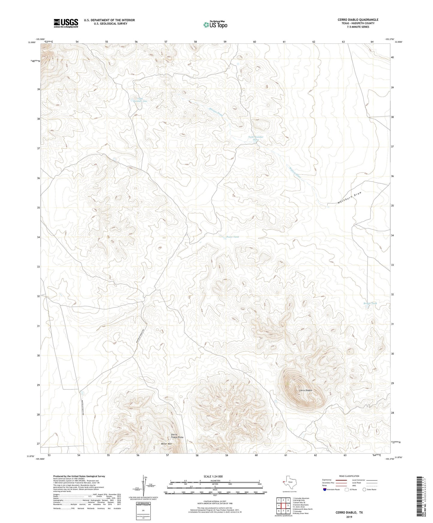
2022 topographic map quadrangle Cerro Diablo in the state of Texas. Scale: 1:24000. Based on the newly updated USGS 7.5' US Topo map series, this map is in the following counties: Hudspeth. The map contains contour data, water features, and other items you are used to seeing on USGS maps, but also has updated roads and other features. This is the next generation of topographic maps. Printed on high-quality waterproof paper with UV fade-resistant inks.
Quads adjacent to this one:
West: Sixteen Mountains
Northwest: Cornudas Mountain
North: McVeigh Hills
Northeast: Shiloh Hills SE
East: C And L Draw
Southeast: Mickey Draw West
South: Cornudas
Southwest: Molesworth Mesa North
This map covers the same area as the classic USGS quad with code o31105h4.
Contains the following named places: Bright Tank, Carpers Well, Cerro Diablo, Dell City Division, Mayfield Ranch, Mayfield Ranch Airport, Peace Tank, Tank Number One, Tank Number Three, Tank Number Two, Wasson Draw