MyTopo
Alamo Mountain New Mexico US Topo Map
Couldn't load pickup availability
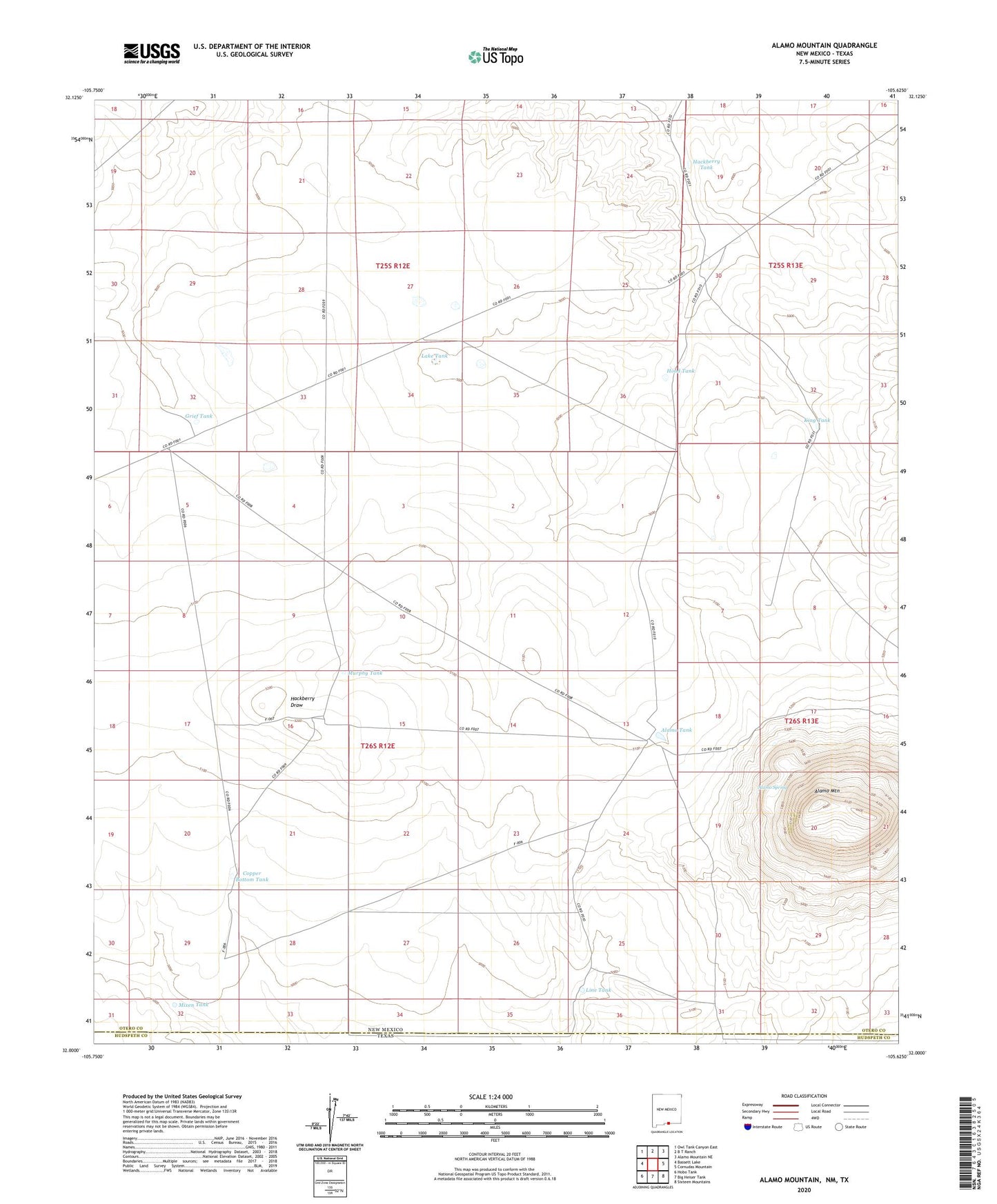
2023 topographic map quadrangle Alamo Mountain in the state of New Mexico. Scale: 1:24000. Based on the newly updated USGS 7.5' US Topo map series, this map is in the following counties: Otero, Hudspeth. The map contains contour data, water features, and other items you are used to seeing on USGS maps, but also has updated roads and other features. This is the next generation of topographic maps. Printed on high-quality waterproof paper with UV fade-resistant inks.
Quads adjacent to this one:
West: Bassett Lake
Northwest: Owl Tank Canyon East
North: B T Ranch
Northeast: Alamo Mountain NE
East: Cornudas Mountain
Southeast: Sixteen Mountains
South: Big Heiser Tank
Southwest: Hobo Tank
Contains the following named places: Alamo Mountain, Alamo Spring, Alamo Springs Stage Station Historic Site, Alamo Tank, Bennett Ranch, Copper Bottom Tank, Grief Tank, Grief Well, Hackberry Tank, Hood Tank, King Tank, Lake Tank, Line Tank, Mixen Tank, Murphy Tank, Partnership Well, Pate Windmill