MyTopo
Dorsey Ranch New Mexico US Topo Map
Couldn't load pickup availability
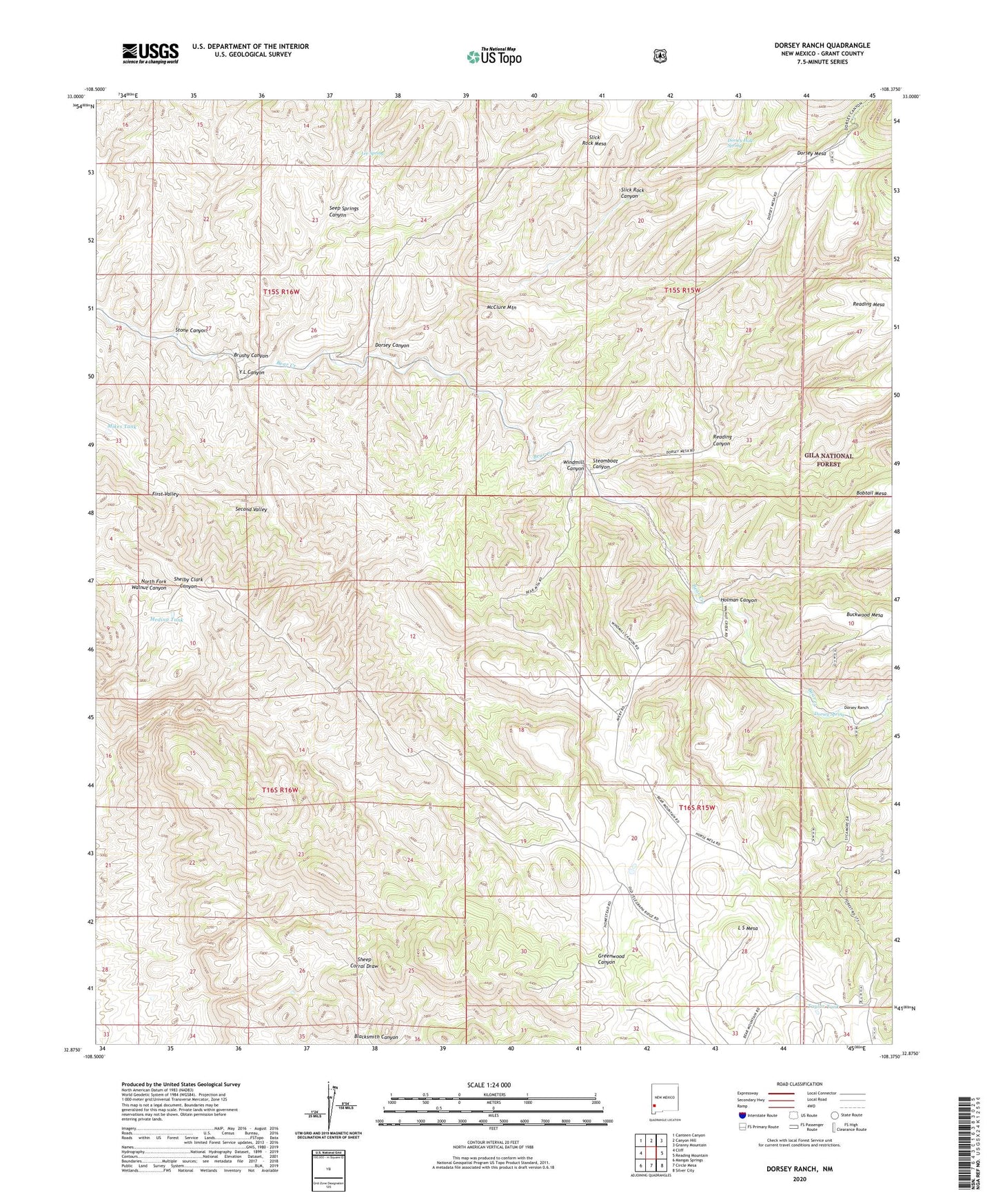
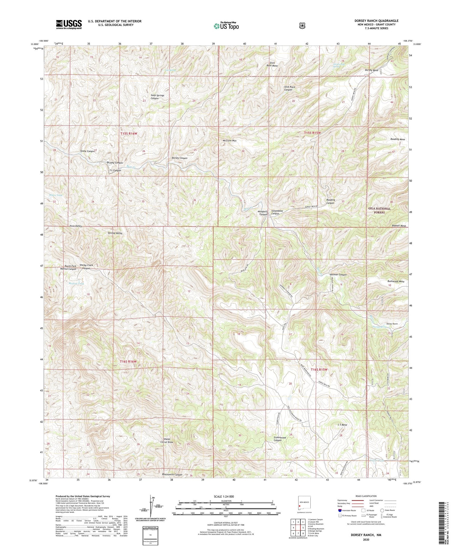
2020 topographic map quadrangle Dorsey Ranch in the state of New Mexico. Scale: 1:24000. Based on the newly updated USGS 7.5' US Topo map series, this map is in the following counties: Grant. The map contains contour data, water features, and other items you are used to seeing on USGS maps, but also has updated roads and other features. This is the next generation of topographic maps. Printed on high-quality waterproof paper with UV fade-resistant inks.
Quads adjacent to this one:
West: Cliff
Northwest: Canteen Canyon
North: Canyon Hill
Northeast: Granny Mountain
East: Reading Mountain
Southeast: Silver City
South: Circle Mesa
Southwest: Mangas Springs
Contains the following named places: Avery Ranch, Brushy Canyon, Dorsey Camp, Dorsey Canyon, Dorsey Hole Spring, Dorsey Mesa, Dorsey Ranch, Dorsey Spring, H W Ranch, Hells Half Acre, Holman Canyon, Lee Spring, McClure Mountain, Medina Tank, Mikes Tank, Reading Canyon, Redding Mesa Dam, Second Valley, Seep Springs Canyon, Slick Rock Canyon, Steamboat Canyon, Stone Canyon, Taylor Tank, Windmill Canyon, Y L Canyon