MyTopo
Cliff New Mexico US Topo Map
Couldn't load pickup availability
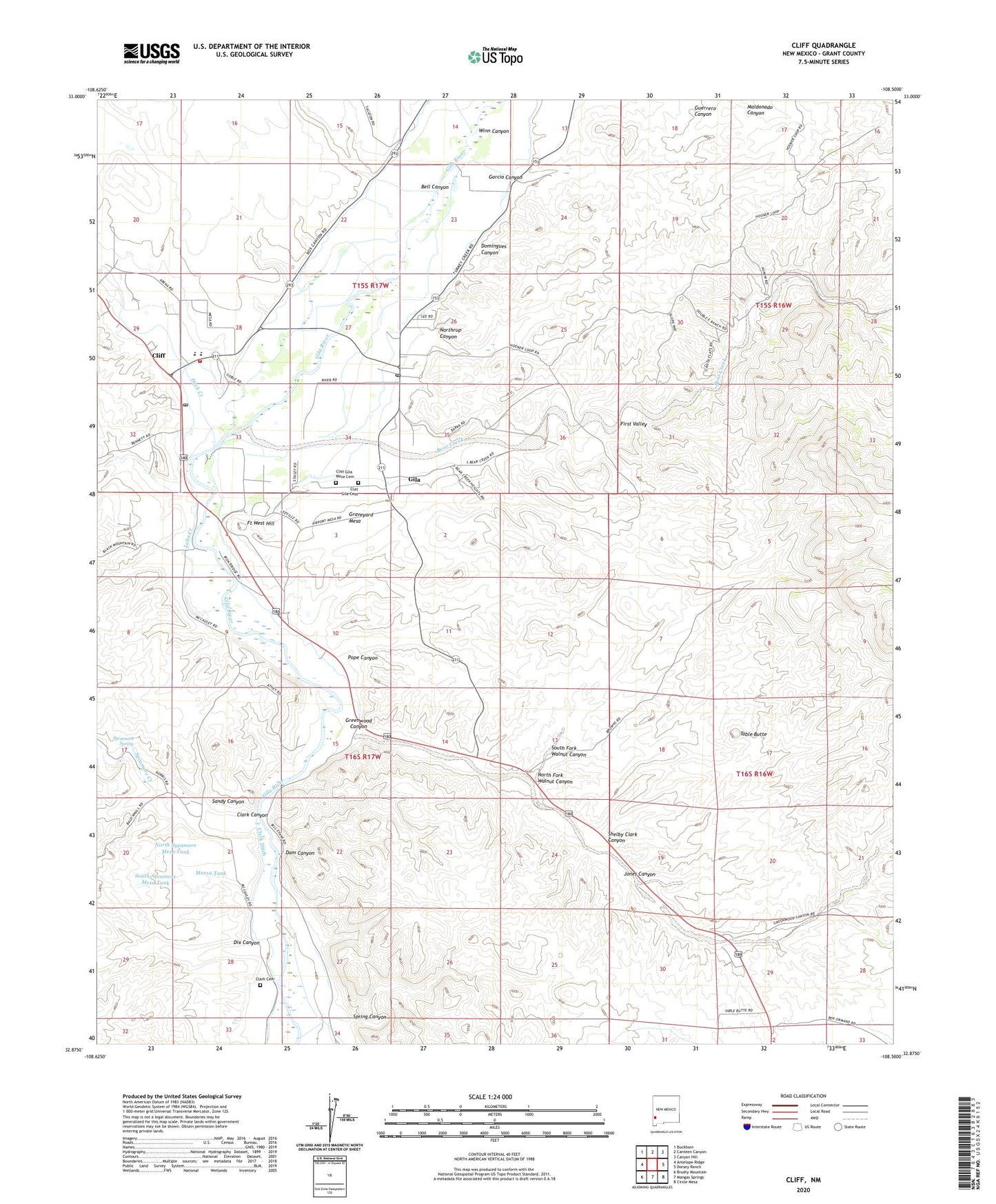
2023 topographic map quadrangle Cliff in the state of New Mexico. Scale: 1:24000. Based on the newly updated USGS 7.5' US Topo map series, this map is in the following counties: Grant. The map contains contour data, water features, and other items you are used to seeing on USGS maps, but also has updated roads and other features. This is the next generation of topographic maps. Printed on high-quality waterproof paper with UV fade-resistant inks.
Quads adjacent to this one:
West: Antelope Ridge
Northwest: Buckhorn
North: Canteen Canyon
Northeast: Canyon Hill
East: Dorsey Ranch
Southeast: Circle Mesa
South: Mangas Springs
Southwest: Brushy Mountain
This map covers the same area as the classic USGS quad with code o32108h5.
Contains the following named places: Bear Creek, Bell Canyon, Church of Christ, Clark Canyon, Clark Cemetery, Clark Ditch, Cliff, Cliff - Gila Valley Volunteer Fire Department and Emergency Medical Services, Cliff Census Designated Place, Cliff Elementary School, Cliff Gila Cemetery, Cliff Gila Mesa Cemetery, Cliff High School, Cliff Post Office, Cliff Weather Station, Crawford-De Forest Ditch, Dam Canyon, Dix Canyon, Domingues Canyon, Duck Creek, First Valley, Fort West, Fort West Ditch, Fort West Hill, Garcia Canyon, Gila, Gila Census Designated Place, Gila Farm Ditch, Gila Post Office, Gila Valley Baptist Church, Graveyard Mesa, Greenwood Canyon, Hillside, Indian Ruins, Jones Canyon, Kwilleyleka Historic Site, L C Ranch Headquarters Historic Site, Lobo Creek, Marsa Tank, McMillen Ditch, North Fork Walnut Canyon, North Sycamore Mesa Tank, Northrup Canyon, Pope Canyon, Riverside, Riverside Ditch, Sandy Canyon, Sandy Canyon Tank, Shelby Clark Canyon, Slayback Ditch, South Fork Walnut Canyon, South Sycamore Mesa Tank, Spring Canyon, Sycamore Creek, Sycamore Spring, Table Butte, Trinity Presbyterian, Upper Gila Ditch, Upper Gila Site Number Four Dam, Upper Gila Site Number One Dam, Upper Gila Site Three Dam, Upper Gila Valley Site Number 12 Dam, Winn Canyon