MyTopo
Garcia Peak New Mexico US Topo Map
Couldn't load pickup availability
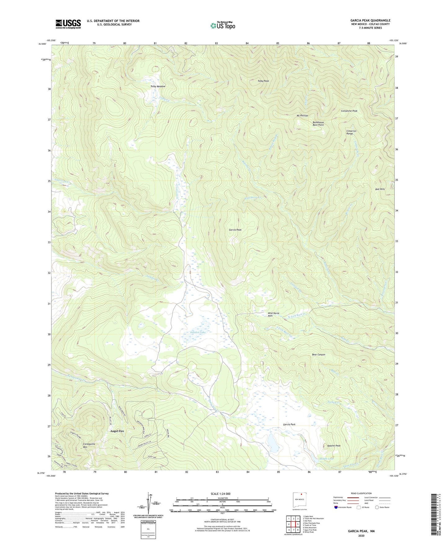
2020 topographic map quadrangle Garcia Peak in the state of New Mexico. Scale: 1:24000. Based on the newly updated USGS 7.5' US Topo map series, this map is in the following counties: Colfax. The map contains contour data, water features, and other items you are used to seeing on USGS maps, but also has updated roads and other features. This is the next generation of topographic maps. Printed on high-quality waterproof paper with UV fade-resistant inks.
Quads adjacent to this one:
West: Palo Flechado Pass
Northwest: Eagle Nest
North: Touch-Me-Not Mountain
Northeast: Ute Park
East: Tooth of Time
Southeast: White Peak
South: Agua Fria Peak
Southwest: Osha Mountain
Contains the following named places: Agua Fria Lake, Agua Fria Trail Camp, American Creek Cow Camp, Apache Peak, Apache Springs Camp, Bear Canyon Camp, Beaver Creek, Brownsea Camp, Buck Creek Camp, Bunkhouse Bare Point, Cieneguilla Mountain, Cimarron Range, Clear Creek Camp, Comanche Camp, Comanche Creek, Comanche Peak, Comanche Peak Camp, Crooked Creek, Crooked Creek Camp, Garcia Cow Camp, Garcia Park, Garcia Peak, KAFR-FM (Angel Fire), Llano Vista, Lost Cabin Camp, Middle Lake, Mount Phillips, Mount Phillips Camp, North Fork Buck Creek, Ojo de Maiz Creek, Old Cartwright Mill Site, Porcupine Camp, Porcupine Creek, Red Hills, Red Hills Camp, Rincon Rayado, Saladon Lake, South Fork Buck Creek, Tolby Meadow, Tolby Peak, Turkey Creek, Wild Horse Creek, Wild Horse Park