MyTopo
Osha Mountain New Mexico US Topo Map
Couldn't load pickup availability
Also explore the Osha Mountain Forest Service Topo of this same quad for updated USFS data
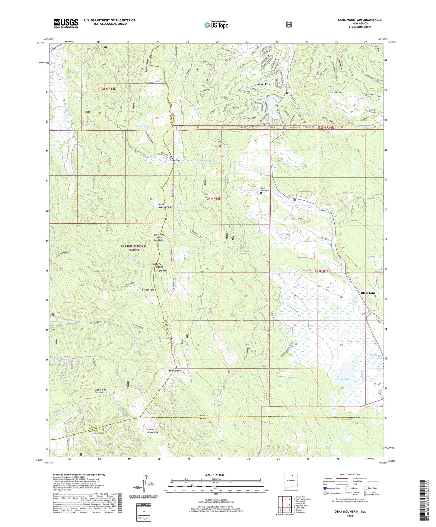
2023 topographic map quadrangle Osha Mountain in the state of New Mexico. Scale: 1:24000. Based on the newly updated USGS 7.5' US Topo map series, this map is in the following counties: Colfax, Taos, Mora. The map contains contour data, water features, and other items you are used to seeing on USGS maps, but also has updated roads and other features. This is the next generation of topographic maps. Printed on high-quality waterproof paper with UV fade-resistant inks.
Quads adjacent to this one:
West: Shady Brook
Northwest: Pueblo Peak
North: Palo Flechado Pass
Northeast: Garcia Peak
East: Agua Fria Peak
Southeast: Guadalupita
South: Chacon
Southwest: Cerro Vista
This map covers the same area as the classic USGS quad with code o36105c3.
Contains the following named places: Angel Fire - Fire Department Station 2, Angle Fire, Baca Canyon, Black Lake, Black Lake Cemetery, Black Lake Weather Station, Black Lakes, Borrego Crossing, Corner Park, Cuchillo de Fernando, Espinosa, Jarocita Park, Jarosa Creek, Little Coyote Creek, Little Garcia Park, Monte Verde Unit One, Moreno Valley Fire Department Black Lake Station, Osha Mountain, Osha Pass, San Antonio Church, Tienditas Creek, Torres, Torres Pit, Upper Black Lake School, Valle Largo