MyTopo
Good Sight Peak NE New Mexico US Topo Map
Couldn't load pickup availability
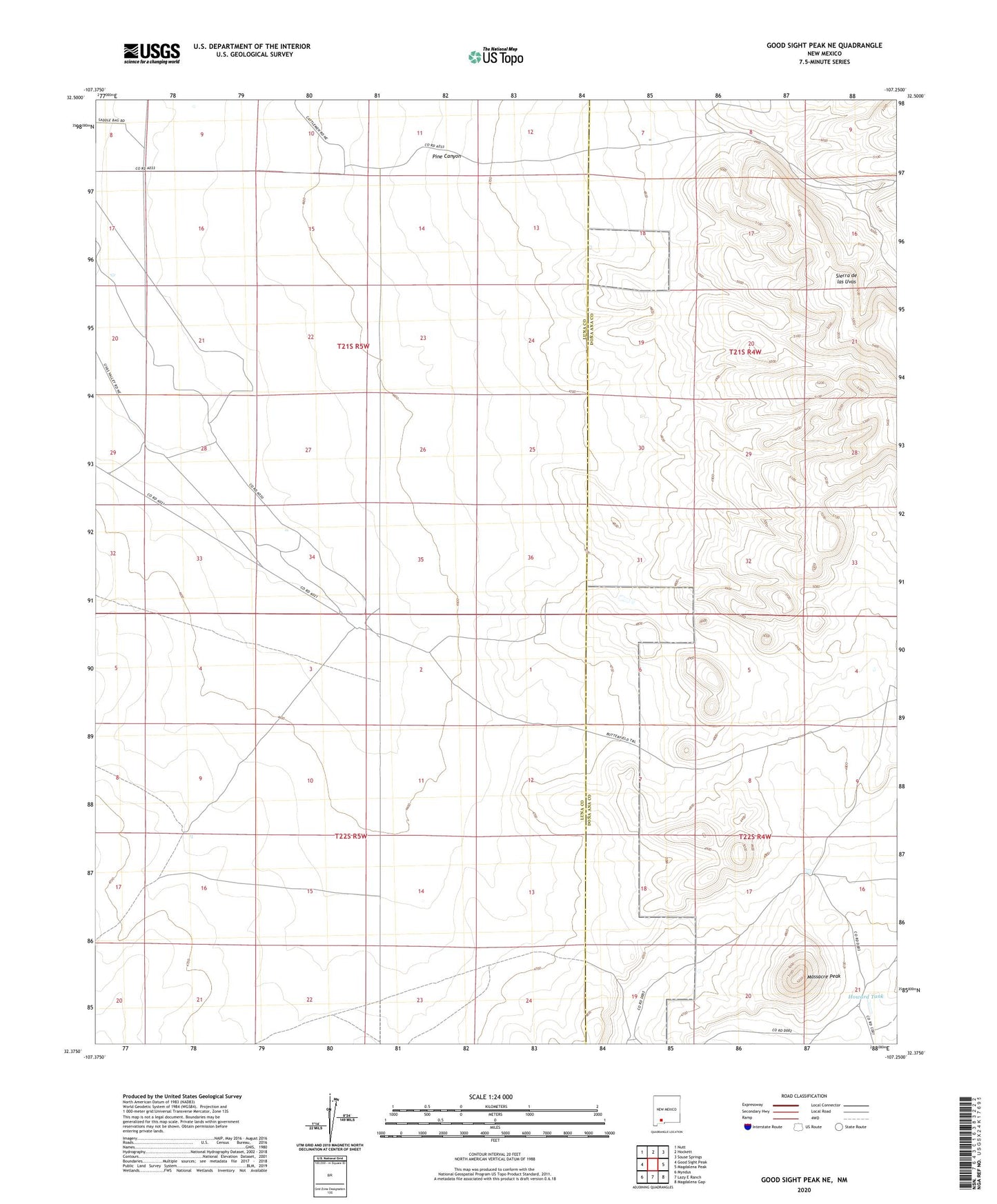
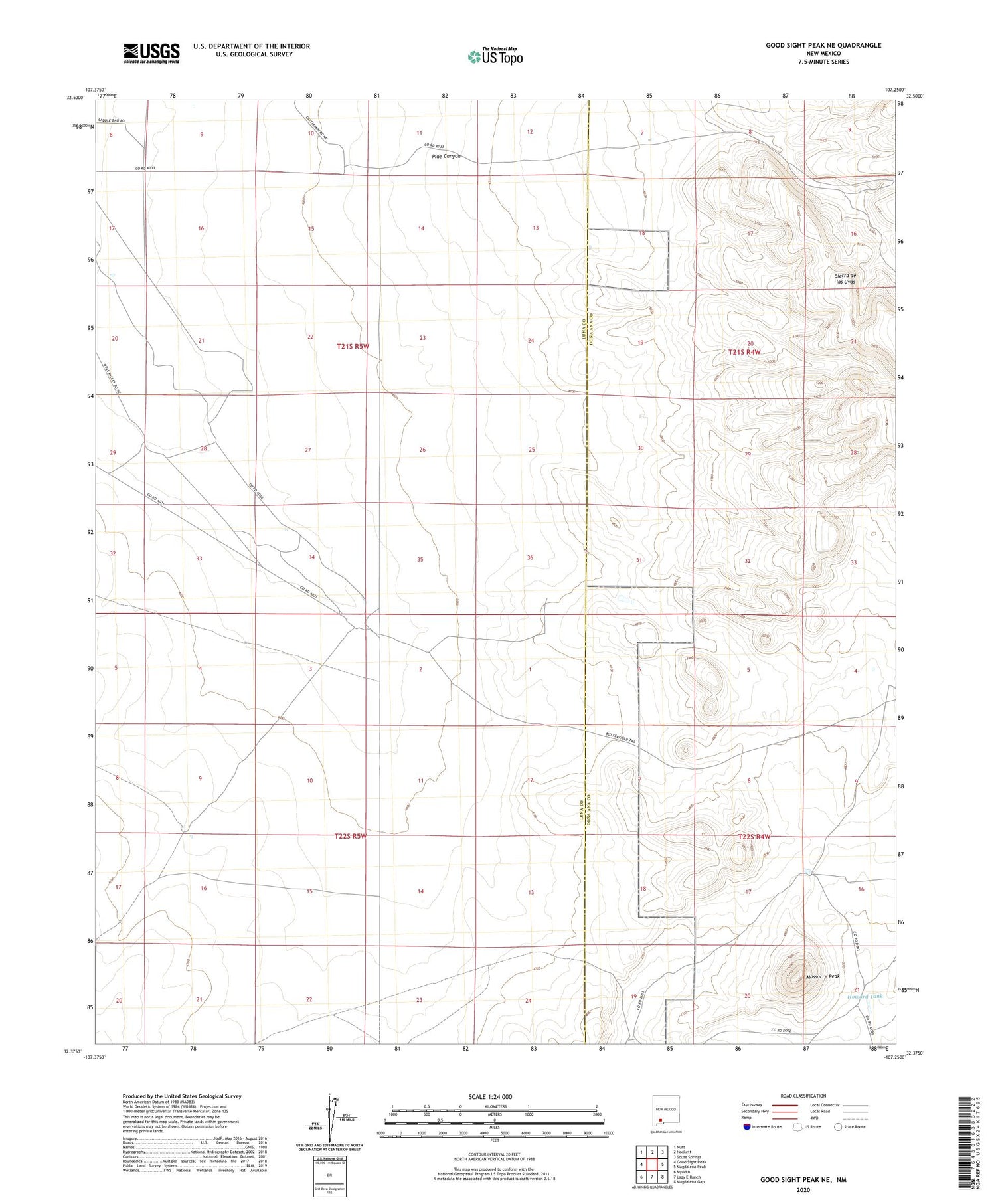
2020 topographic map quadrangle Good Sight Peak NE in the state of New Mexico. Scale: 1:24000. Based on the newly updated USGS 7.5' US Topo map series, this map is in the following counties: Luna, Doña Ana. The map contains contour data, water features, and other items you are used to seeing on USGS maps, but also has updated roads and other features. This is the next generation of topographic maps. Printed on high-quality waterproof paper with UV fade-resistant inks.
Quads adjacent to this one:
West: Good Sight Peak
Northwest: Nutt
North: Hockett
Northeast: Souse Springs
East: Magdalena Peak
Southeast: Magdalena Gap
South: Lazy E Ranch
Southwest: Myndus
Contains the following named places: 01202 Water Well, 05001 Water Well, 05002 Water Well, 05003 Water Well, 05012 Water Well, 10016 Water Well, 10018 Water Well, 10019 Water Well, 10020 Water Well, 10021 Water Well, 10460 Water Well, 10461 Water Well, 10462 Water Well, 10463 Water Well, 10464 Water Well, 10465 Water Well, 10466 Water Well, 10467 Water Well, 10475 Water Well, Howard Tank, Massacre Peak, NH 54 Water Well, NH 59 5 Water Well, Number 1201 Water Well, Pine Canyon, Pole M Ranch, Weldon Burris Homestead, Wright Windmill