MyTopo
Myndus New Mexico US Topo Map
Couldn't load pickup availability
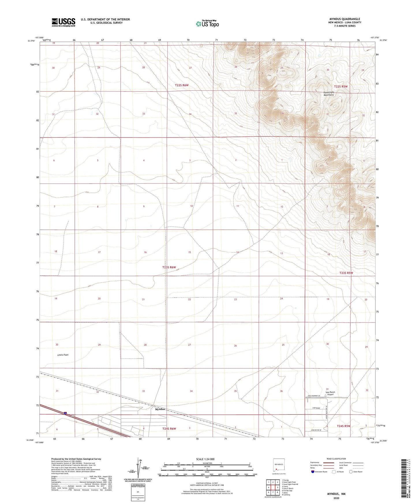
2023 topographic map quadrangle Myndus in the state of New Mexico. Scale: 1:24000. Based on the newly updated USGS 7.5' US Topo map series, this map is in the following counties: Luna. The map contains contour data, water features, and other items you are used to seeing on USGS maps, but also has updated roads and other features. This is the next generation of topographic maps. Printed on high-quality waterproof paper with UV fade-resistant inks.
Quads adjacent to this one:
West: Carne
Northwest: Florida
North: Good Sight Peak
Northeast: Good Sight Peak NE
East: Lazy E Ranch
Southeast: Cambray
South: Akela
Southwest: Florida Gap
This map covers the same area as the classic USGS quad with code o32107c4.
Contains the following named places: 01582 Water Well, 01588 Water Well, 01593 Water Well, 01594 Water Well, 01595 Water Well, 01596 Water Well, 01597 Water Well, 01599 Water Well, 01601 Water Well, 01602 Water Well, 01603 Water Well, 06112 Water Well, 06113 Water Well, 06114 Water Well, 06115 Water Well, Coyote Well, Fox Well, Good Sight Well, Lewis Flats, Macho Creek, Myndus, Myndus Post Office, Number 1210 Water Well, Pipe Tower Well, Plain Mountain Well, Plain Well, Plank Well, Salt Well, Sand Well, Simpson Ranch, Solo Ranch Airport, Steam Pump Well